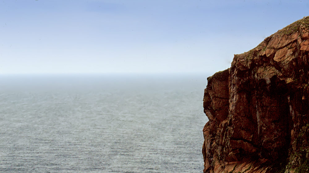
This is where the British mainland ends – and it does so impressively! The “Clo Mor” cliff drops 190 metres, sheer. If that’s not an ending with a bang, what is?
Cape Wrath isn’t just about the cliff, though – there’s more to it. A beautiful white lighthouse stands here, built in 1828 by Robert Stevenson. The Ozone Cafe serves hot drinks and snacks for visitors. Nearby stand a few unsightly ruins of a former coastguard station – even a couple of old car wrecks sit there.
Several walking routes run along the coast from Cape Wrath, and thanks to the scenery they’re well worth doing – these days often with professional guides too.
There’s one catch: you can’t simply drive there. Anyone wanting to see the “end” has to put in a bit more effort. Cars and motorbikes stay behind at the car park in Keoldale – only bicycles are allowed to come along. From there, a ferry takes visitors across the Kyle of Durness. On the other side, a minibus runs to Cape Wrath and back.
Alternatively, you can bump your way along the 18 kilometres on a bicycle over the gravel track – or cover the route on foot through the striking Highland scenery.
Please note: Cape Wrath is a military area, and the Royal Navy likes to use it for live firing exercises. So if red warning flags are flying anywhere, nobody is allowed onto Cape Wrath. Always check in advance.
Personal note: a beautiful walk
We chose the “walking” option at the time. In my view, the hike through the wild landscape to Cape Wrath was actually more rewarding than Cape Wrath itself. We set aside two days for it, as we were carrying heavy packs and a tent. Most of the photos below were taken along the route to Cape Wrath. If you’re planning to spend more than a day out there, it’s essential to check beforehand that the Navy isn’t running any firing exercises.
For the way back, we then took the minibus.
Did you know: one of only two capes
In this case, “Wrath” doesn’t mean anger – it’s an anglicised corruption of the Gaelic “Am Parbh”, pronounced roughly “am parve”, which means the same thing as “Cape”: a headland or point of land. In effect, Cape Wrath means “Cape Cape”.
Incidentally, there are only two “Capes” on the British mainland: Cape Wrath, and Cape Cornwall, which forms the island’s southern tip.
Robert Stevenson, who built the lighthouse at Cape Wrath, was an engineer who went on to build a good many more lighthouses across Scotland, as did his sons after him, who carried on his work. His grandson, however, became even more famous – he was called Robert Louis Stevenson, and he wrote the adventure novel “Treasure Island”.
Getting there:
From Durness, take the A838 towards Rhiconich. After around two to three kilometres, a sign on the left-hand side points to “Keoldale” and “Cape Wrath” – turn right there, drive through the settlement and park in the car parks; eventually you’ll reach a sign reading “No parking beyond this point”. Leave the car no later than that. From there it’s on to the ferry, across, and then onward by minibus, bike or on foot.
Ferry timetables and prices can be found on the website capewrathferry.co.uk.