In the Muir of Dinnet nature reserve in the Cairngorms, trails lead not only through beautiful countryside, but also through history.
From the Ice Age to the Iron Age, through the Middle Ages and finally to the 19th century. The circular trails in Muir of Dinnet lead through the ages. They reveal impressive natural surroundings. Around the large Loch Kinnord and its neighbour, Loch Davan, there is a green landscape of forest and ferns.
This part of the Cairngorms is well worth exploring. However, visitors will need to lace up their walking boots. But don’t worry, the Muir of Dinnet has something for everyone, whether you’re fit or less so: longer hikes and short walks. For wheelchair users, the Muir offers an accessible picnic area.
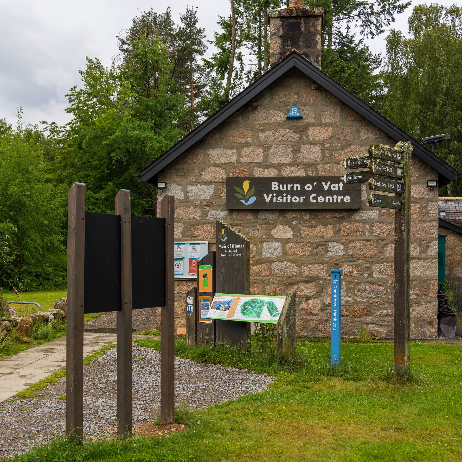
The centre of most activities in Muir of Dinnet is the car park at the visitor centre on the B9119. This is where the nature trails start.
Here are two routes that we walked. First, the short tour to The Vat (red), then the longer route along Loch Kinord (purple) and Loch Davan.
You are currently viewing a placeholder content from Google Maps. To access the actual content, click the button below. Please note that doing so will share data with third-party providers.
More InformationBurn o’ Vat Trail (red)
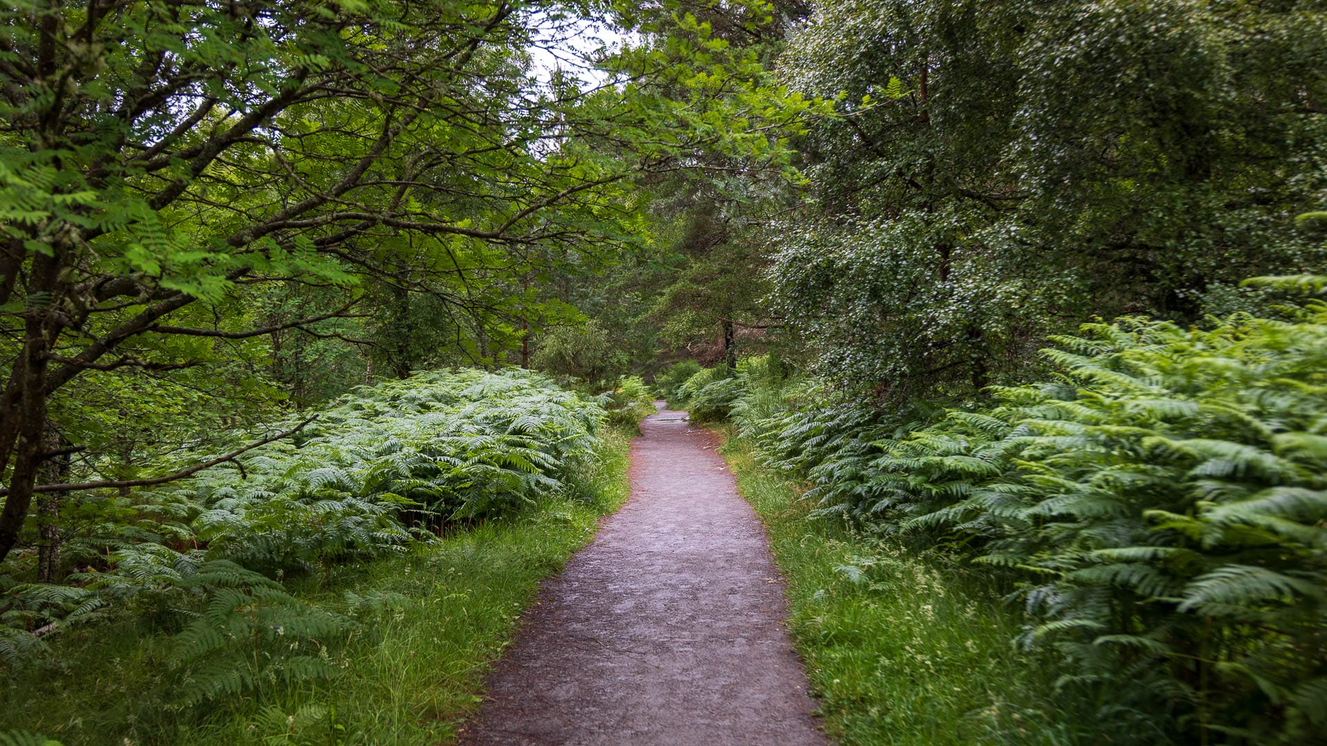
The Vat is a special place. This huge rock basin is only accessible through a narrow gap. A relic from the Iron Age that fascinates visitors. The short walk there and to the viewpoint takes only about half an hour and is just over a kilometre long.
It is only a few minutes to the rock basin, the path is well maintained, but the passage into the basin leads through a crevice and over boulders.
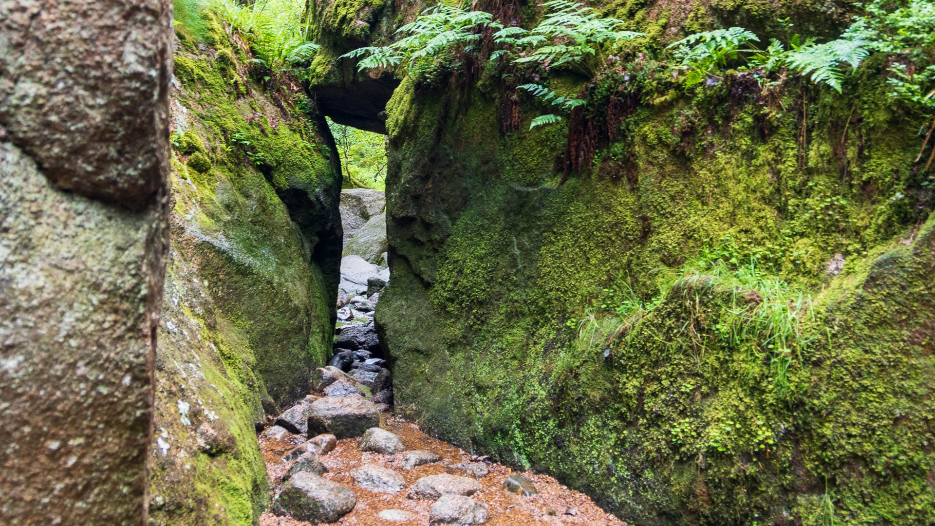
When you come out on the other side of the narrow passage, the basin opens up in front of you. Opposite, the stream makes its way down over a small waterfall.
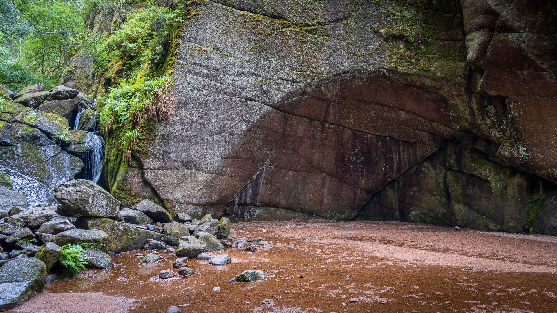
The basin is truly amazing. It is the result of the persistent work of water. During the Ice Age 16,000 years ago, the land was covered by glaciers. When the ice sheet began to melt, the water flowed away, carrying huge rocks with it.
One of these blocked a spot and forced the water to form a whirlpool in front of it. The circular current then carved the pothole out of the pink granite rock.
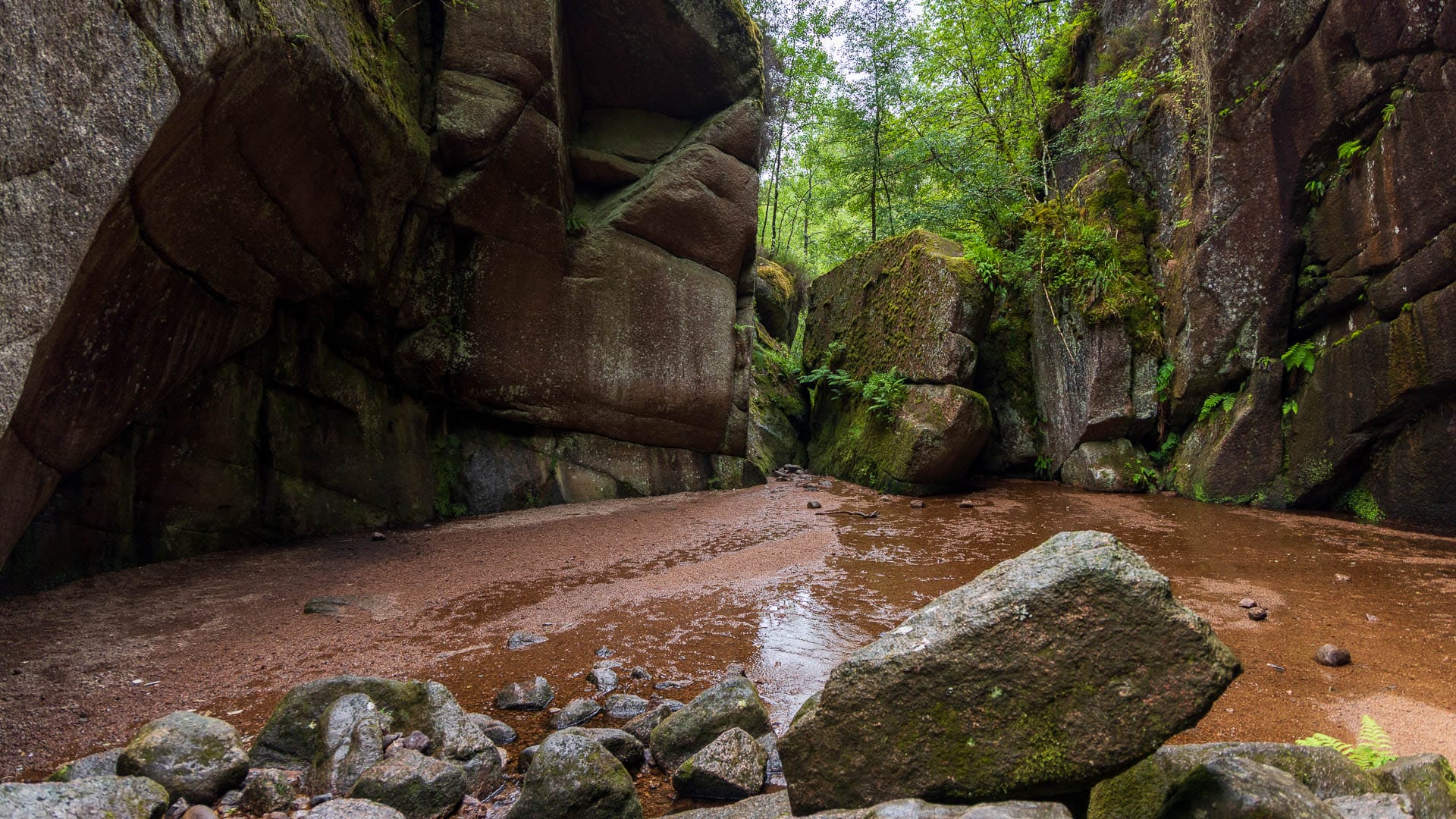
When the melting was over, the river dried up and became the stream we see today.
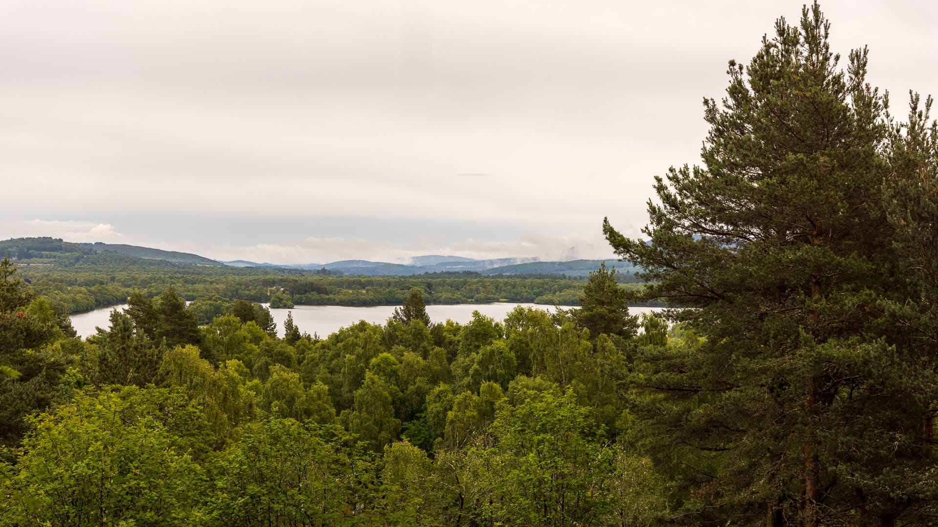
After visiting the basin, you can either return directly to your car or take the short climb to the viewpoint. As a reward, you will be treated to a view over the forests to the loch.
After a short descent, the trail ends back at the car park.
Little Ord Trail (purple)
This circular trail is about 5.5 kilometres long and should take 1.5 to 2 hours to complete. It follows forest floors and meadow paths. Good footwear is recommended, even though there are no particularly difficult passages. However, there are still adders in the area. All the more reason to wear sturdy walking boots.
Among other things, visitors to the Little Ord Trail can expect to see:
- Esker Ridge, surrounded by kettle holes from the Ice Age
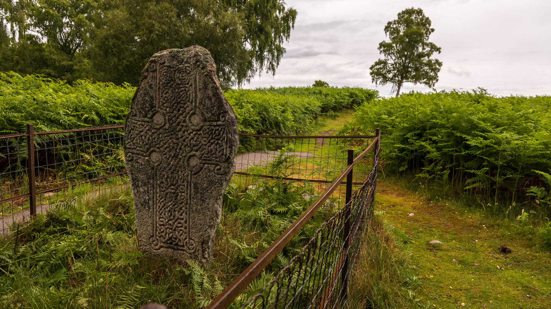
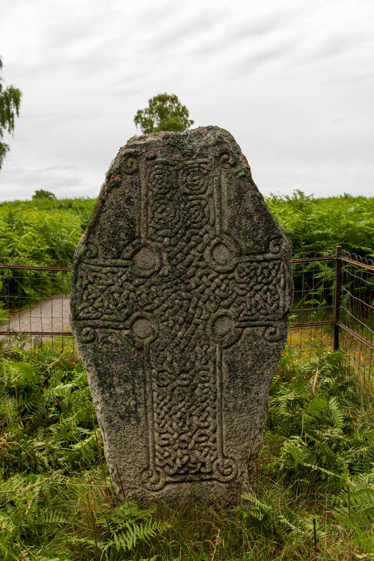
- Kinord Cross, a stone decorated with a Celtic cross
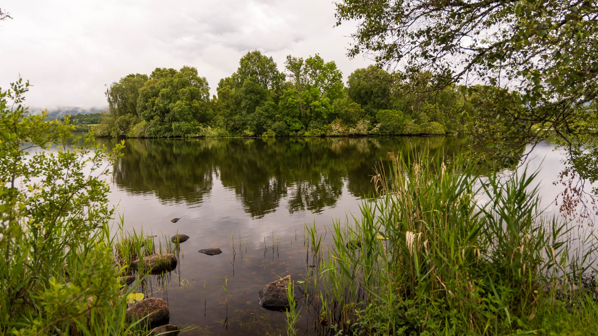
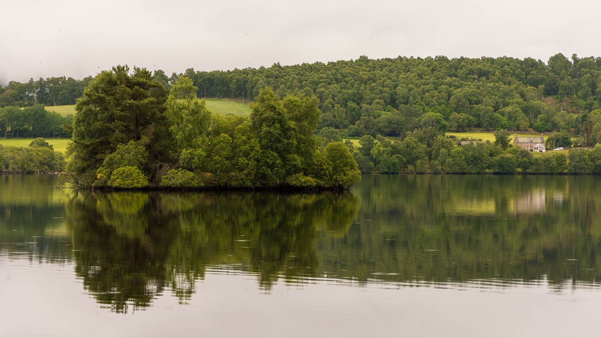
- Loch Kinnord with the islands on which a castle and a crannog once stood
- Iron Age village, the remains of which can be seen in a clearing
- Old Kinord, the remains of an ancient village
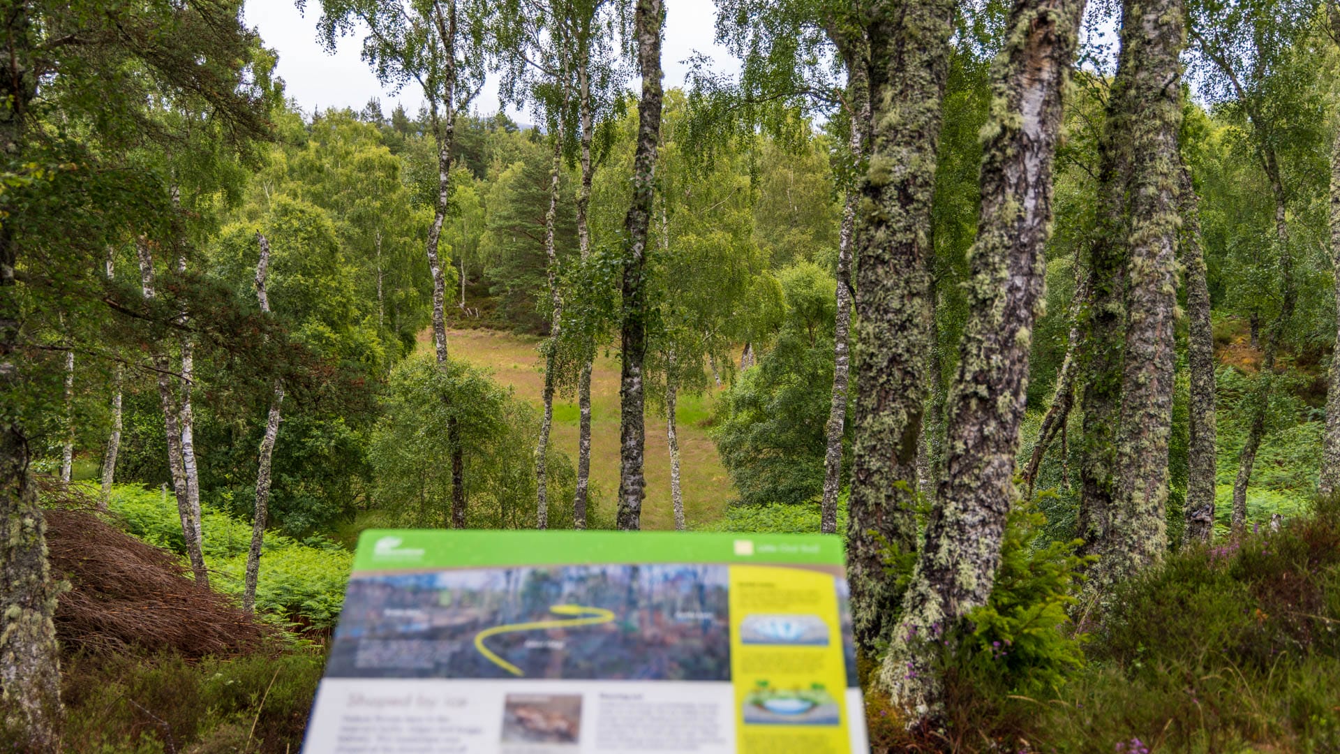
The trail starts on the other side of the road and leads into the lush forests. The trees, some of which are very old, are intertwined and covered with lichen. Various birds frolic in the branches, and with a little luck you can hear the cuckoo calling.
The path then leads over Esker Ridge, an elevation with deep depressions on either side. These are kettle holes. These holes were formed at the end of the Ice Age. When a chunk of ice was covered by sediment and then melted, a depression formed there, which is lined with fertile soil.
Soon the forest opens up onto a meadow. At the end of the meadow, the path leads down to the hole and Kinord Cross.
The trail now continues along the shore. Again and again, the forest opens up to reveal views of the lake. A large island soon appears. Between 1000 and 1600 AD, it formed the basis for a castle that even hosted Scottish kings. The only way to get there was via a dam. However, the castle burned down around 1600. Today, only the dam and the buildings can be guessed at.
As the thicket opens up further, hikers catch a glimpse of the old crannog. Here, too, only an island remains. But the information board explains clearly what the building probably looked like two millennia ago.
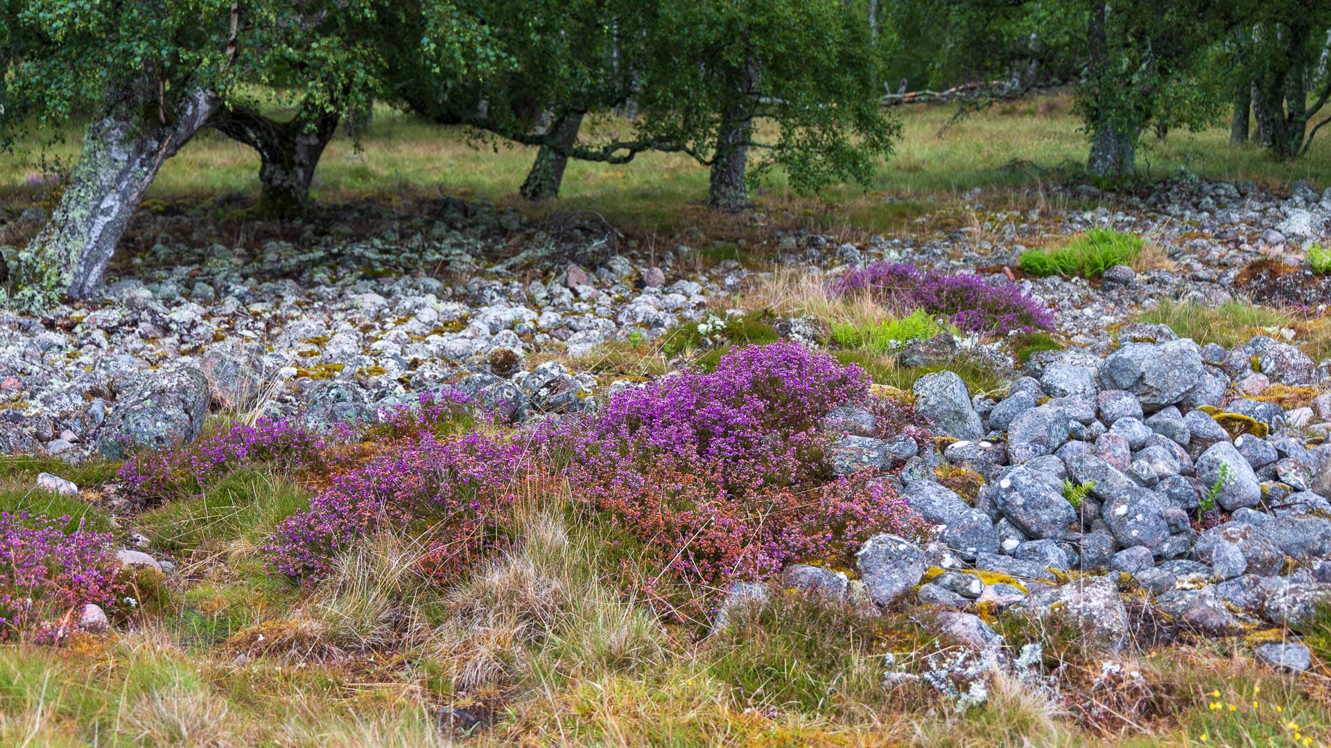
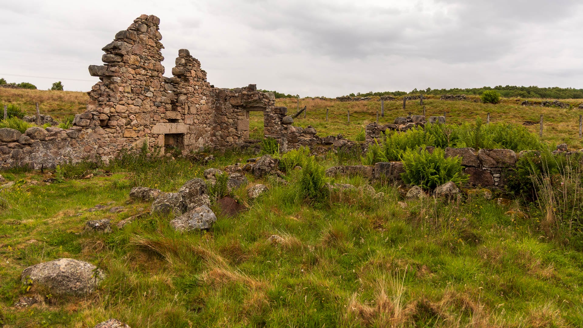
The route leaves Loch Kinord and heads over to Loch Davan. However, it never quite reaches the shore, but instead leads across a clearing where the remains of an Iron Age village stand. Depending on the season, the grey stones are lined with beautiful heather.
Here, too, an information board explains how the village was once built. The ground plans are still clearly visible. A little further on, the clearly visible and somewhat ghostly remains of the 19th-century village of Old Kinord rise up.
From here, the trail returns to the forest path over Esker Ridge back to the car park.
How to get there
With a sat nav: “AB34 5NB” will take you close.
Without satnav: From Ballater, take the A93 towards Dinnet (or vice versa) until you see the brown sign announcing Muir of Dinnet. Turn onto the B9119 here. If you are coming from the north, take the A97 and turn onto the B9119 at the sign for Muir of Dinnet. Continue to the car park at the Visitor Centre.