Find out here why a major city in Canada is named after a small bay, and what makes this bay so special.
James Farquharson MacLeod, a lieutenant colonel in the Canadian Mounted Police, had survived the harsh winter of 1874, when his uniform had been reduced to rags, his unit was no longer receiving pay, and 18 of his men had deserted. Afterward, he had fallen out with his superior and, in early 1876, finally resigned from the Mounties in frustration.
Now he was a guest here—here in his native Scotland, here on the Isle of Mull, here in Calgary Bay.
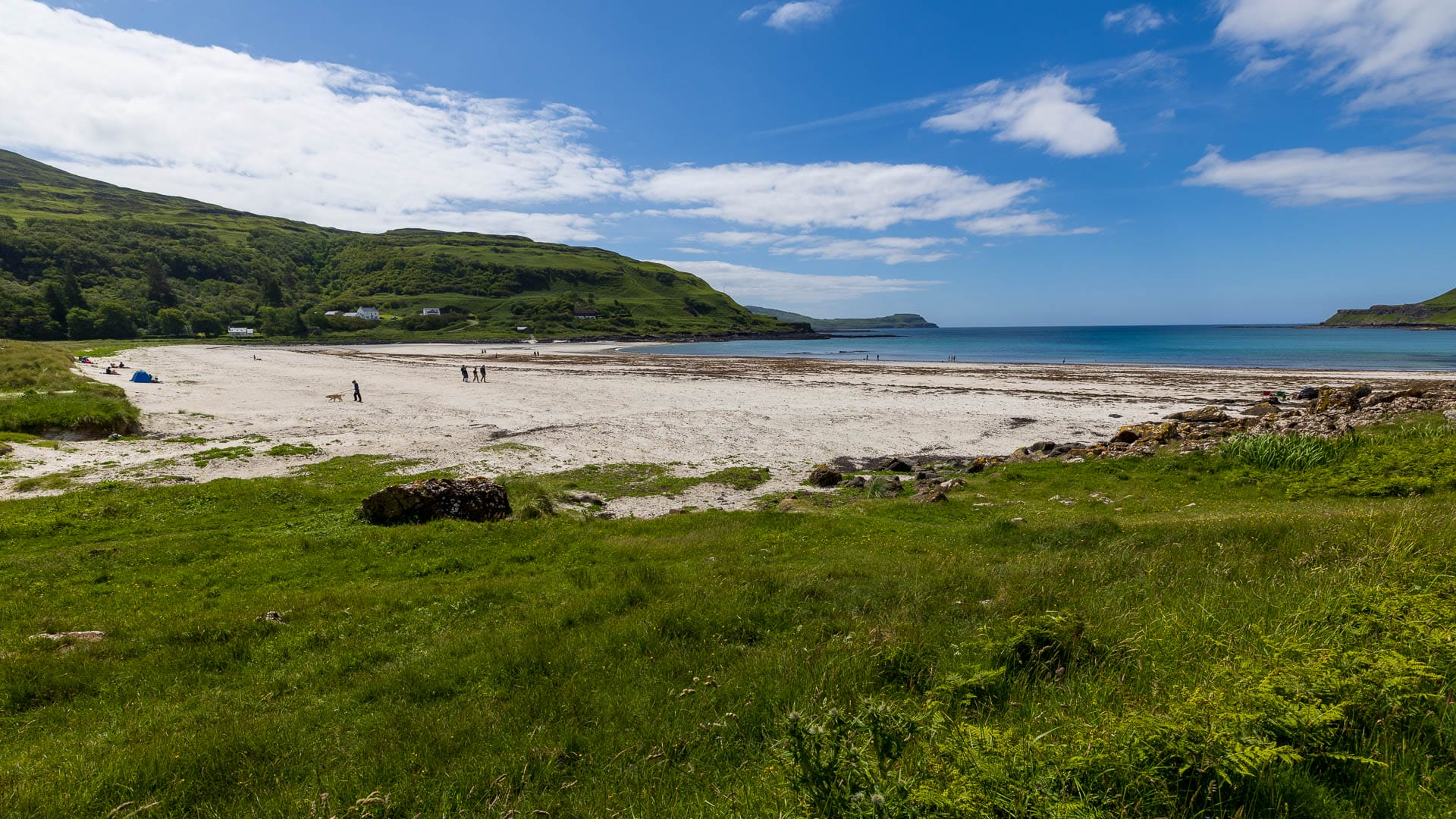
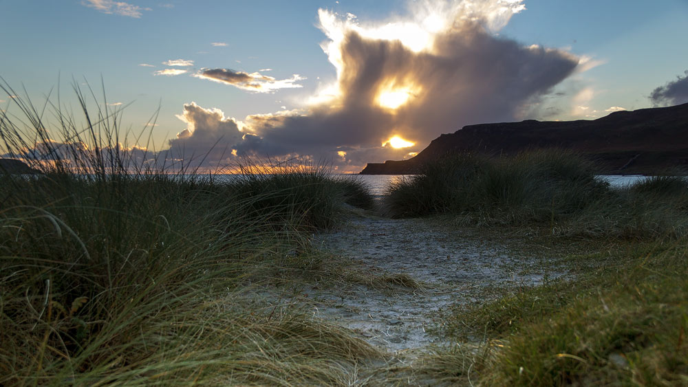
Beautiful Calgary… Gentle hills roll out into a long, lush grassland that is ultimately bordered by a white sandy beach. High cliffs line the sides of the bay, offering protection from overly strong winds and waves.
In this idyllic setting, MacLeod finds the peace he needs; he can relax once more and recharge his strength. For he would be returning to Canada. He had been offered another position with the police there—this time a better one. And without hesitation, he had accepted. His journey would soon take him to Fort Brisebois.
Fort Brisebois—what a name! MacLeod made up his mind: He would simply rename this little fort in Canada—to Calgary.
Did You Know: The End of James MacLeod and the Meaning of the Name Calgary
In fact, a settlement grew up around the new Fort Calgary. And by the time James MacLeod finally died there of kidney failure in 1894, the settlement had already become a small town.
Today, Calgary is the fourth-largest city in Canada.
The meaning of the name Calgary is unclear. Some sources say it derives from the Gaelic “caladh” and “garaidh,” meaning “harbor by the dike.” Another source suggests it comes from “Cala ghearraidh,” which translates to “beach of the willow.” Still others claim it derives from the Old Norse “Kali” and “geiri”—“Kali’s land.”
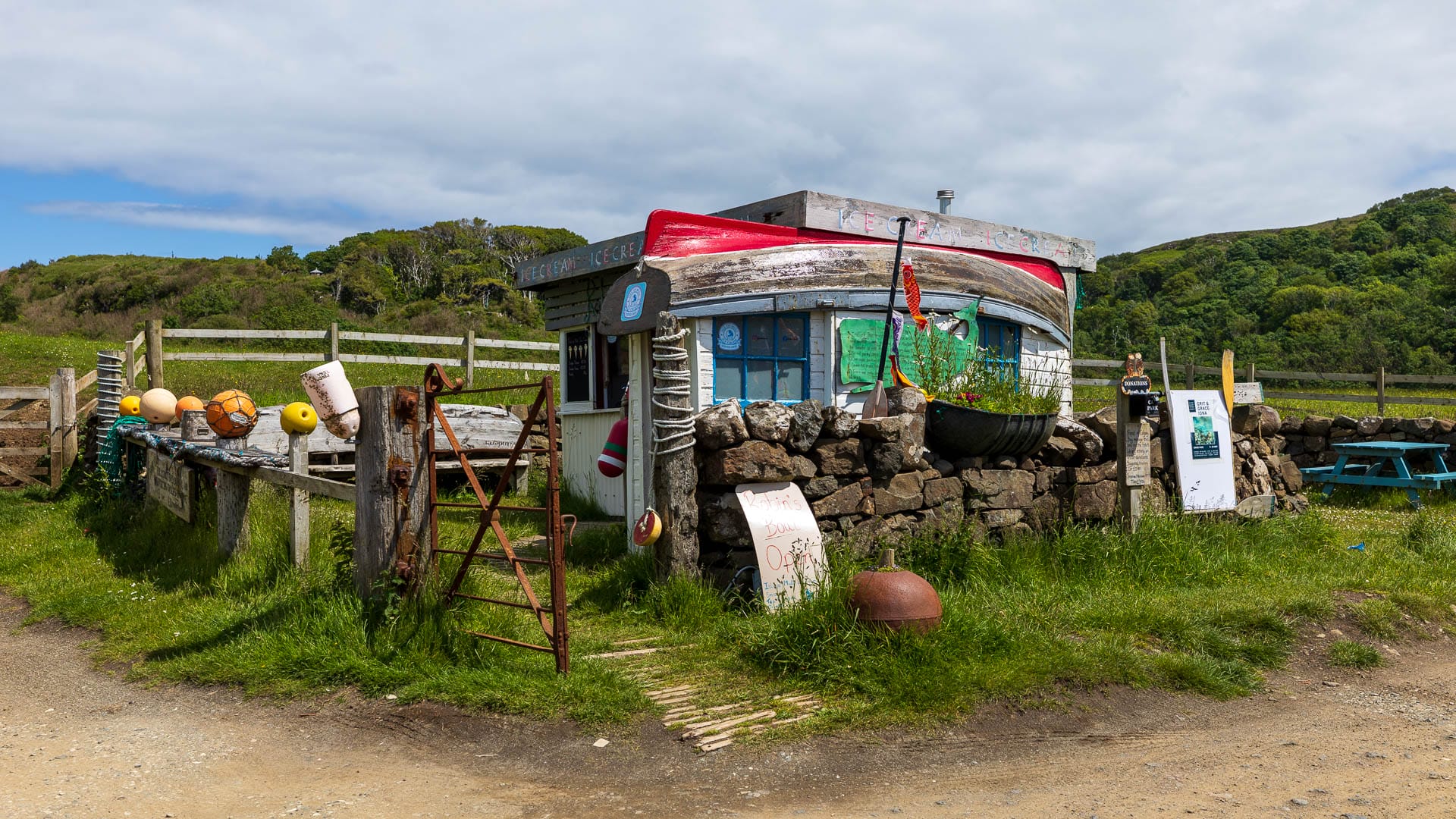
Tip: Ice cream and a hike to the cliffs
When the weather is nice, visitors can also buy ice cream, coffee, or a snack on the beach. These treats are available at the house with the boat-shaped roof.
You can also explore the ruins of the abandoned village of Inivea, located slightly above the bay, or the remains of the small pier at the northern end of the beach, where small steamships once delivered food and fuel to Calgary Castle in the 19th century.
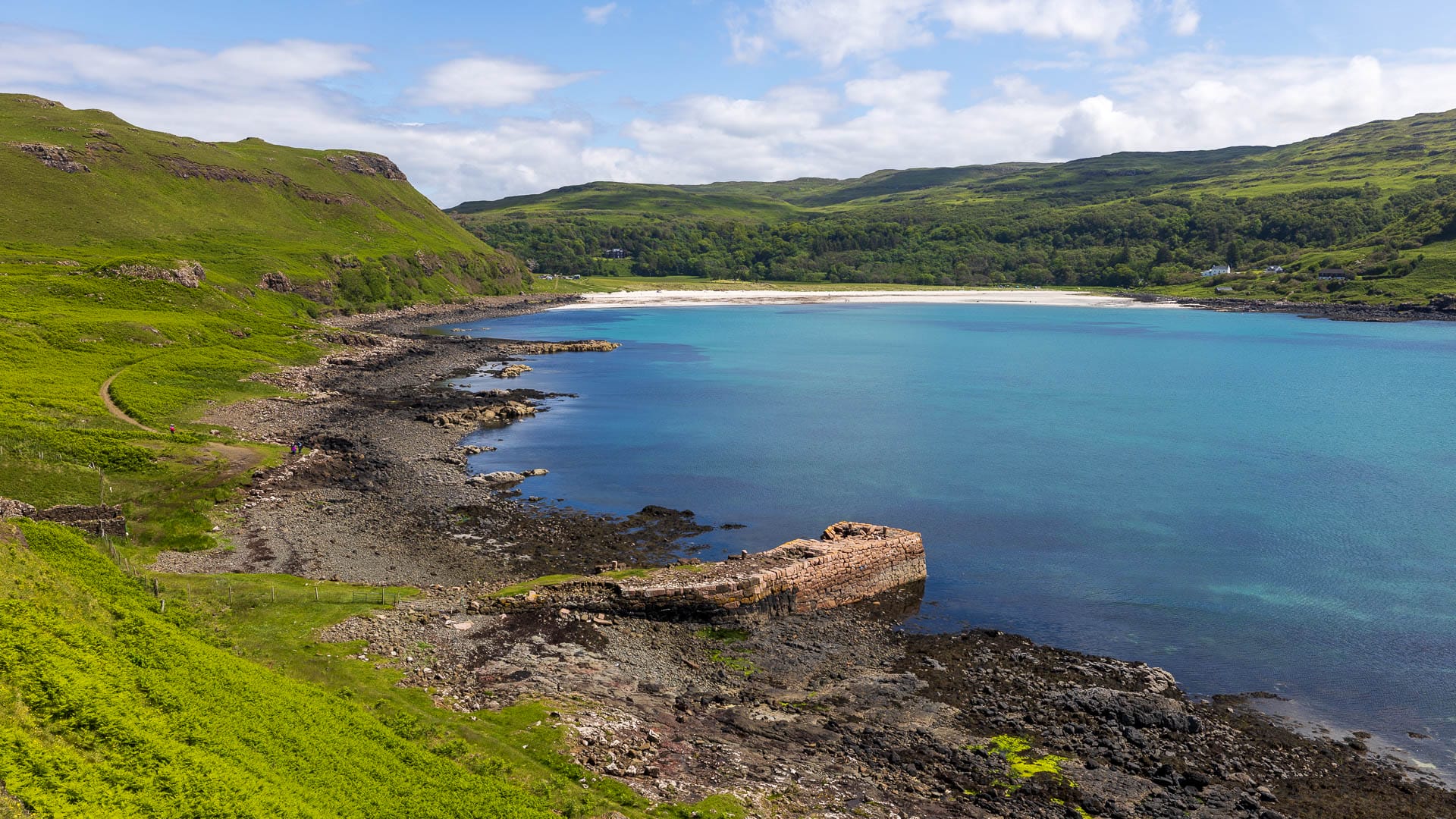
The path is easy to walk on. You just have to be careful on the pier itself. It’s about one kilometer to the pier. If you like, you can continue along the top of the pier and enjoy a wonderful view of the bay.
You are currently viewing a placeholder content from Google Maps. To access the actual content, click the button below. Please note that doing so will share data with third-party providers.
More InformationIn principle, you can walk quite far along the trail, depending on the weather, your fitness level, and how far you feel like going. Just before the pier, you’ll need to go up and then through the gate on the left. After a short climb, a grassy path leads along the cliffs as far as your feet will take you.
Directions:
If you have a GPS, just enter “PA75 6QU.” This video explains exactly how to do that.
Without a GPS: From Tobermory, take the road toward Dervaig and Calgary. It’s basically impossible to get lost; after 20 winding kilometers on a narrow road, you’ll reach the bay. Turn right here into the signposted parking lot.