Some places are only a few metres away, and yet worlds apart. The little island of Brough of Birsay can be reached on foot at low tide, and it takes visitors into a different millennium.
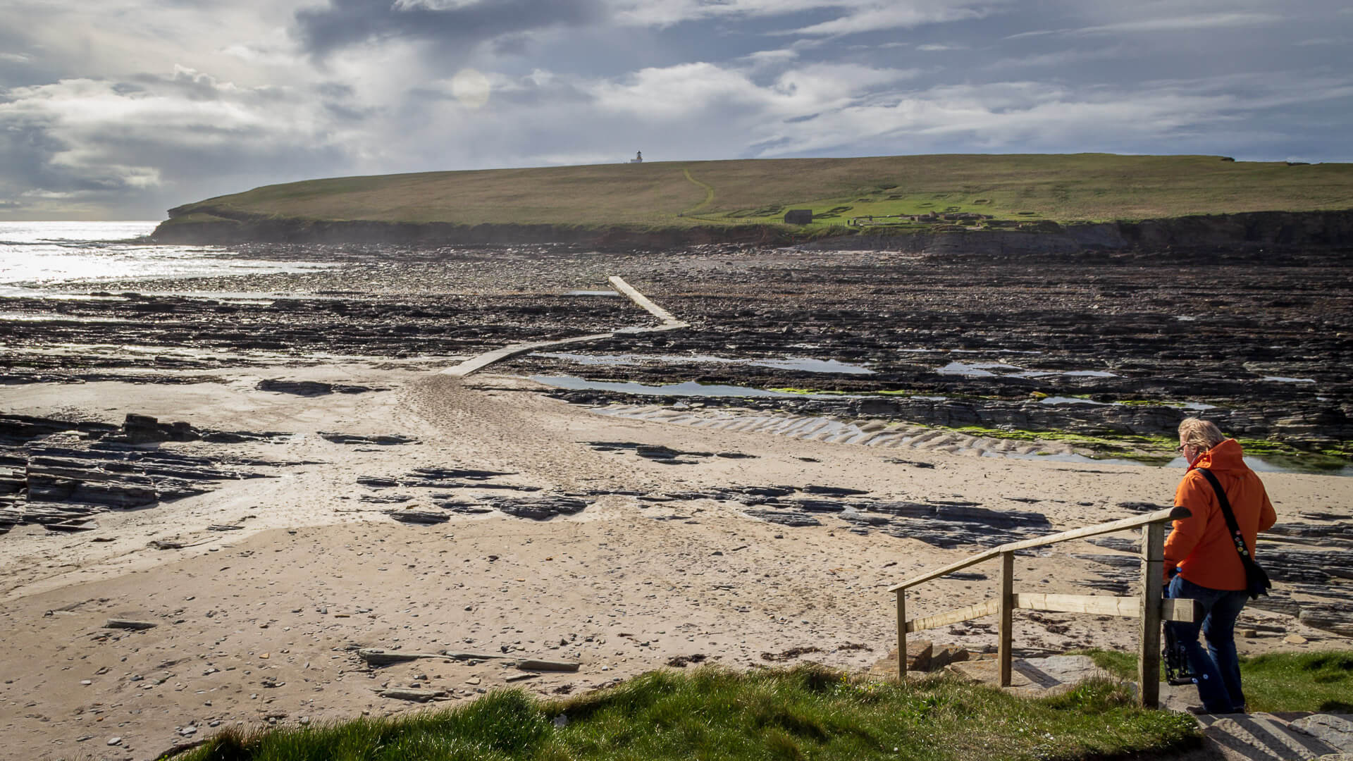
Here, on this small island, once lay the centre of power in the 11th century AD. From his Birsay, his “island fortress”, the Norwegian “Thorfinn the Mighty” ruled over Orkney, Shetland, and Caithness and Sutherland.
Thorfinn was not a pleasant man. Contemporaries described him as tall and powerfully built, with a great nose and bushy black eyebrows – all in all, rather ugly. He’s said to have been hungry for power, but also brave and shrewdly tactical.
On Birsay he felt safe, since the island could only be reached via a narrow crossing, and only at low tide – though boats could still be launched from one side of the island. It was here that Thorfinn built his farmstead. In doing so, he took over much of the existing Pictish and Viking settlement, including an old Pictish symbol stone. Nor did Thorfinn go without his comforts: his house was heated by underfloor heating, with a sauna attached.
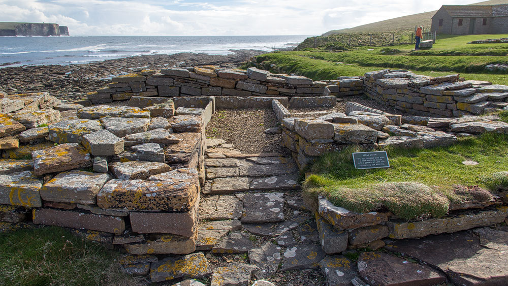
Despite all his hunger for power and his skill at warfare, Thorfinn was a Christian. He even made a pilgrimage to Rome to visit the Pope. And so Birsay soon had its own church, complete with a bishop’s seat.
From Birsay, Thorfinn thus ruled over what was, for the time, a substantial realm. Only his descendants later moved the seat of power to Kirkwall. Since then, this little island has grown quiet.
Good to know: About the Brough of Birsay and its lighthouse
As with the word “Cape Wrath“, the name “Brough of Birsay” conceals a kind of doubling-up of Scots and Norse words. “Brough” means “fort” and is essentially just a variant of the common word “broch”. “Birsay” comes from the Old Norse “Byrgisey”, meaning roughly “island fortress” or “island reachable only via a narrow strip of land”.
The Brough of Birsay covers 21 hectares, roughly the size of 30 football pitches. The path from the car park to the island is about 260 metres long.
The settlement history of the Brough of Birsay begins sometime around 600 AD. At that time, the Picts held power here, and it’s from this era that the Pictish stone dates, now displayed here as a replica, with the original kept safely in Edinburgh. Before long, though, the Vikings took over not just the whole of Orkney, but the settlement on Birsay too. They built a farmstead and houses, of which many wall remains can still be seen today. Around 1100 AD, a monastery was then established on Birsay, though it was soon abandoned again, as St Magnus Cathedral in Kirkwall took on the more prominent role around that time.
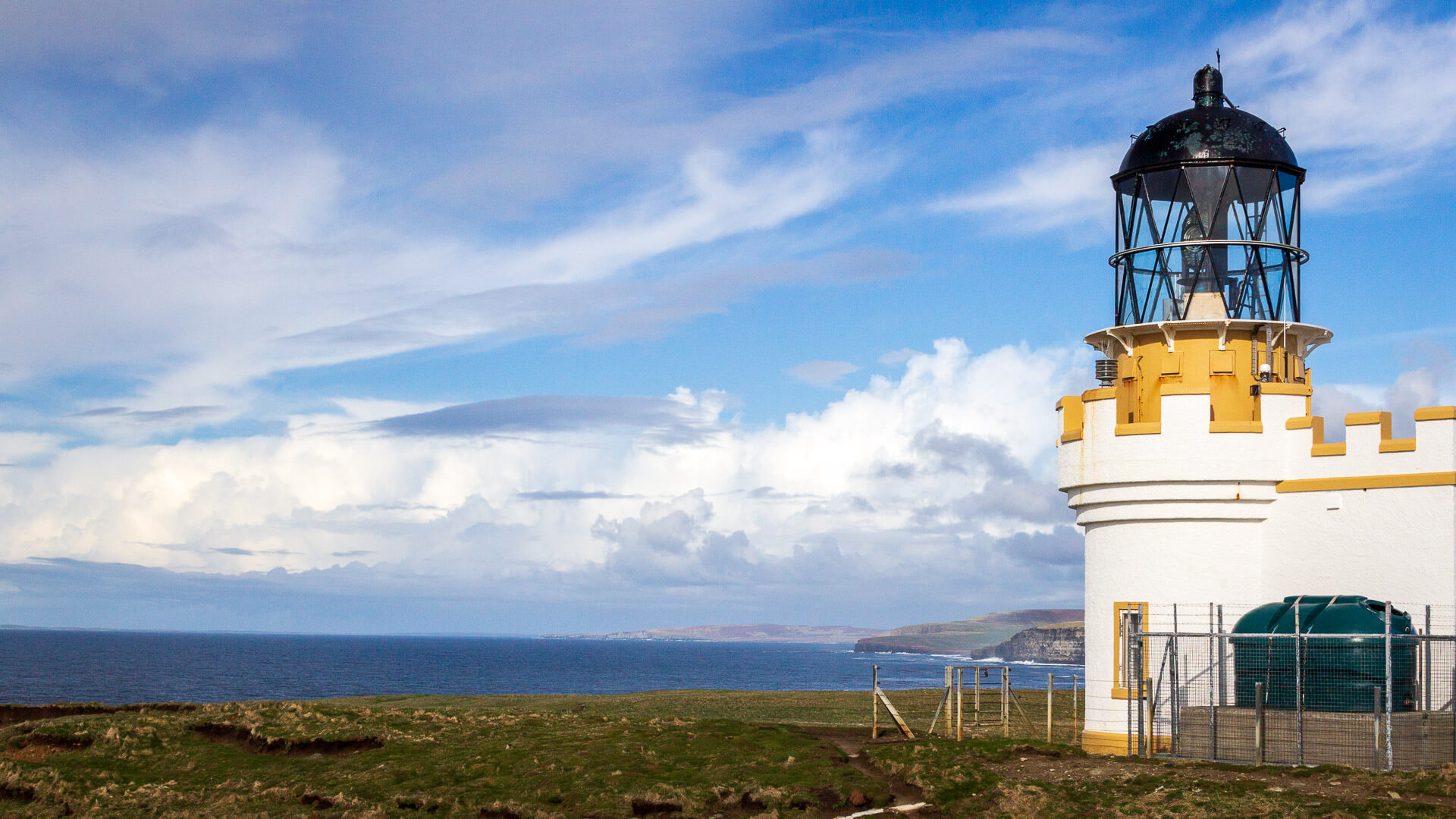
Today, the island is uninhabited. The only two modern buildings are the small visitor centre and the lighthouse at the top of the island. Like almost every lighthouse in Scotland, this one too was built by a member of the famous Stevenson family of engineers – in this case David A. Stevenson, in 1925. The tower itself is only eleven metres tall, but thanks to the island’s elevation, its light reaches a height of 52 metres above sea level.
Personal note: A well-explained village with a view
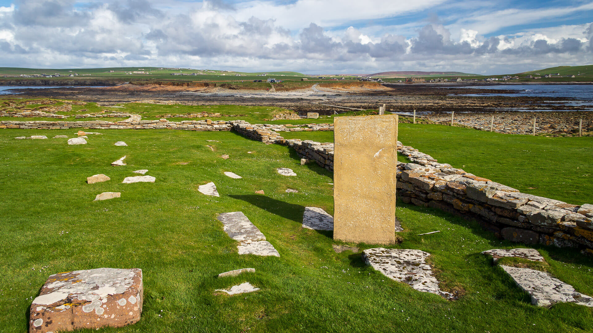
The stone ruins are rather bewildering when you’re standing in front of them. But the good signage and helpful explanations quickly help you grasp the layout of the settlement. The information at the visitor centre helps too.
Just imagine the view the settlers must have had back then – all from a house fitted with underfloor heating…
Tip: A short walk with a big view
Once you’ve taken your time exploring the settlement at the start of the island, it’s worth setting aside a little more time for a walk to the lighthouse and beyond. The path climbs the rise over soft grass. On the other side, the island then drops away steeply. Seabirds dart about between the cliffs here, with the sea roaring below.
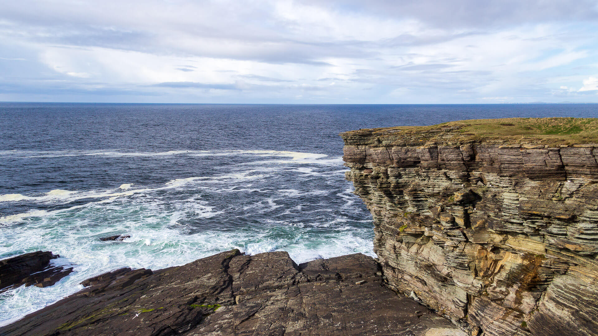
Only a few visitors take this path, so with a little luck you’ll have the island to yourself here, and for a moment, you’ll genuinely feel like you’re in another world.
You can then take the way back along the flank of the island, on the side to the left of the settlement as you look at it.
Getting there:
With a sat nav: “KW17 2LX” will bring you to the village. From there, watch for the signs to the Brough.
Without a sat nav: From Stromness, first take the A965 towards Kirkwall, then after just a few hundred metres turn left onto the A967. Sandwick, and already Birsay, are signposted here. Follow this road for around 14 kilometres (9 miles), until you reach a T-junction. Turn left there towards Birsay, staying on the A967. At the next major sign, on a 90-degree bend, turn onto the A966 towards Birsay. Follow the road, and shortly before the old Earl’s Palace, a brown sign for the Brough of Birsay appears. From there, simply follow the road to the car park.
From Kirkwall, first take the A965 towards Stromness, then turn right shortly after Finstown onto the A967 towards Harray, Dounby and Birsay. Continue until you reach the A966, as described above.