Small alleyways wind their way between old stone houses down to the fishing boats. The harbour town of Crail in Fife promises a romantic visit.
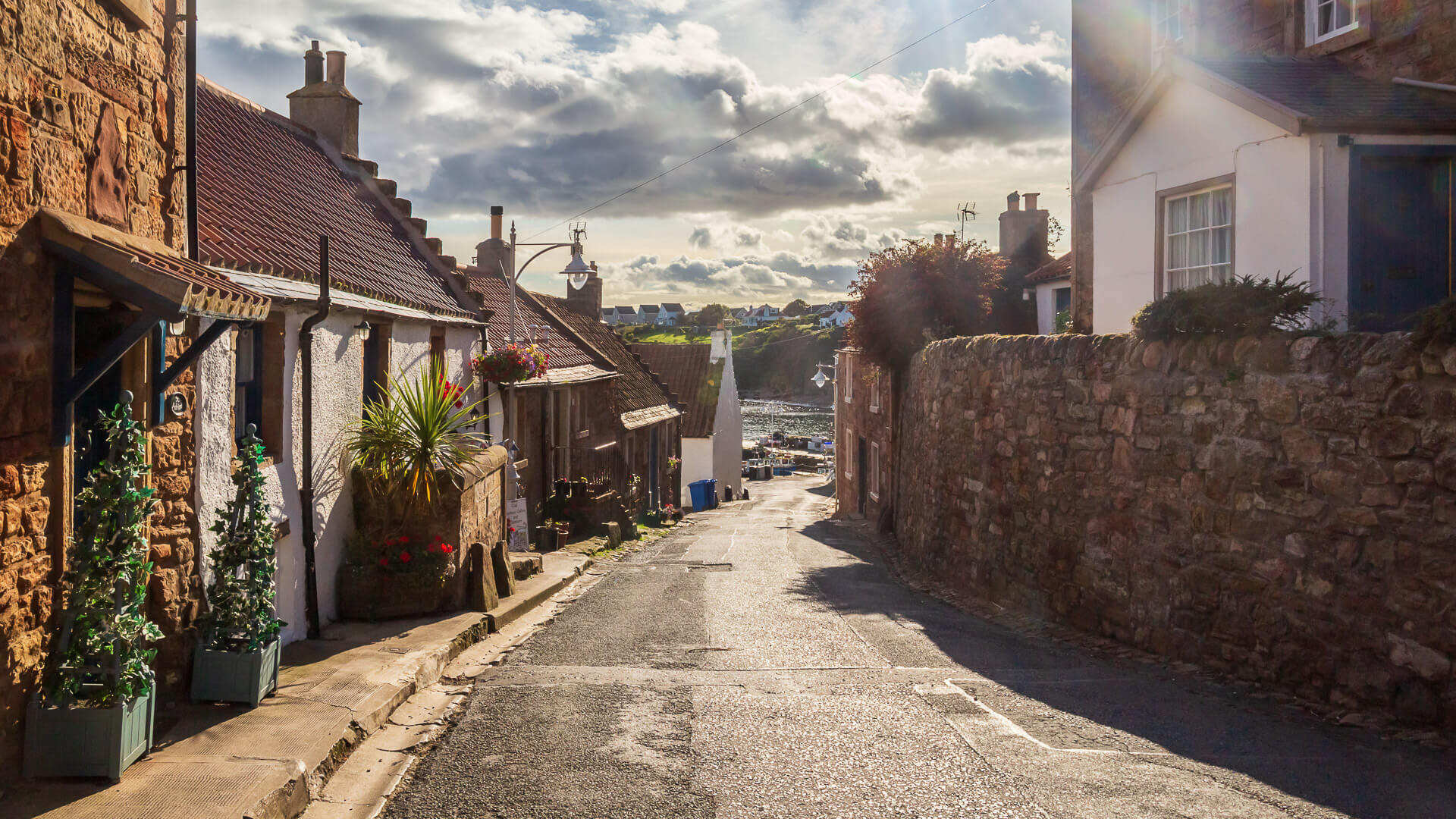
Crail is perhaps the most beautiful harbour town in Fife – if not in the whole of Scotland. Strolling between the houses, visitors feel transported back to the time of medieval burghs, or market towns.
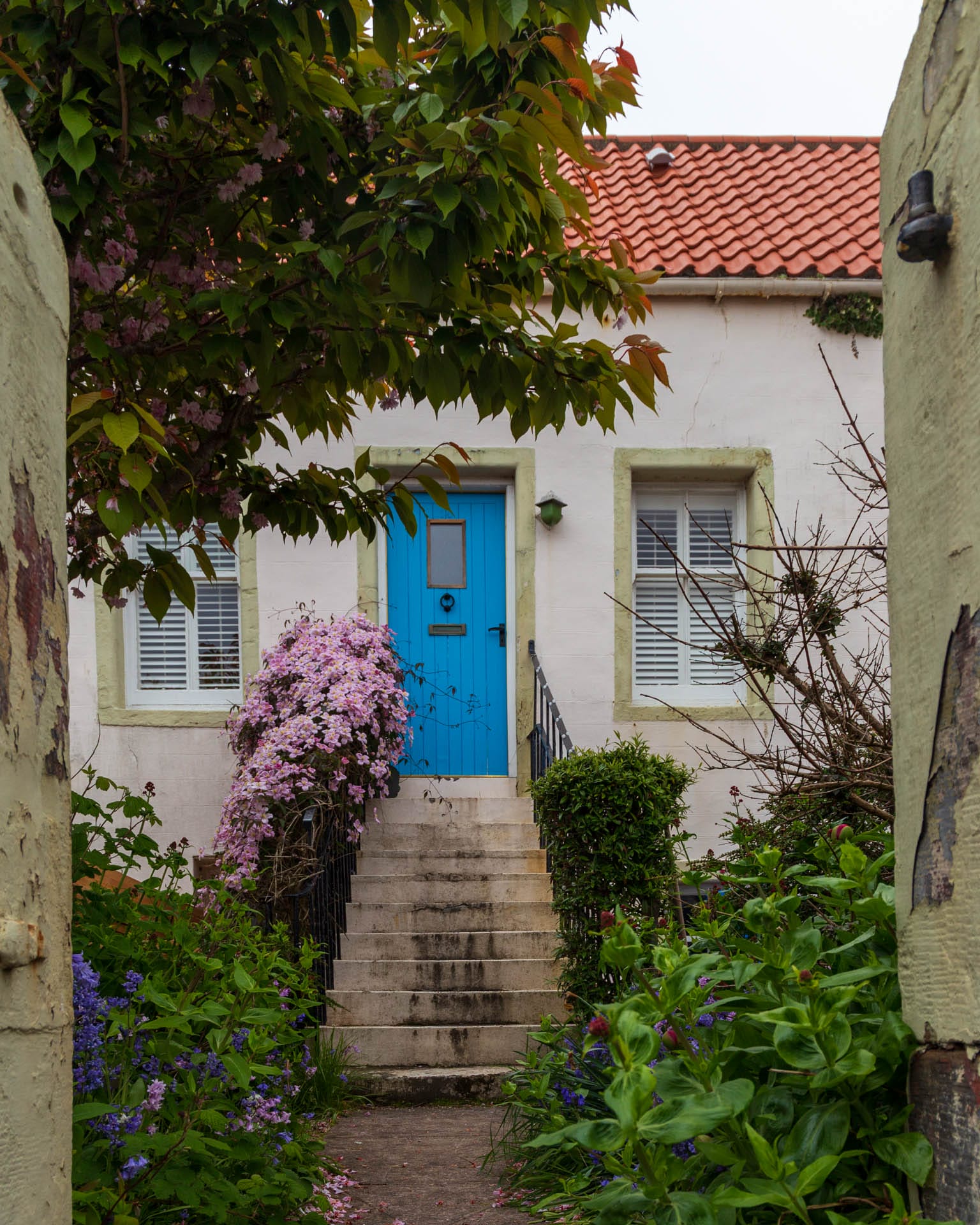
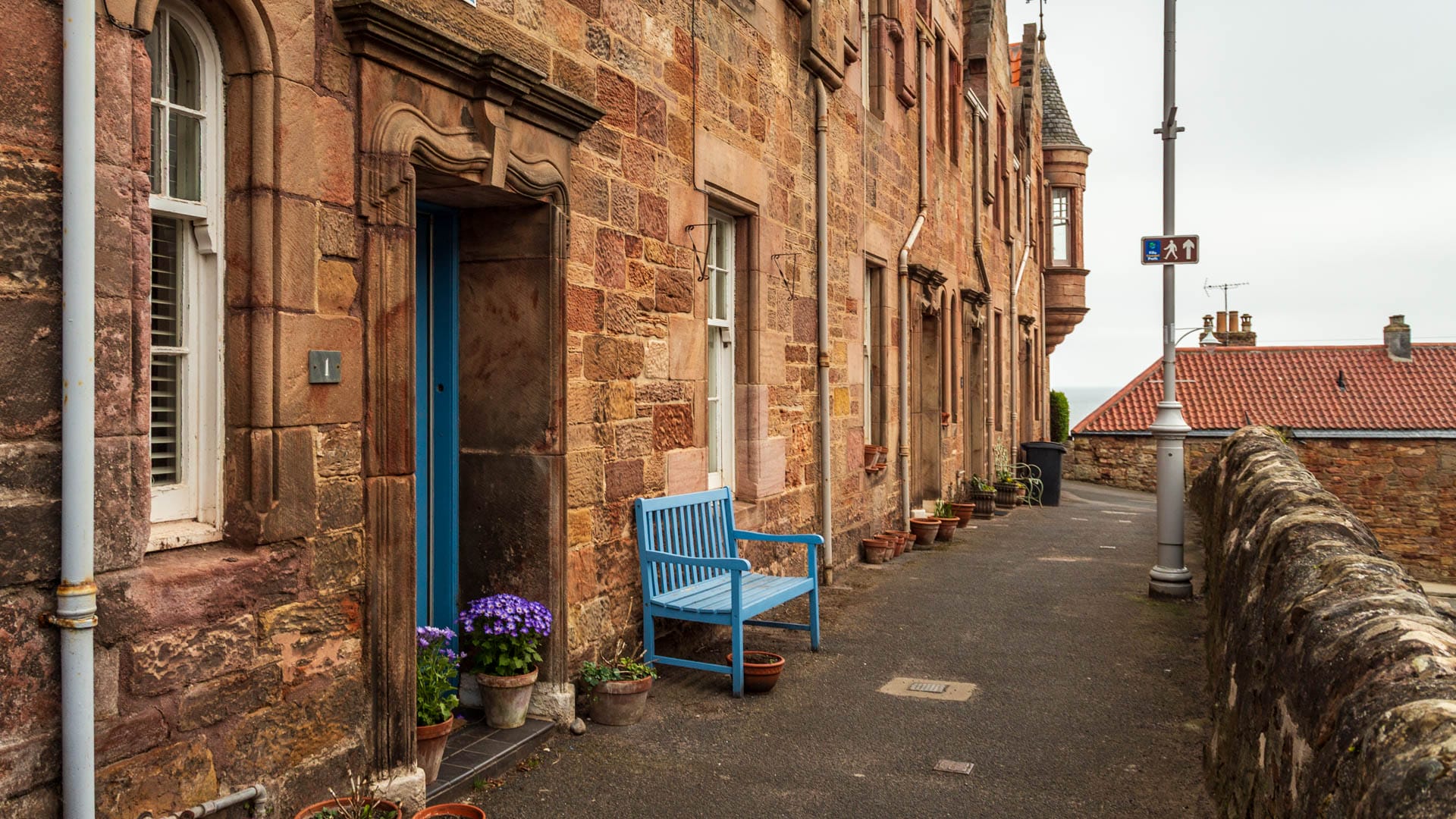
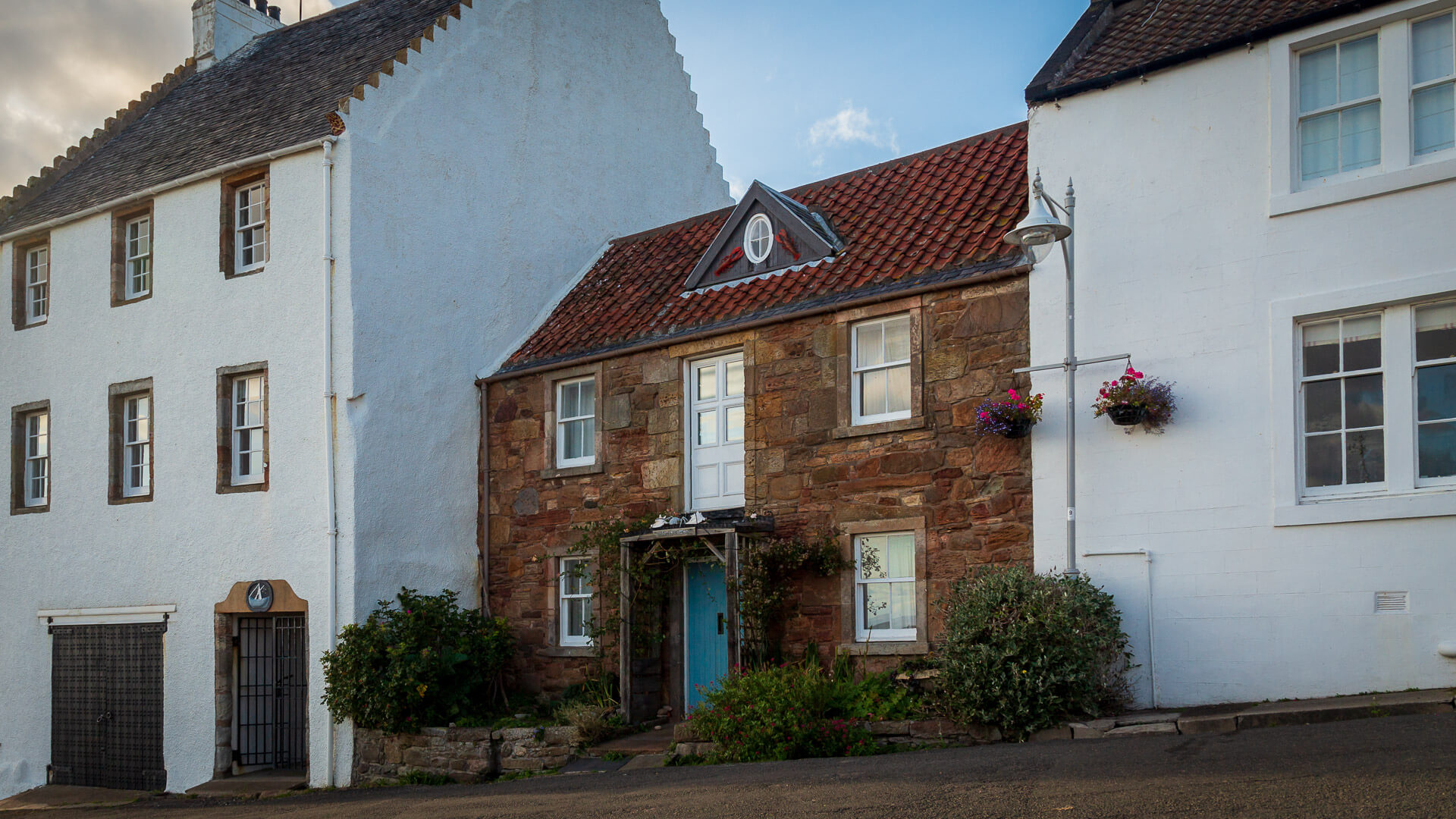
The buildings really do have a look all of their own. Everything seems a bit lopsided in Crail. The façades either show the natural stone or are whitewashed. The gables of the houses proudly bear the steps so typical of the Fife region.
In front of the doors, small landings lead up from the weathered kerbs. Almost all the residents decorate them with plants – real and fake.
Crail is a total work of art, none of the buildings stands out as a separate sight. It is therefore worth taking a long walk to enjoy the place.
The car has to be parked in the upper part of the village anyway – it is forbidden to drive down to the harbour. However, it is much nicer to explore the alleyways on foot anyway.
The sights of Crail in one walk
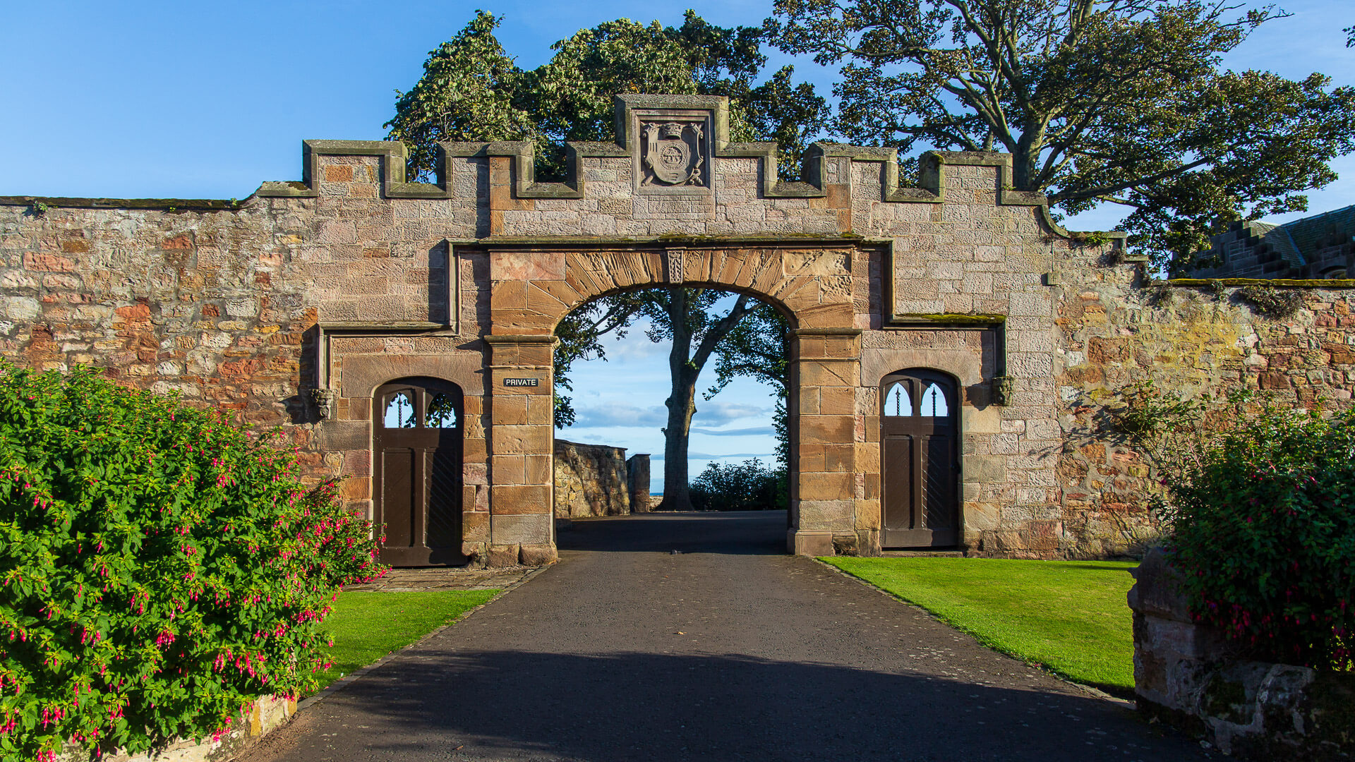
The starting point can be the Nethergate car park. From there, the path leads via Nethergate, Rumford to Castle Street. However, the former castle is no longer there. Only the old gate with the coat of arms above it has been preserved.
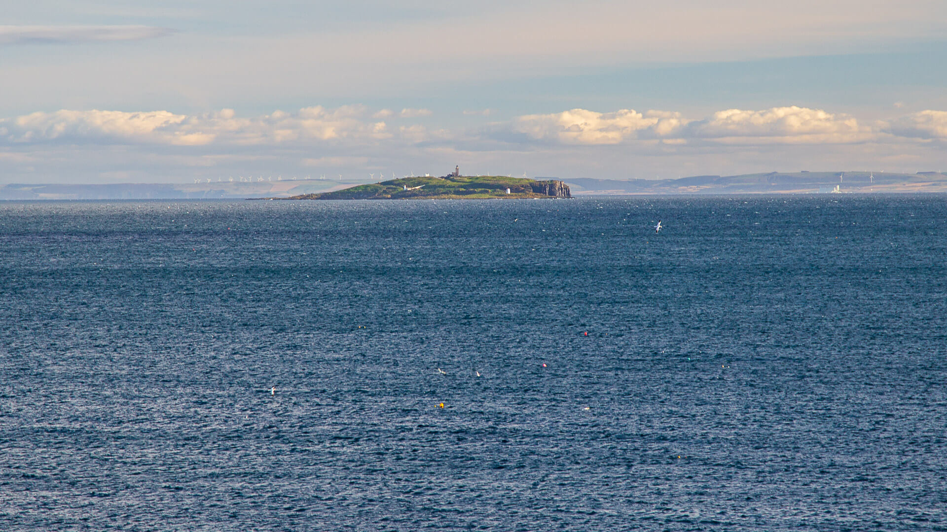
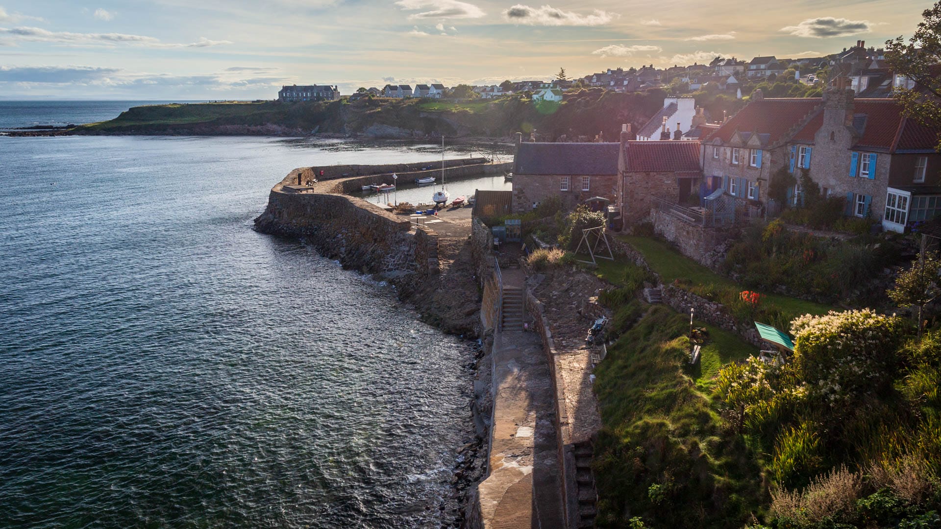
However, it is more interesting to walk along the wall on the left. This is the Castle Walk and it offers a wonderful view across the sea to the Isle of May.
There is also a good view of the part of the town below with the harbour.
The old sundial on the Castle Walk is also fascinating. It stands on a fossilised tree trunk.

The path around the old castle ends at Castle Terrace with a row of houses dating from around 1900.
The descent to the harbour via Shoregate begins here. To the left and right of the ancient houses, a view of the fishing boats opens up below.
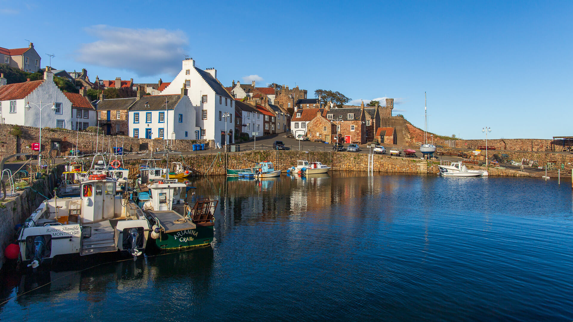
Important old buildings are lined up around the pier. For example, the former customs house.
You can almost walk around the harbour basin on the wall. This also opens up a view of the small beach.
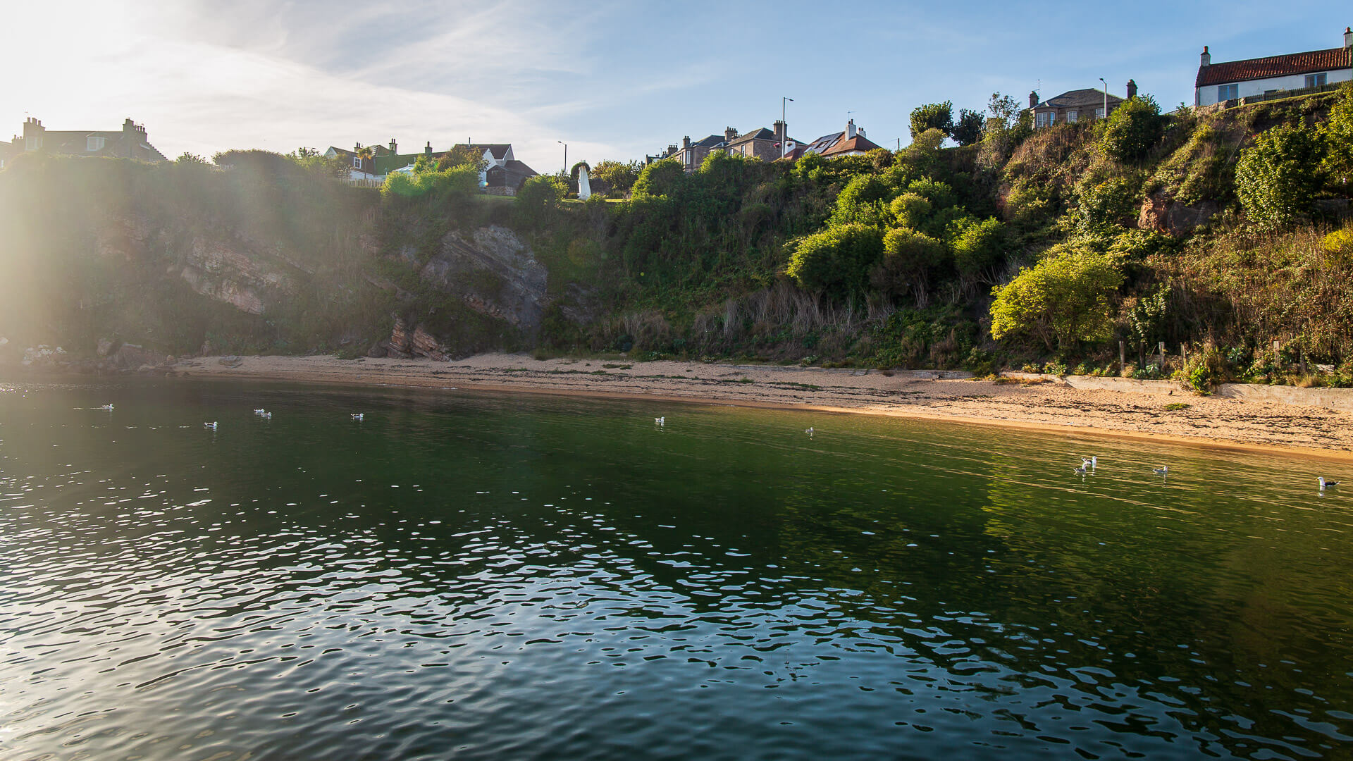
If you want to visit the beach, you can, but the tide might put a spanner in the works. Fossils can also be seen at the end of the beach.
Just before the beach, however, the climb back up to the upper part of the village begins.
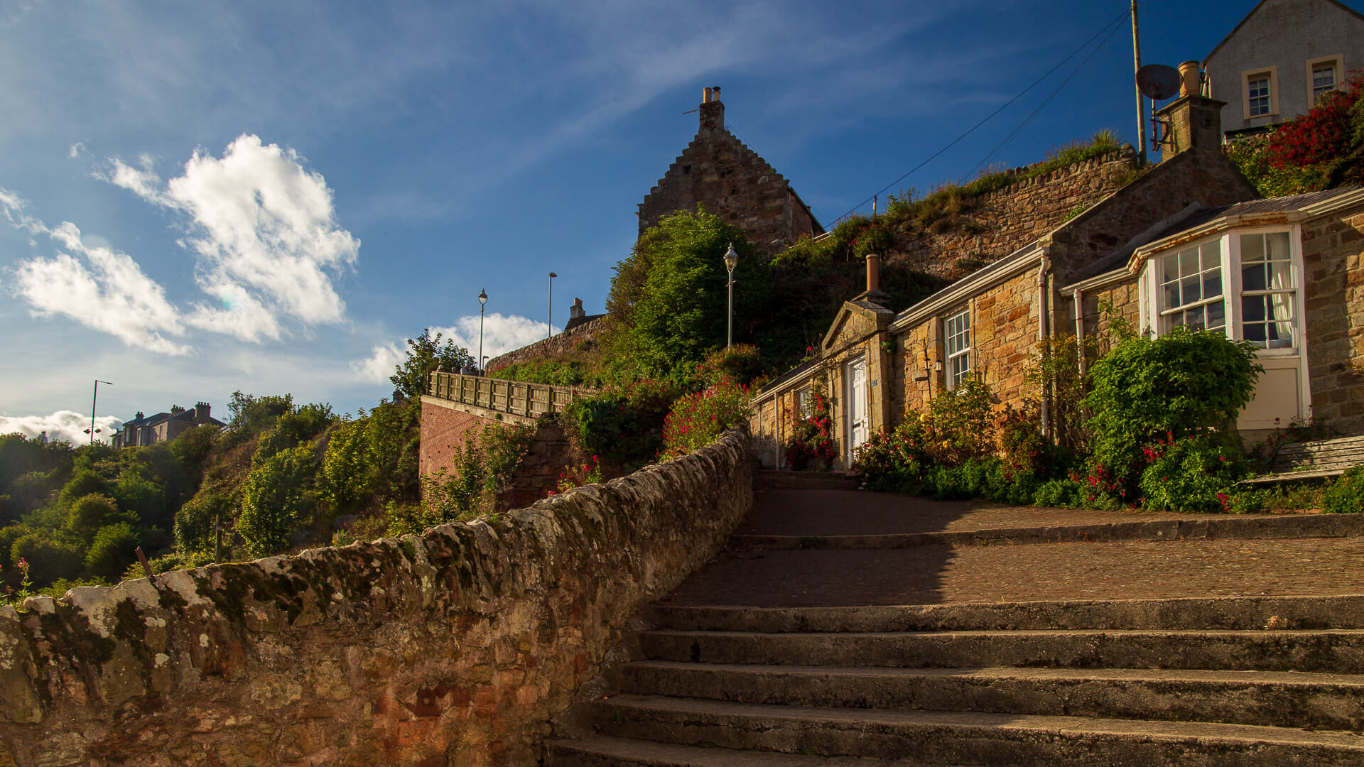
These are the so-called Hen’s Ladder Steps. The steps were restored in 2001 with EU funds and offer another beautiful view as you climb up.
At the top, follow Westgate and High Street back up to the building with the tower, the Tollbooth. Turn right here into Tollbooth Wynd and you will reach the car park again.
Knowledge: History of Crail
Crail was able to develop so well because it had an important patron: King David I. He seemed to like the harbour town so much that he had a castle there and granted Crail market rights. In Scots, this is a burgh.
This meant that Crail was allowed to hold a market on Sundays. At the same time, this supported trade. One of the most important partners was the Netherlands. Traces of this connection can be seen in the tower of the Tollboth (the old administration building), which features Dutch architecture. Some say that the Dutch even helped to build the harbour.
The reddish shingles on the houses are also said to have originally come from the Netherlands. Back then, they were used as ballast in the empty ships.
Crail’s source of wealth was, of course, fishing. The merchants shipped salted herring and dried haddock.
In the 16th century, however, Crail lost its importance – larger towns and harbours took over its role. And so it became the small and romantic fishing village of today, which, together with St Monans and Pittenweem, makes the coast of Fife so beautiful.
How to get there
With satnav: enter “KY10 3TZ”, this will take you to Crail.
Without satnav: Coming from Edinburgh, take the M9 onto the A92 towards Kirkcaldy. At Kirkcaldy, take the roundabout towards “Kirkcaldy East and Central” and at the next roundabout take the exit for “Leven A915”. Stay on the A915 and later the A917, Crail will soon be signposted.