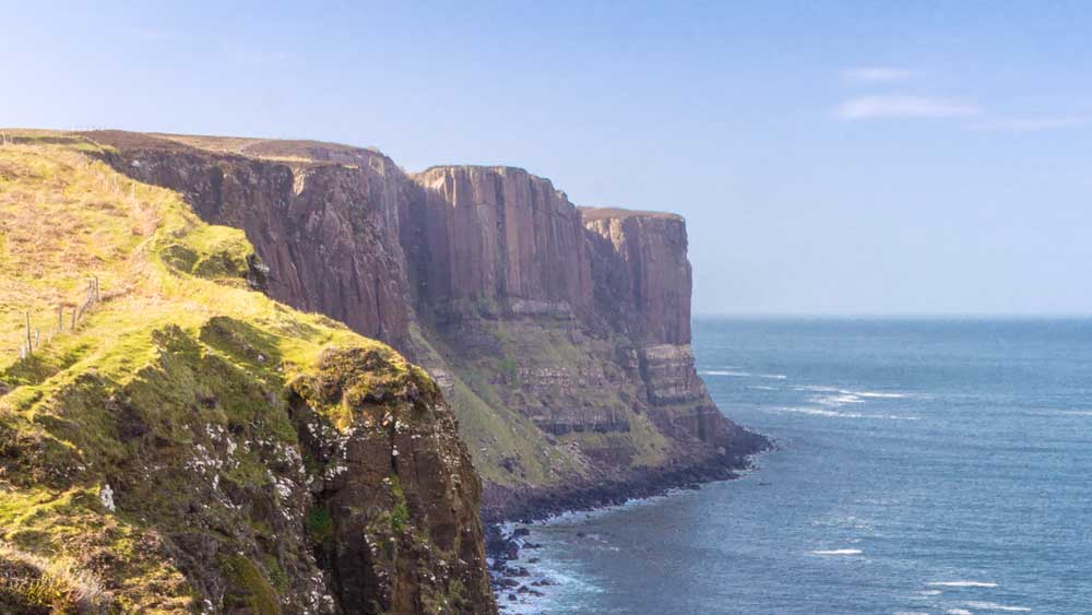
His resemblance to the tartan pattern of the kilt earned this coastline the name Kilt Rock. In the past, sailors used it as an important landmark. Today, it is mostly admired by tourists.
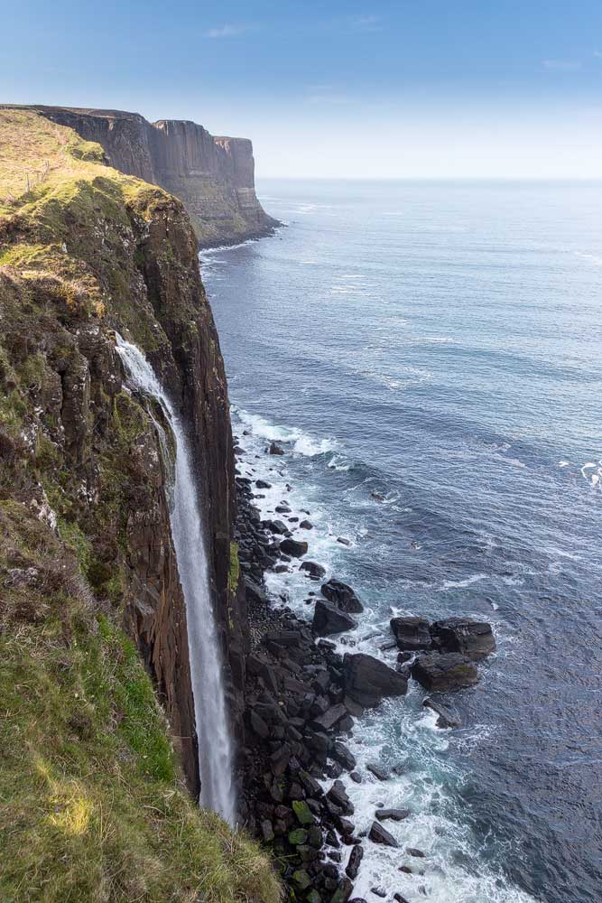
Whoever wants to see the rock should be free of giddiness. For to get a good look, visitors step out onto a semicircular platform. Below: First nothing for a long time, then the roaring sea.
But the view is worth it. For not far from the platform, a waterfall plunges boldly down the cliff. It is the Mealt Fall, exit of the eponymous Loch Mealt.
Not infrequently, however, the wet doesn’t reach the bottom at all: The wind sometimes atomizes it into a fine mist and carries it away.
Further in the background the visitor then sees Kilt Rock. The rock seems to stretch upward like ancient columns. As it does so, the different layers form a checkered pattern, which gave the rock its name.
Knowledge: Shaped by natural forces
Volcanic activity is to blame for this unusual rock formation. About 60 million years ago, lava was constantly flowing between sandstone and cooling. That created the pattern.
In total, the northern peninsula of the Isle of Skye has been covered by layers of lava up to 1.2 kilometres thick.
Tip: Also go to the right
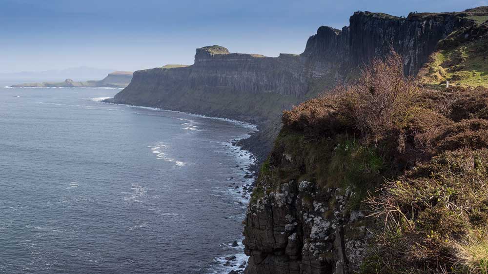
The attractions – that is, Kilt Rock and the waterfall – are on the left. But it’s worth going a few more feet to the right, a bit away from the platform. Then you can see the massive rock walls there getting lost in the horizon.
These are also where far fewer other people go, most staying at the lookout itself.
Personal note: Lots going on there
The platform is not very big and you can only get a really good view from one particular spot. Unfortunately, when we went there, there was just another tour bus. And mostly people then take pictures of themselves on the platform without appreciating the scenery for long.
When we finally got some space, we had to lean out quite a bit for the photos … a bad feeling, especially since I was still holding the camera out.
Approach:
With satnav: Entering “IV51 9JE” will take you as far as Elishader, which is a little over 500 yards away.
Without sat nav: Coming from Portree, take the A855 to Staffin, which is to the north. After about 25 minutes you pass the village of Valtos. Then on the right hand side the sign for the car park to the viewpoint. In total it is perhaps 25 kilometres from Portree.
From the north, for example from Quiraing, you first pass the village of Staffin before the sign to the viewpoint appears on the left after about three kilometres.
By the way, the parking lot is big enough for lots of cars.