A spit of land stretching into the sea with bizarre shapes: the Brother’s Point. People once lived on it, and dinosaur footprints can be found around it.
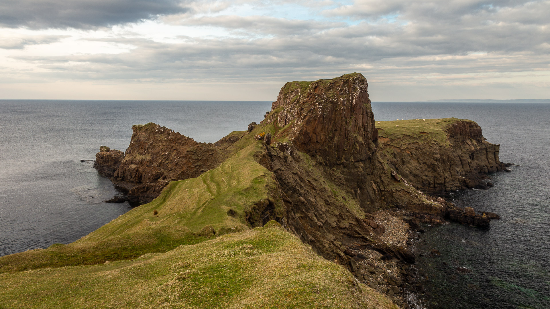
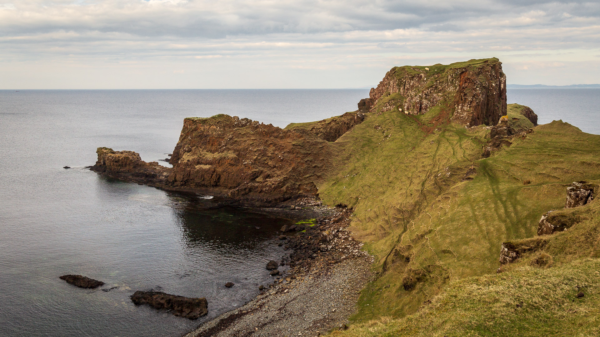
Rubha nam Bràithrean, or Brother’s Point in English, is an impressively beautiful headland of rock. It thrusts into the strait between Skye and Raasay in the east of Isle of Skye -very similar to Neist Point in the west of Skye.
However, Brother’s Point has a unique structure. For if you stand right at its beginning, it looks as if the land branches left and right after a large rock. The flanks are partly bare rock, but partly gentle grassy slopes with a sort of wave pattern on them.
To admire this natural spectacle, visitors must lace up their hiking boots. And no: that’s not a metaphor, because even though the trail is only about three kilometers short, there are some sections that require a firm footing.
The nice thing is that along the way there are not only excellent views of the headland, but also other places of interest. For example, there lie the remains of old houses. At one that once belonged to Ruaraidh Dhomhnaill a’ Chuirn, you can even still see the chimney. It is said to have been inhabited until the end of the 19th century.
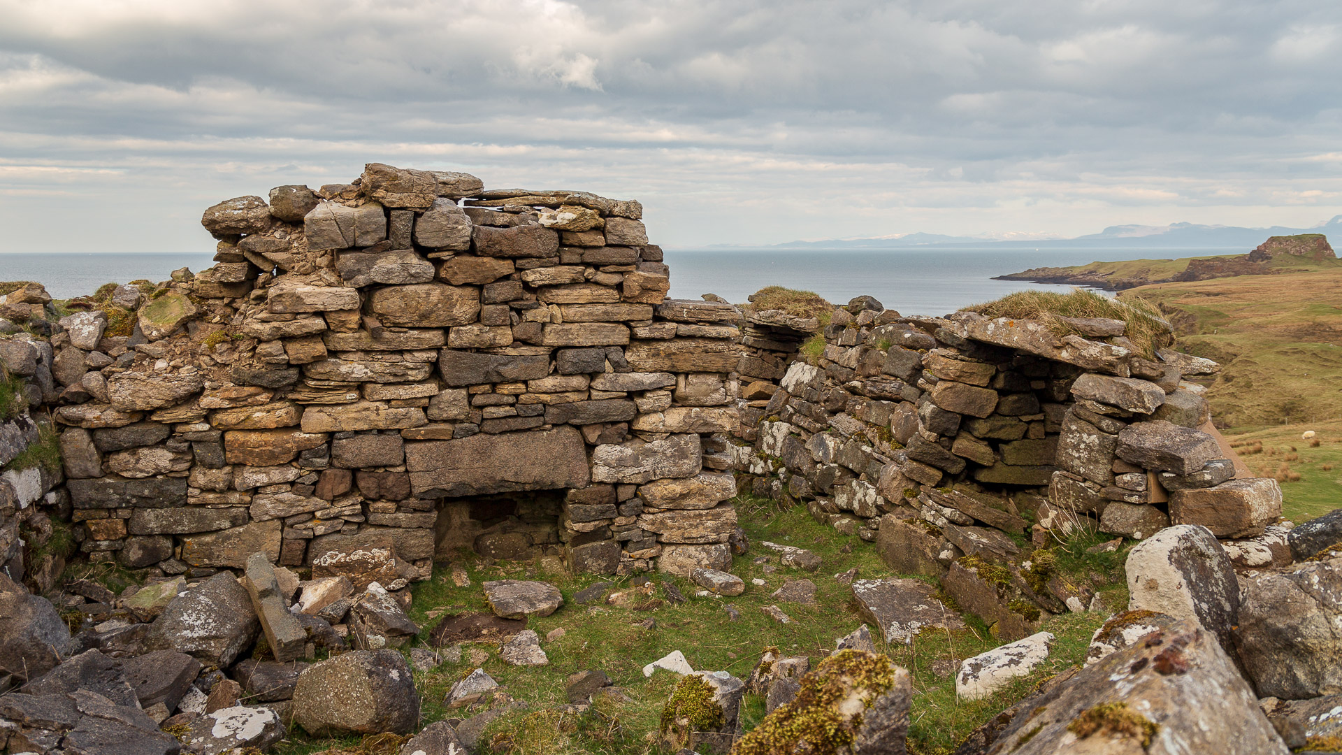
Past the stone beaches stands another ruin of a cottage. The Salmon Bothy, or hut, is one of many once built for salmon fishing along the coast of the Trotternish peninsula on the Isle of Skye.
In the beach area in front of Rubha nam Bràithrean, hikers will also be lucky to find some of the 50+ dinosaur footprints. However, the search for them can take time and it must be low tide. Easier to find are the prints at Staffin a little further north.
Also on the main attraction itself, the Rubha nam Bràithrean, there are still small sights of its own. For instance, there are remains of walls on the large rock called Dun Hasan. And down on the grassy plains, the rounded shapes of old huts show themselves.
But the most beautiful sight is really the view of the headland – especially on a fine day, when the soon-to-set sun from the west lights up the rocks.
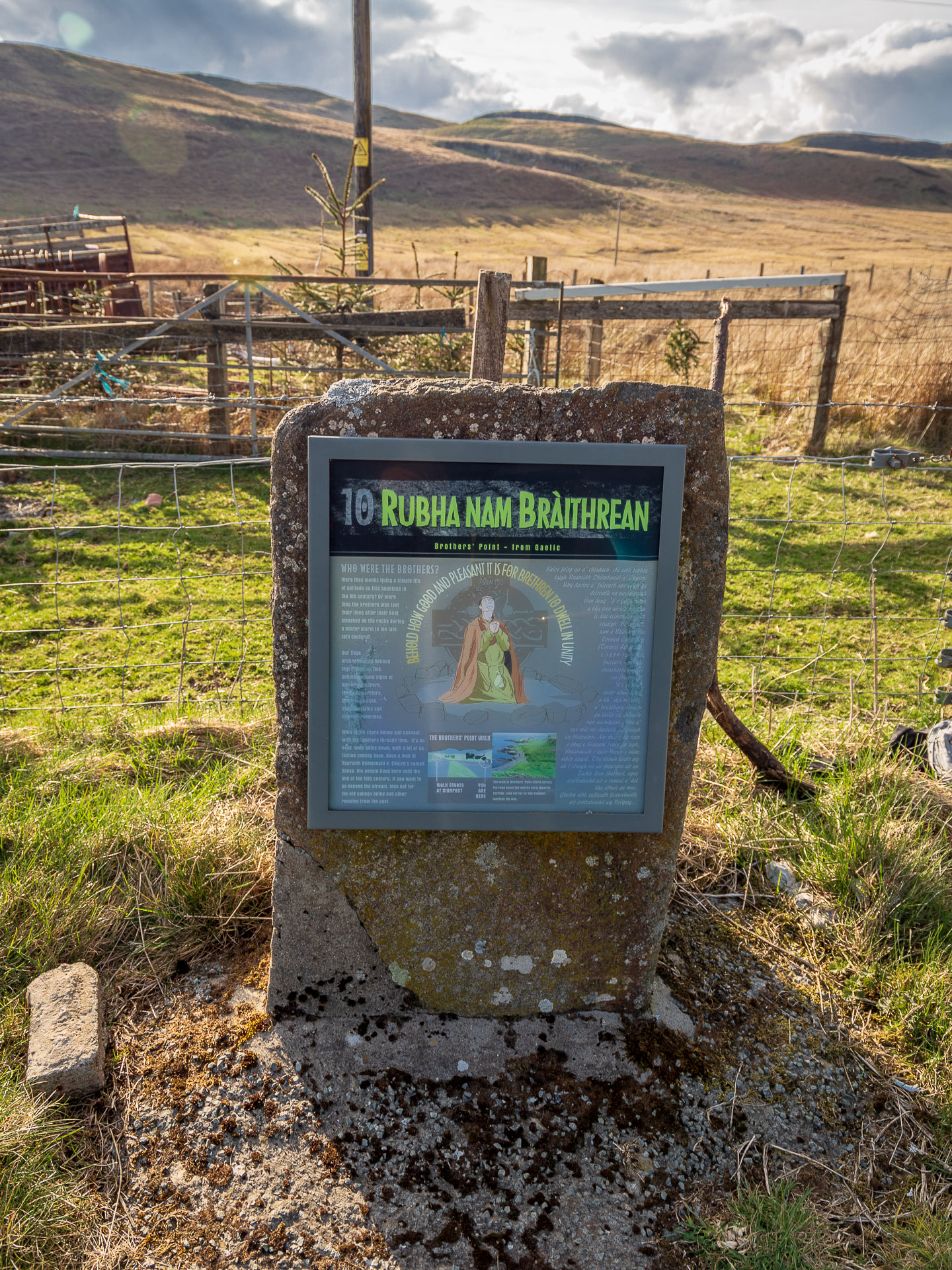
Knowledge: About the name “Rubha nam Bràthairean”
Why the place is called “Brother’s Point” – in Gaelic, “Rubha nam Bràthairean” – is not entirely clear. It could be that monks once lived there – the wall remains on Dun Hasan could be a clue to that. Since it was probably built too late for an Iron Age fort, some think of it as a small monastery, which might explain the name.
Other legends say that the brothers were two crooks, sometimes joining the MacDonalds, sometimes the MacLeods. But even this is not certain.
How to get there: The hike to Rubha nam Bràithrean
Length: 3 kilometers, Time: about 1 to 1.5 hours
The trail is short, but overcomes some elevation gain. Hiking boots are definitely in order, especially since a short section of the trail is quite dangerous.
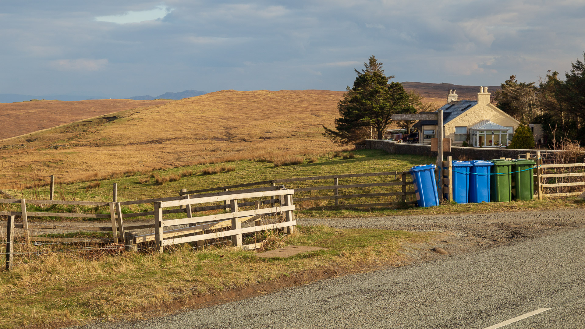
A parking lot is located on the main road (see directions below). There is also an information board about the hike here.
On the A855, we backtrack a few yards before a sign points the way.
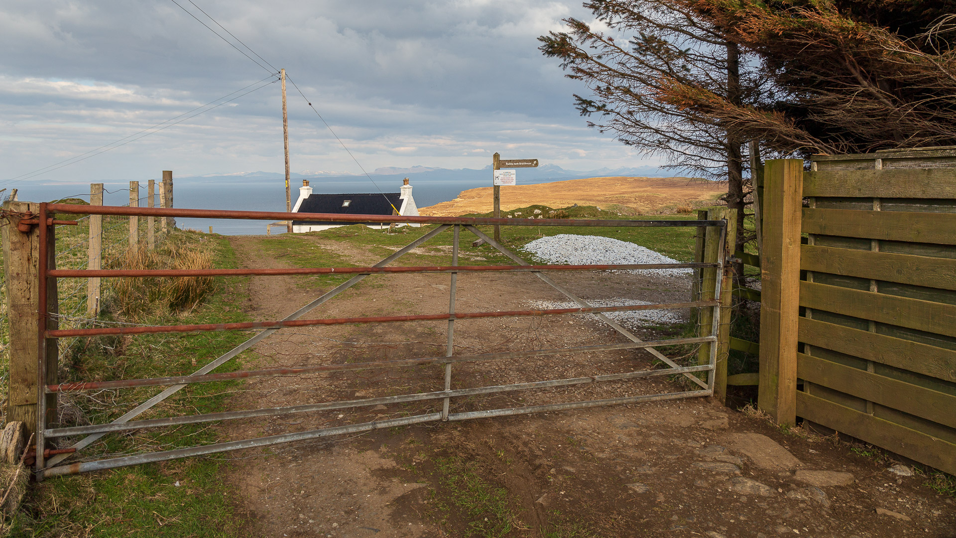
The path leads past houses to two large gates. Through the right of these.
Now head down the hill and you’ll eventually reach the remains of some old houses.
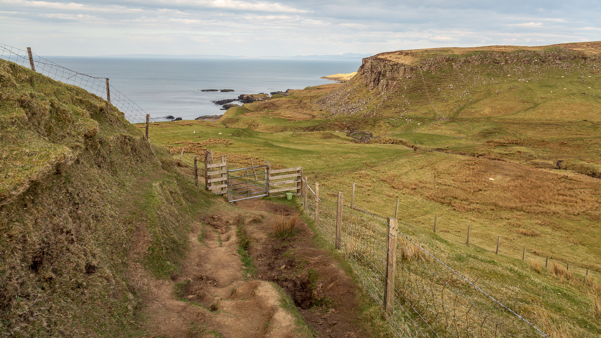
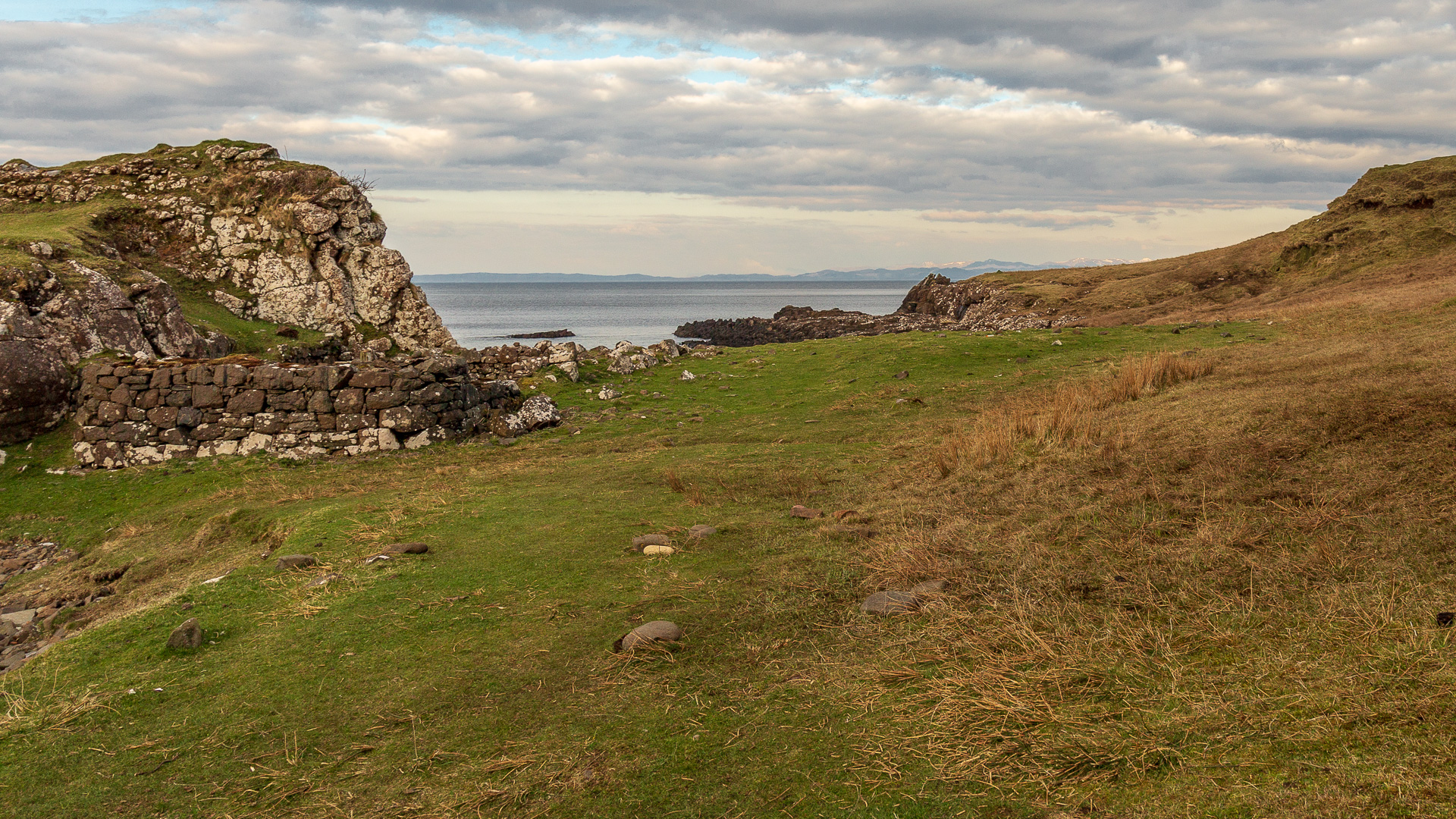
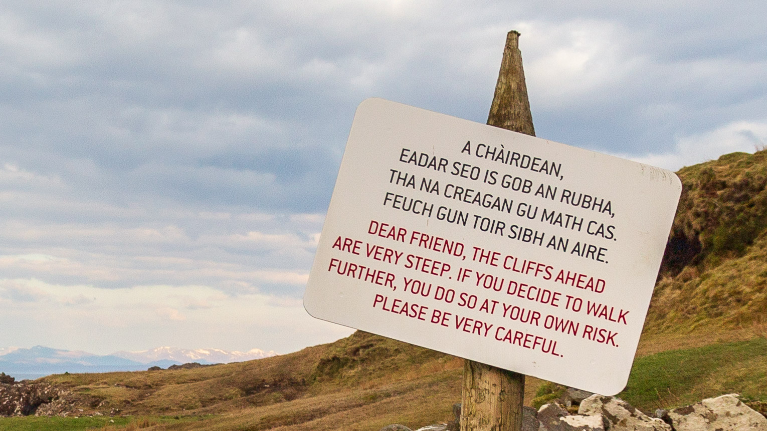
The path soon loses itself on a beach covered by large pebbles and stones. Shale is also sometimes found. Then it continues on a flat. A warning sign now indicates that the trail is becoming dangerous.
It goes over a narrow ledge that drops steeply to the sea on one side. It is not difficult, but it is scary. Then the hiker reaches the level before Brother’s Point. Here the view of the cliffs provides the photo motif.
Those who like, walk up to the headland. In doing so, the steep Dun Hasan must be negotiated. On the other side, the walker reaches a grassy plain that affords views of distant Kilt Rock. Afterwards, it is the same way back again.
Directions:
With sat nav: “IV51 9JH” will get you to Culnacnoc. See next paragraph for parking.
Without sat nav: Coming from Portree, drive north along the A855 until a car park appears on the left just after the Glenview Hotel in Culnacnoc. Coming from the north – i.e. Staffin or the Quiraing the car park is a few hundred yards past Kilt Rock.