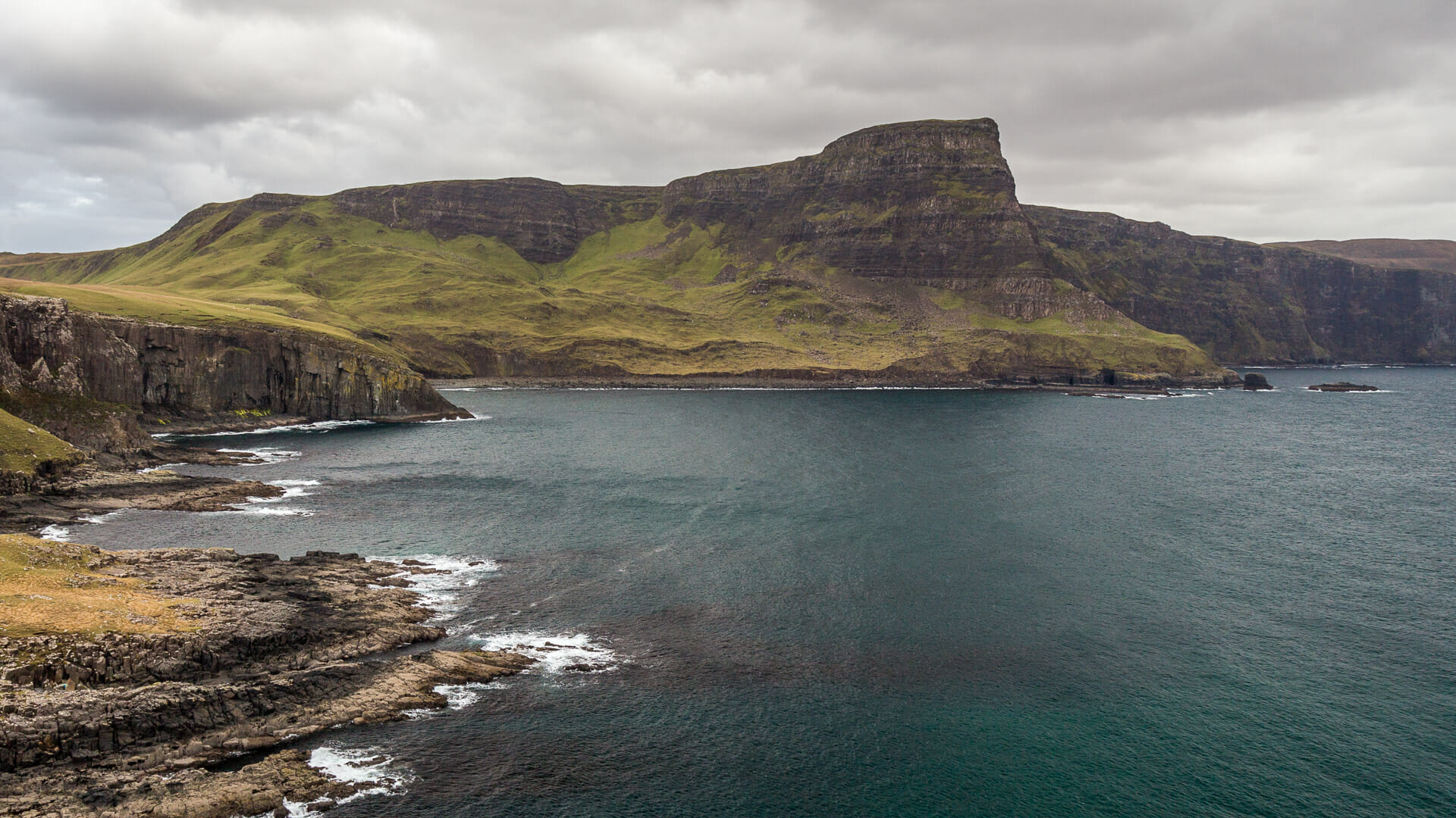
The end of the Isle of Skye comes with a thunderclap: Neist Point, on the far west of the island, features an impressive interplay of cliffs and sea.
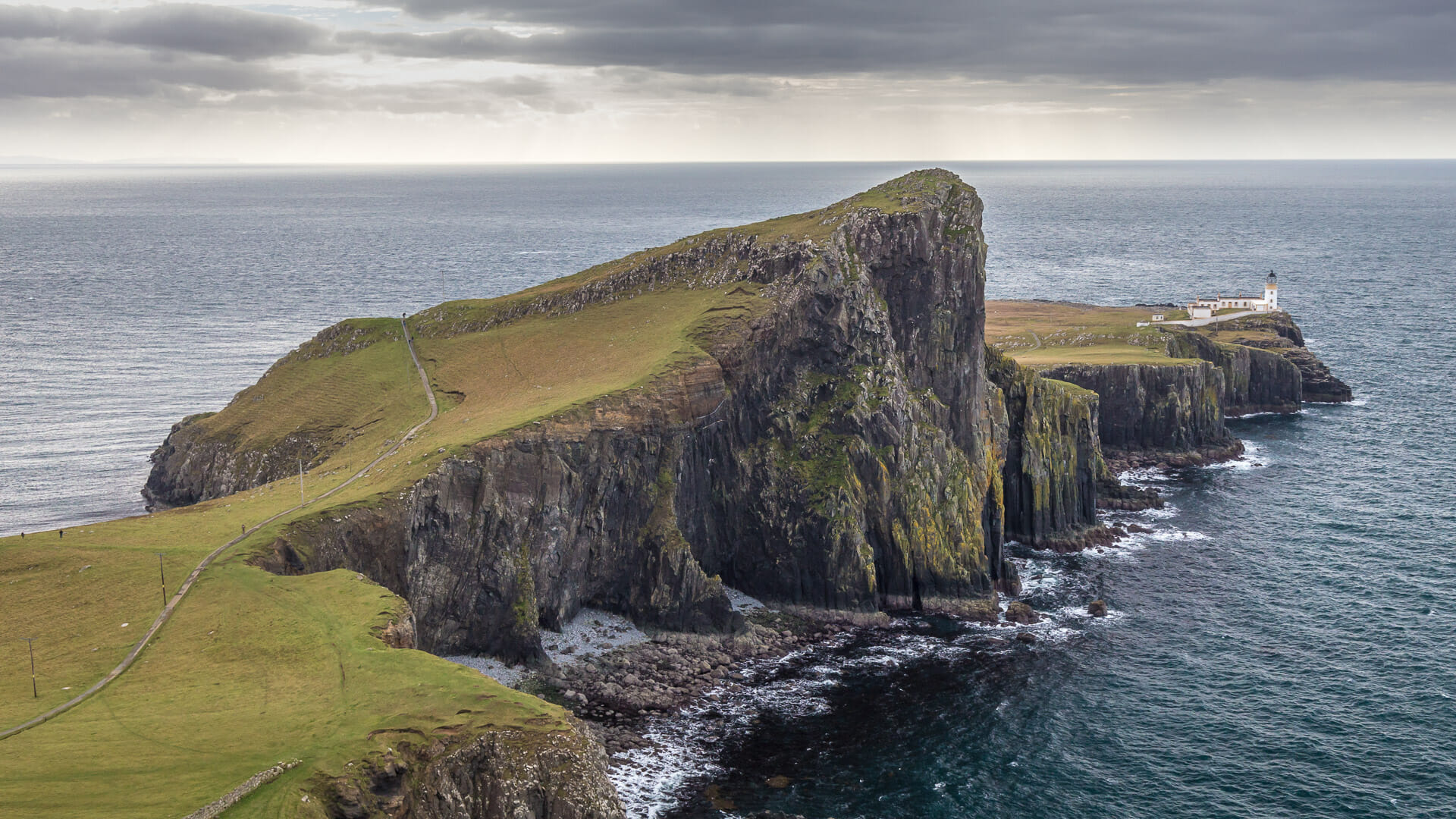
A headland of sheer cliffs stretches into the sea at the westernmost end of the Isle of Skye – almost as if Skye were trying to touch the Outer Hebrides.
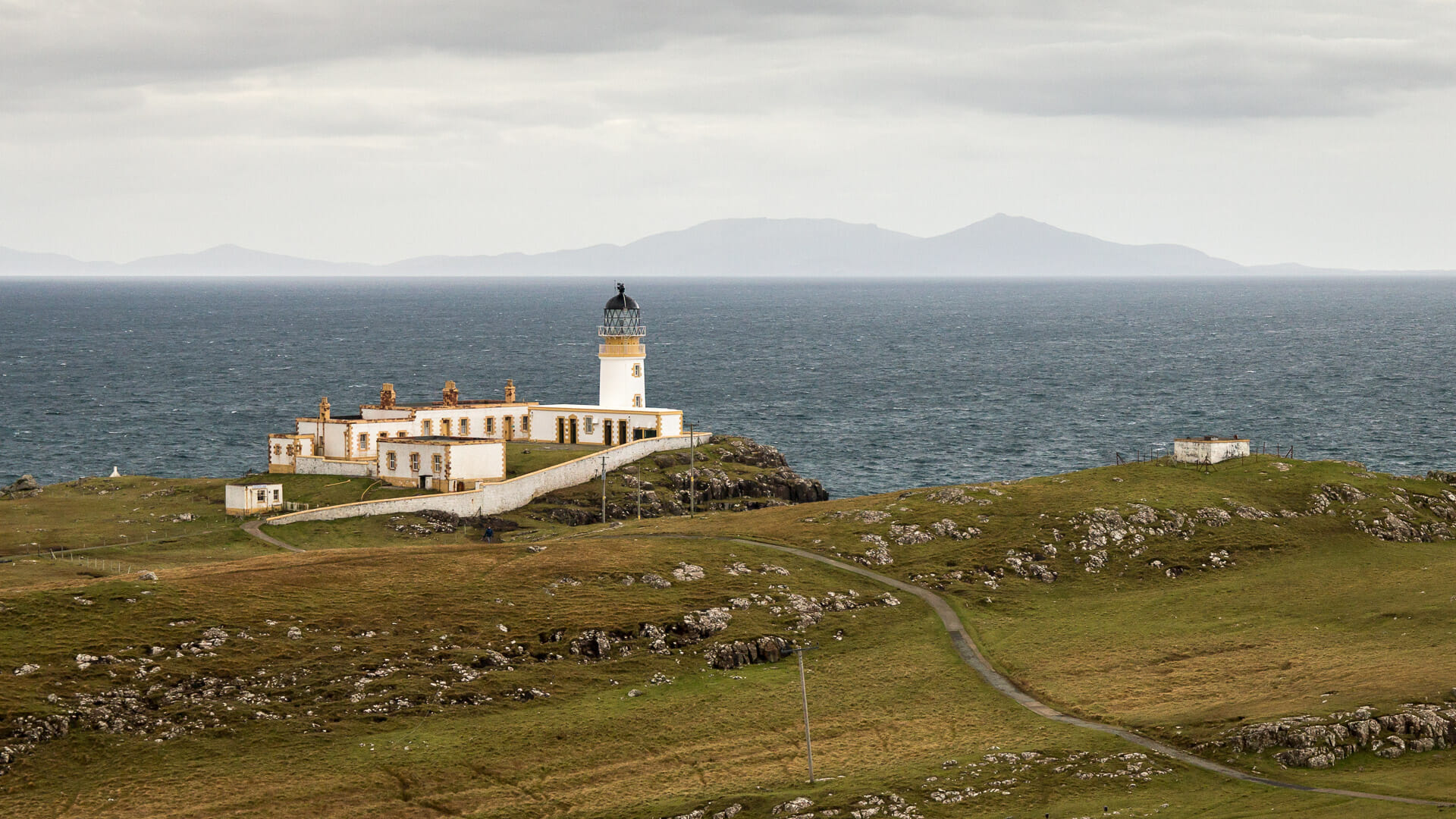
The shape of this headland is unique: like a ski jump, the first part of Neist Point rises first, then swings out into a plateau beyond. At the very end sits one of Scotland’s signature lighthouses.
Visitors can view Neist Point in two ways. One is by walking to the lighthouse, but the other is by taking a detour to the side. For walking a short distance along the cliff opens up the typical view of Neist Point as seen in many pictures – including the one above.
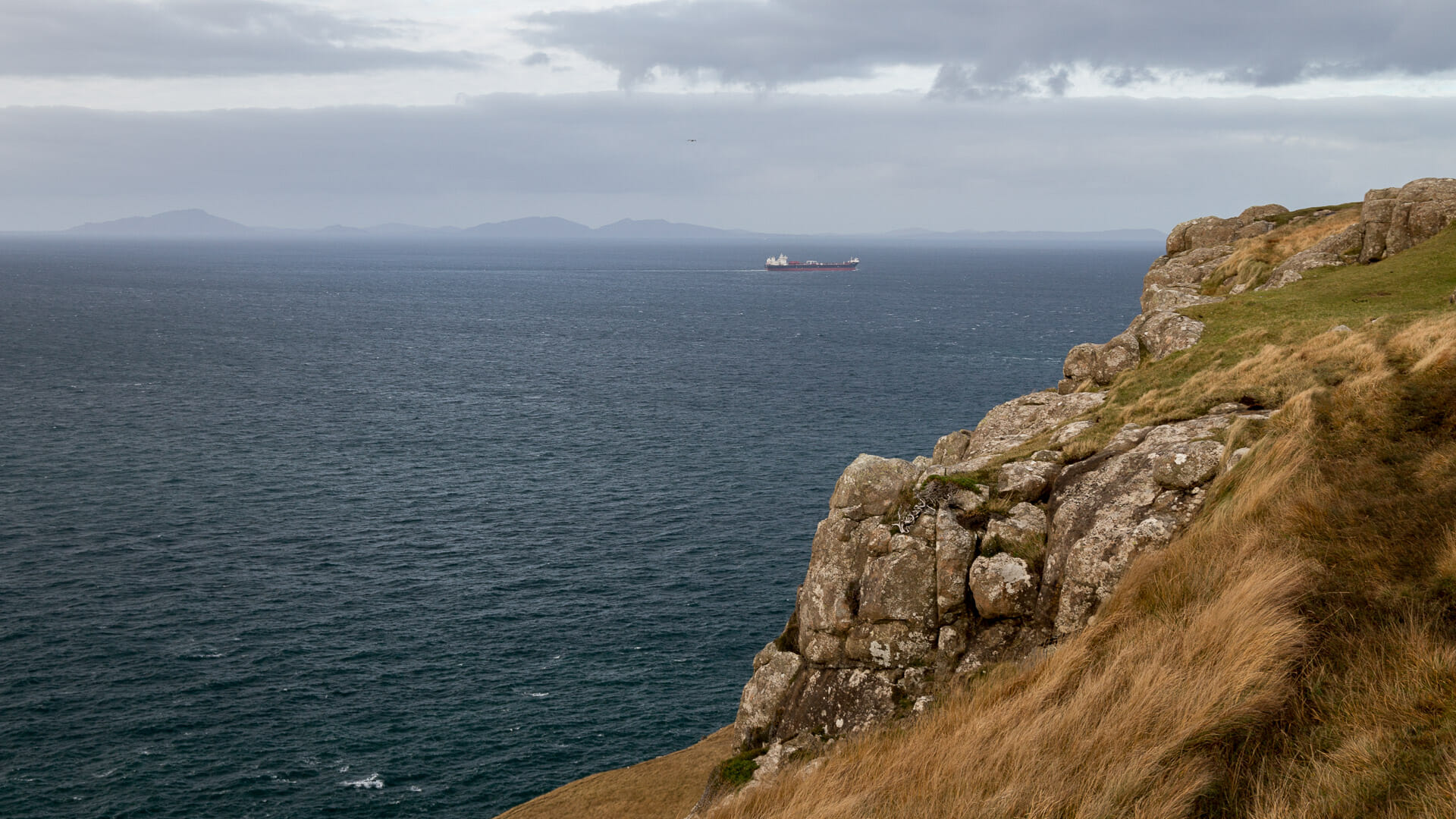
However, the view is worthwhile elsewhere too – across the Minch, that is the sea between the Inner and Outer Hebrides, the silhouettes of Benbecula and South Uist stand out.
Having had your fill of Neist Point from here, stroll back along the bluff. Beware: after all, this is almost 100 metres down to the sea. In 2013, this cost one person his life when he fell down.
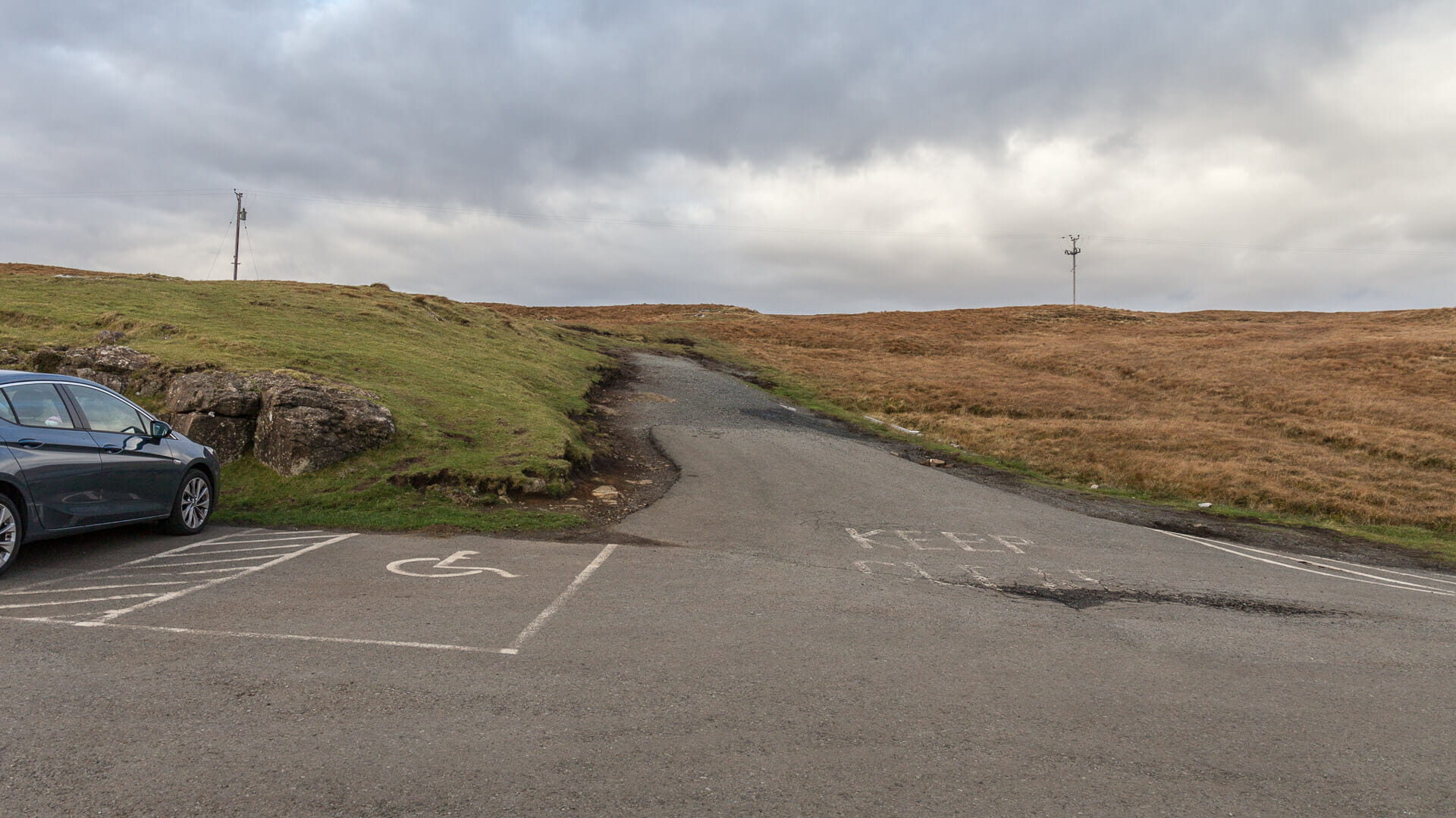
The brave descend directly to the headland from there, but this already requires a sure foothold. All others walk safely back to the parking lot gate and then down the stairs from there.
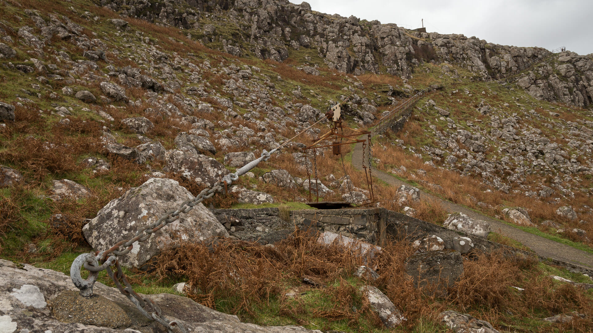
At the bottom of the stairs are still remains of the old cable car that helped residents and workers here transport materials up and down more easily.
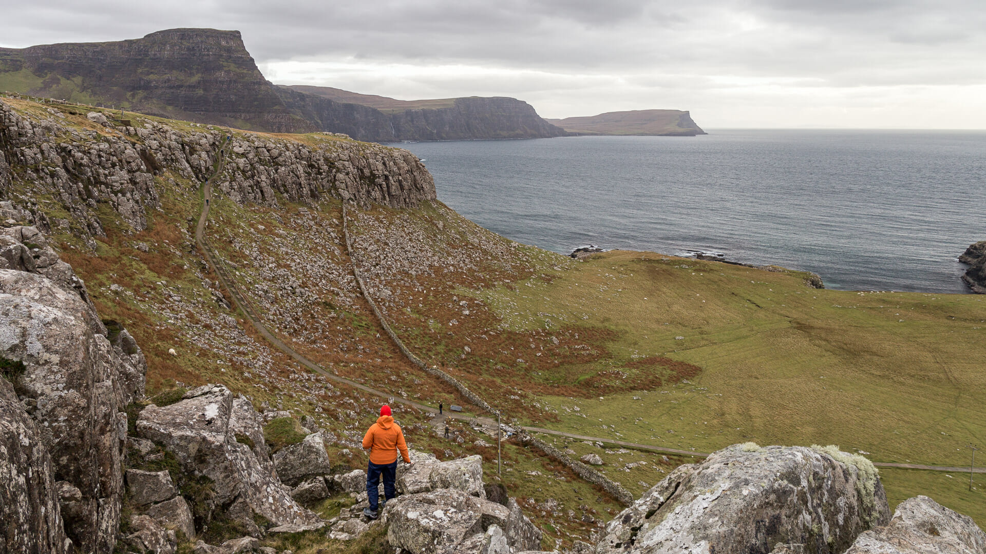
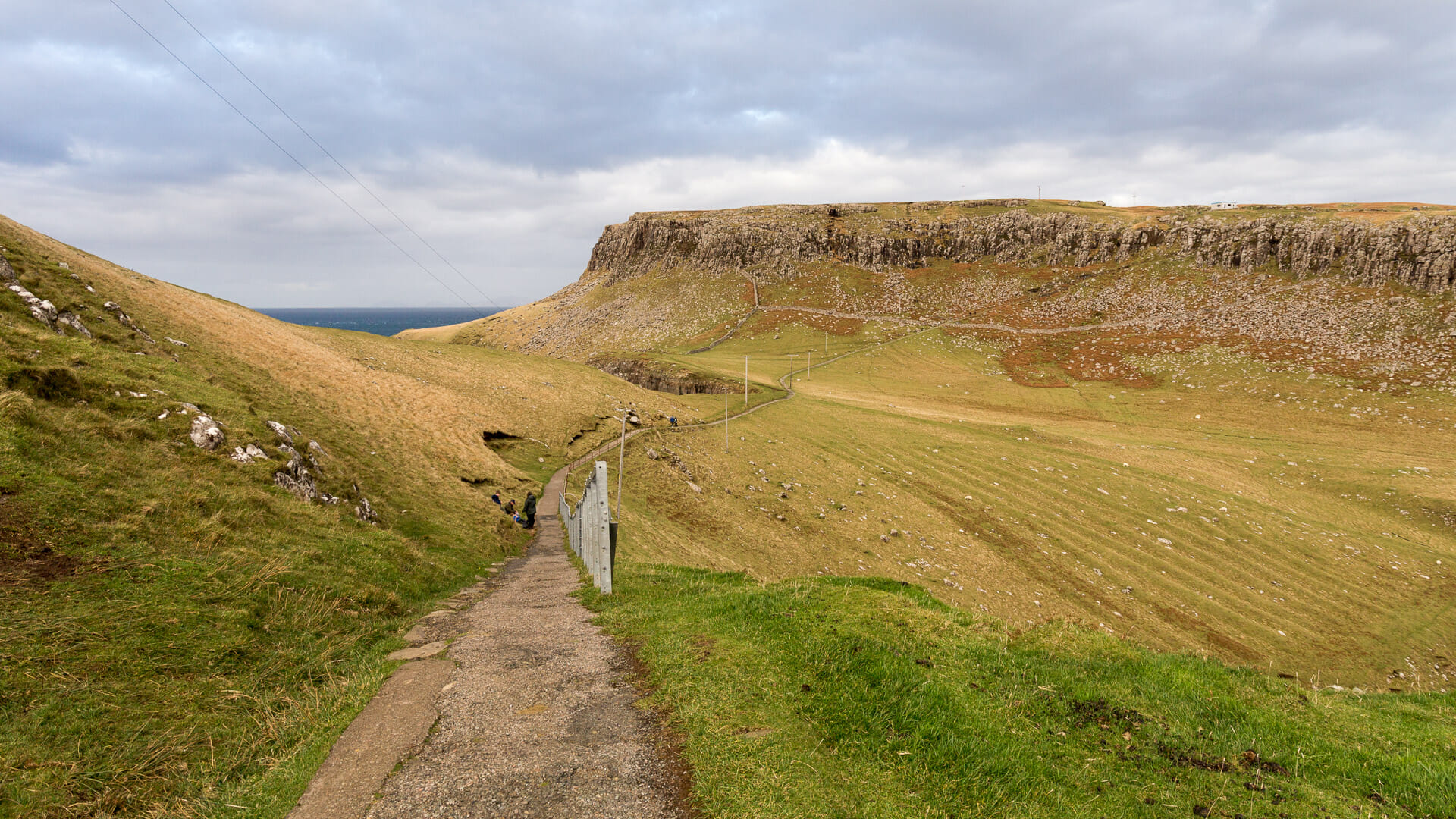
The path to the lighthouse takes the path of least resistance, staying on the flatter side of the small hill that rises before the walkers. This hill is 95 metres high and bears the Gaelic name of An t-Aigeach – the Stallion.
The further up the peninsula you go, the clearer the view across Moonen Bay and Waterstein Head opposite. This mesa rises to 296 metres here, after all.
Following the trail further, the Neist Point lighthouse appears.
The descent from here presents few problems and eventually the hiker reaches the finish.
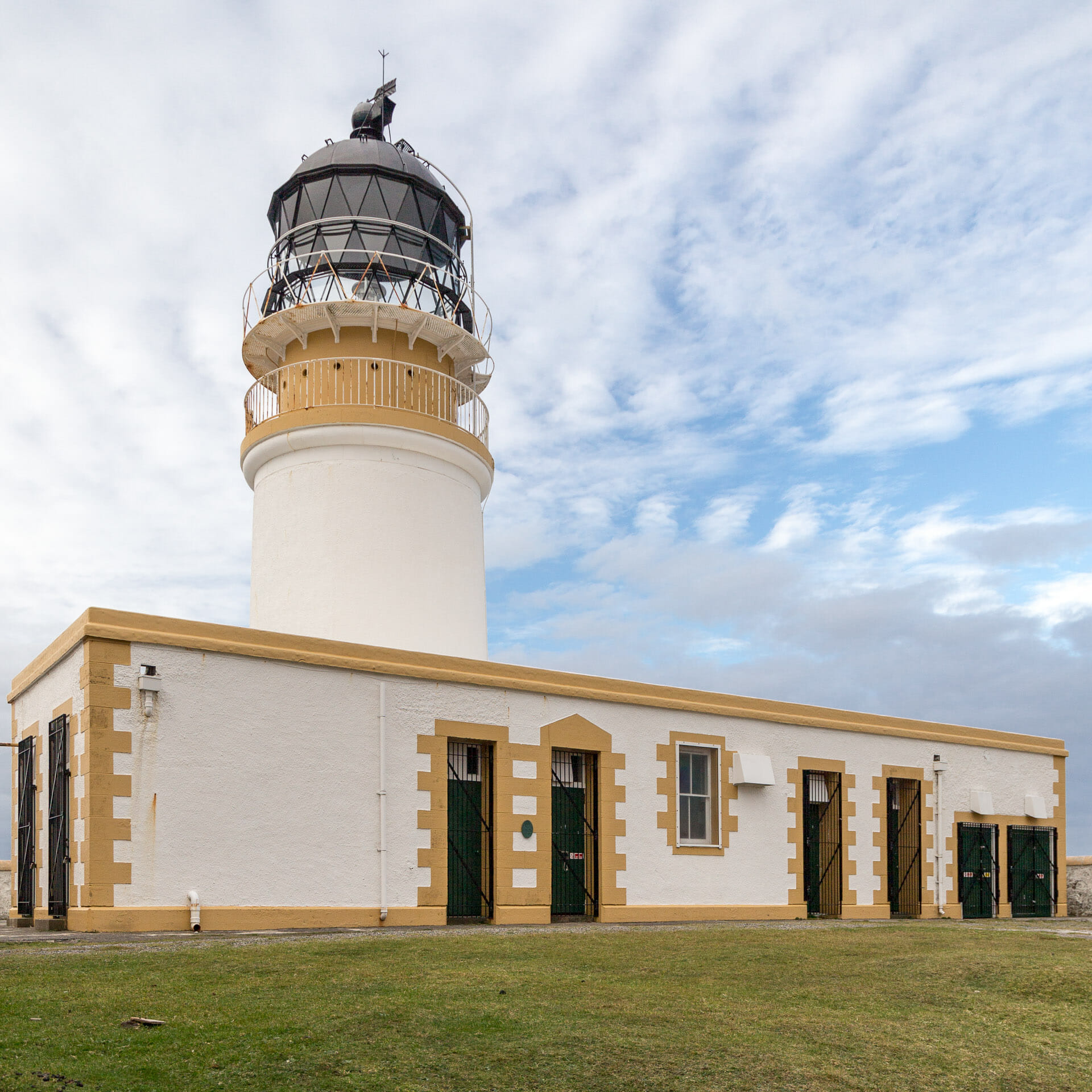
Of course, this beacon has also long since been automated; no lighthouse keeper lives here anymore. More than ten years ago, however, there was even a bed and breakfast here. Why the owner abandoned it is not entirely clear. In 2002, there was dispute with a landowner who generally wanted to ban tourists from Neist Point. Maybe it’s related to that?
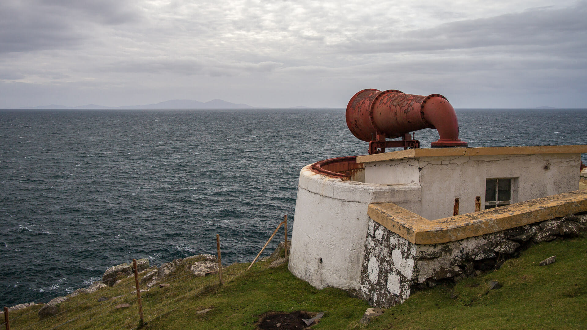
One thing is certain: at a close look, Neist Point Lighthouse turns out to be a dump – not very nice. The B&B rooms are still there, but there’s trash everywhere. Better to go around to the foghorn then.
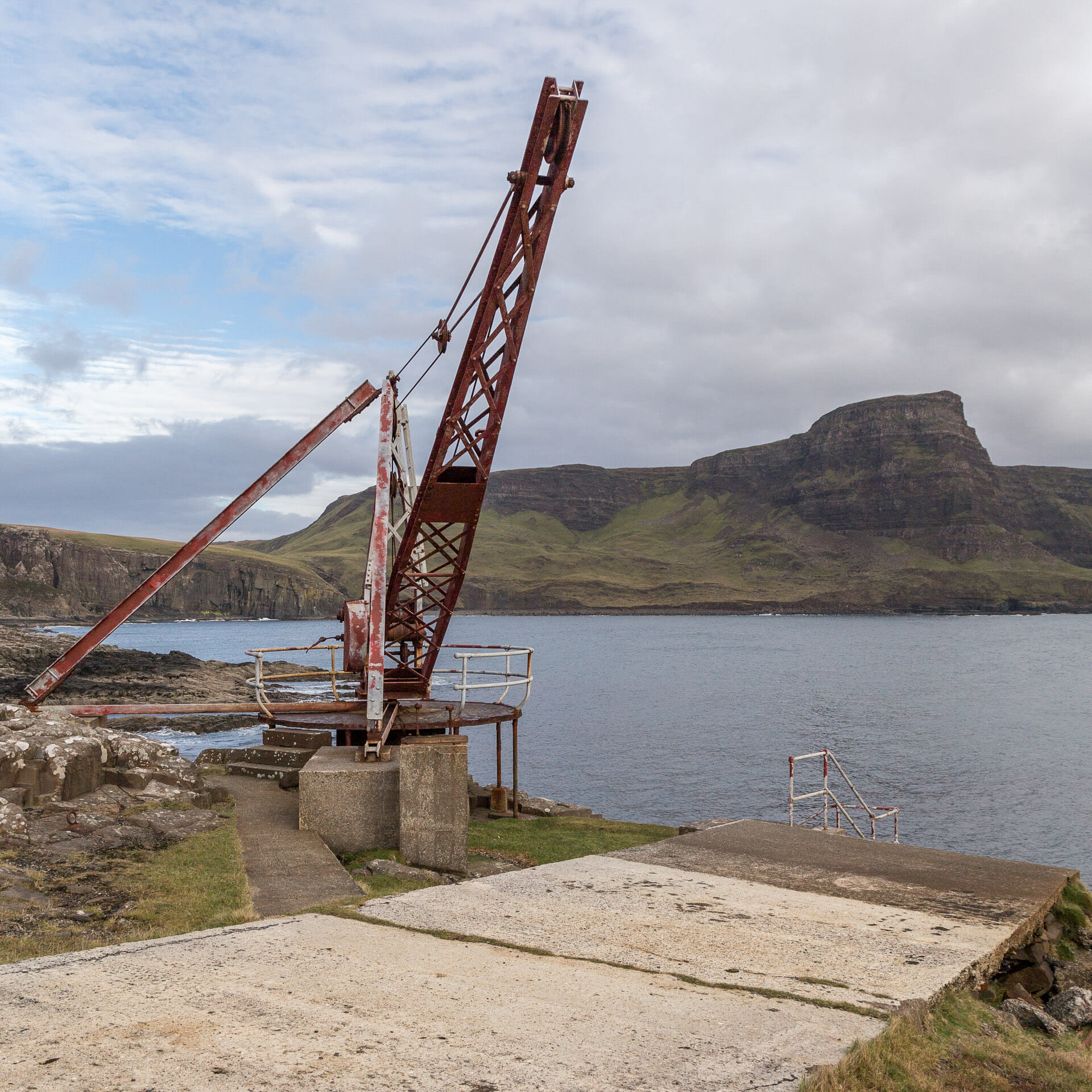
Better, though, is the trip away from the lighthouse down the little trail toward Waterstein Head. At the end of the path is a small concrete jetty with an old crane.
At some point you should then make your way back, which is harder than the way there. For not only must the An t-Aigeach now be conquered once more, but afterwards the many steps up to the parking lot.
The last climb is really energy sapping. But then you arrive back at the parking lot. The distance from the parking lot to the lighthouse, then to the pier and back is about six kilometers. However, you have to climb about 100 metres in altitude.
Visitors with little time, should consider foregoing the walk to the lighthouse and instead just enjoy the view of this unique headland.
Knowledge: About Neist Point
Pronounced roughly, the first part of the name is “sneeze” and not “neest.”
Like almost all of its kind, this lighthouse was built by a member of the famous Stevenson family in 1909. It is about 19 meters high and rises a total of 43 meters above sea level on the cliffs.
The headland and bays are home to many interesting species. Seabirds such as gannets can be seen here and dolphins, and rarely even orcas, can also be seen cavorting here.
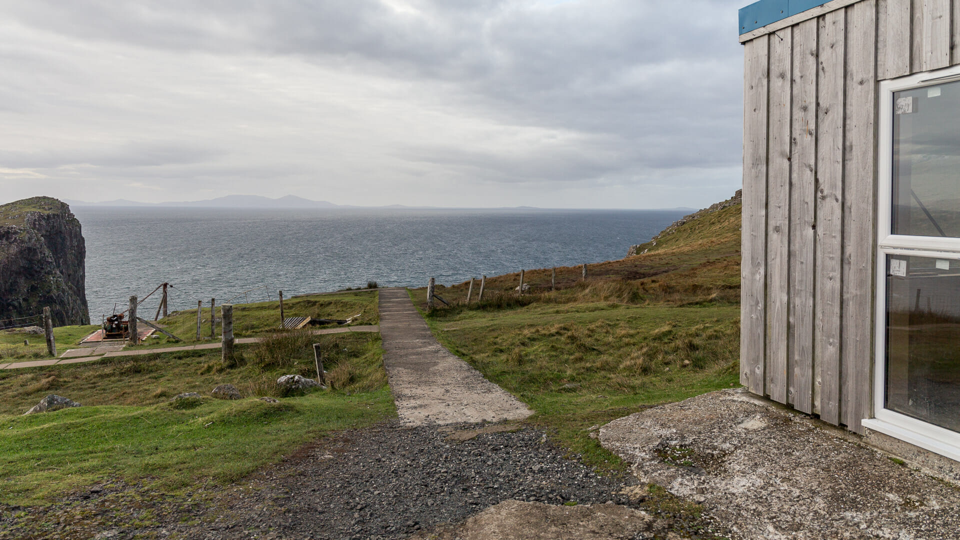
What the shack at the parking lot is for is not entirely clear. It appears to be fairly new. In 2013, it was proposed that a small shop be built here. Possibly the shack is the shell of that.
Tip: Finding the Neist Point photo motif
Just past the gate, the path forks. One takes the steps down to Neist Point, the other goes up along the cliff. You get the typical photos of Neist Point on the trail that branches off to the right.
There are two options. The first leads directly from the car park down a track into “Mointeach nan Tarbh”. Translated, this means the “Moor of the Bull.” You should actually put on proper hiking boots for this one.
After a short while there is no real path, you have to swing towards the sea at some point and head back along the coast towards the car park. Advantage: more nature.
Lighter and less messy, on the other hand: Turn right behind the new cottage at the gate to Neist Point.
Just walk along the shoreline until the camera angle fits. Advantage: faster.
Approach:
With sat nav: “IV55 8WU” gets you on the road to the lighthouse.
Without sat nav: Just before Dunvegan, the single track road B884 leaves the A863 towards Gleann Dail (Glendale). Follow it until just before Milovaig, where a road branches off to Waterstein and Neist Point. At the very end of this road is a car park which ends at a gate. Here it’s a case of putting on your sturdy shoes, as you continue on foot.