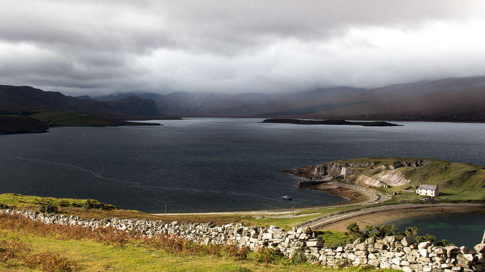
A dark, deep sea loch right in the far north of Scotland – that’s Loch Eriboll. It has a few stories of its own to tell.
Whisky coming from the Highlands is, in a way, almost a contradiction. Whisky needs barley, and barley in turn needs fertile farmland to grow. But in the north of the Highlands, there’s nothing but peat, rock and bracken – no trace of arable farming.
For today’s whisky distillers, that’s obviously no longer a problem – they simply bring in the grain from the Black Isle, one of Scotland’s breadbaskets. In the past, though, that would have been far too laborious, so the farmers of the Highlands helped themselves in a different way: they used lime to make the acidic soil arable, since lime regulates the pH level. In doing so, they wrestled small fertile oases from otherwise acidic ground.
One source of this lime was Loch Eriboll.
Loch Eriboll is a huge sea loch that stretches 16 kilometres inland, right in the far north, between Durness and Tongue, filled with dark seawater. Dark, because the loch is also very deep: the icy seabed only appears at sixty metres.
A road runs around the loch, and at one point a peculiar feature immediately catches the eye: a small island, connected by a narrow spit of land, juts out into the dark water. It’s fringed with light-coloured sandy beaches, and a highly unusual structure rises from the hill at its centre: a large block with round archways at the front.
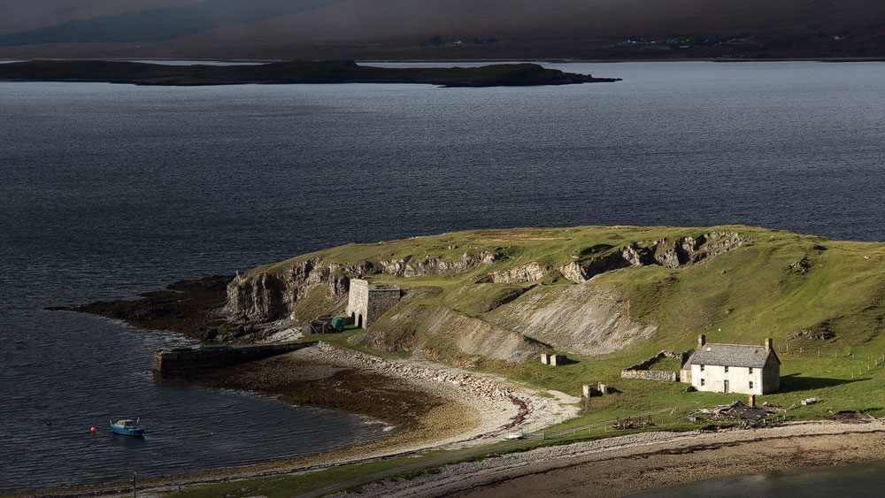
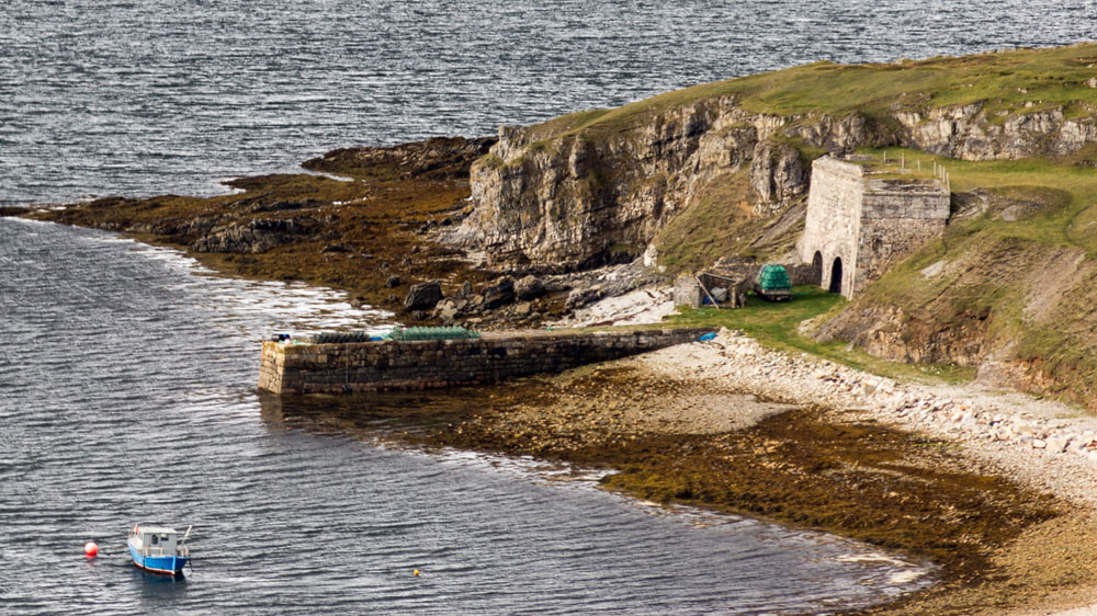
The peninsula is called Ard Neakie, and the odd structure is the old lime kiln from 1870, where limestone was processed into quicklime. Quicklime, in turn, could be used to de-acidify soil – or as a building material such as plaster. In front of the kiln, a pier stretches out into the water, where boats could dock for transport.
33 German U-boats at Loch Eriboll
Besides the lime found in the surrounding area, Eriboll has another advantage thanks to its depth. Ocean-going ships find a safe anchorage here – a fact the British Navy made repeated use of over the years. In the 1920s and 1930s, many warships waited here for deployment.
Out of boredom, some sailors climbed the slopes of the loch and laid out the names of their ships in stones on the ground. Over time these lettering displays have become overgrown and the stones have sunk into the earth, but you can still spot them on the western shore.
In 1945, things got really busy at Loch Eriboll for once. It hosted the largest gathering of German U-boats there has ever been! 33 of the vessels sailed in here, one after another, to surrender to the British Navy. Their ammunition and weapons were sunk on the spot, meaning the bottom of the loch is likely home to a fair number of explosive devices to this day.
Loch Eriboll in the north of Scotland is certainly not a top attraction, but simply driving past would do it an injustice. A short stop to take in the island and the vastness of the sea loch is well worth it all the same.
Know: About the name and the land
The name Loch Eriboll comes from Old Norse and roughly means “farm on the beach”. That farming was possible here at all is thanks to the aforementioned limestone, the Durness Limestone, which surfaces in this sunken stretch of the northern Highlands and produces more fertile soil.
Getting there:
Loch Eriboll is skirted by the A838, which runs the entire length of the north coast.
