The Highlands are part of Scotland, that much is clear. But: where exactly do they begin? Do the islands belong to them? There are several answers to this question. An attempt at a geographical definition.
A geologist’s answer would probably be this: the Highlands lie north of the so-called Highland Boundary Fault. This 240-kilometre-long geological fault begins roughly on the Isle of Arran in the west of Scotland and then runs across the country to the east, to the town of Stonehaven, about 30 kilometres south of Aberdeen.
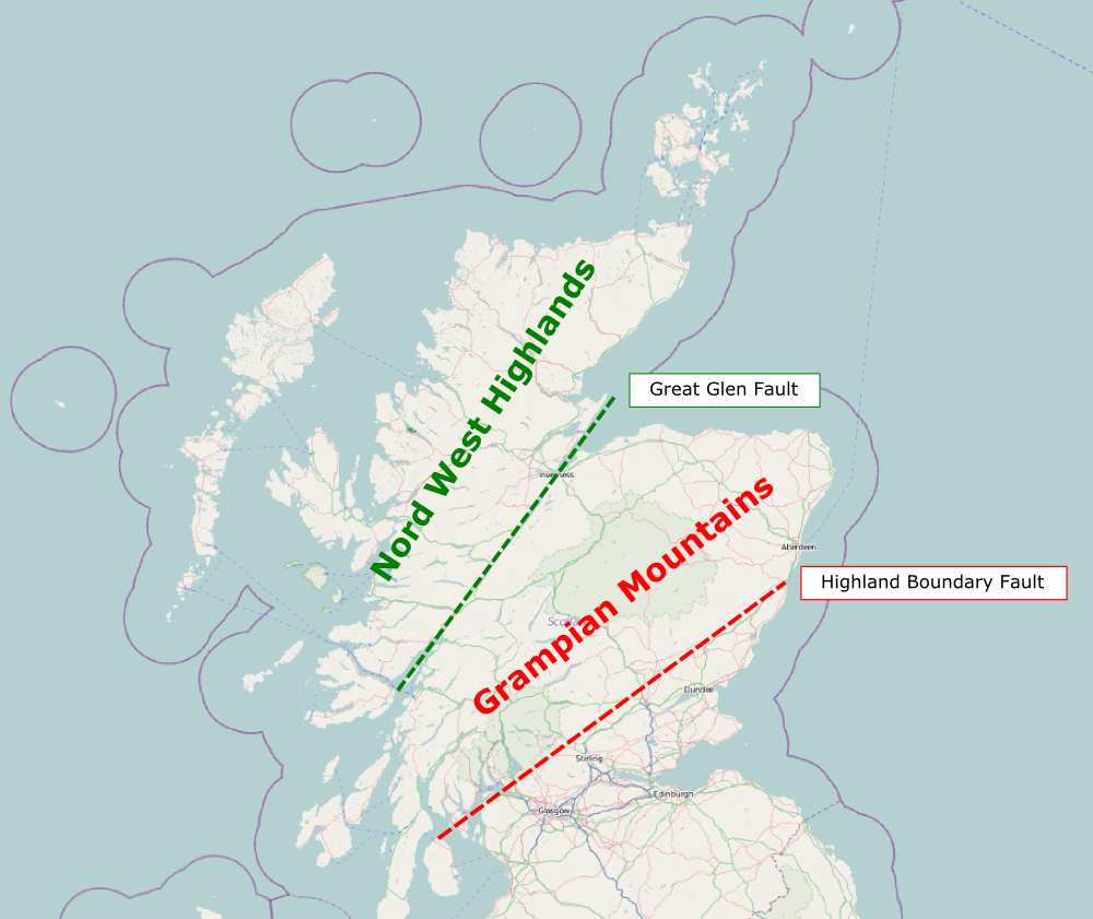
Below this fault lie the Lowlands, which also include Glasgow and Edinburgh. Along the fault line you’ll find sights such as Loch Lomond.
Above the Highland Boundary Fault, the Highlands are divided once more into two areas:
1. The Grampian Mountains, with their wonderful landscapes, take up about half of Scotland’s area. Their most famous representative is certainly Ben Nevis, the highest mountain in Britain, which lies to the west. The Glen Coe valley also belongs here. To the east lies Speyside, home of famous whiskies, and finally Aberdeen.
2. From Inverness in the east to Fort William in the west runs a clear line across the map: the Great Glen Fault. It contains, for example, the famous Loch Ness. Above the “Great Glen fault” one speaks of the North-West Highlands. In this case, this also includes the islands of Orkney and the Hebrides.
How the administration defines the Highlands
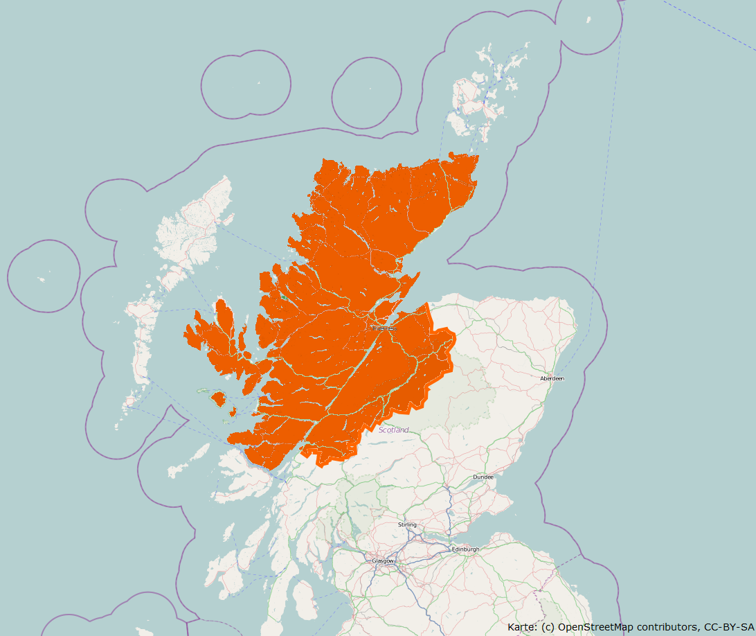
An official would probably speak of the “Highland Council Area”. This covers the areas above the Great Glen Fault. Excluded are the Outer Hebrides and Orkney. It also extends in a semicircular arc below Inverness and Fort William into the Grampians. Inverness, incidentally, is the capital of the Highlands.
However, this is an artificial construct that locals rarely use as a term for the Highlands. They would rather identify with one of the eight districts that lie within the administrative area.
The Highlands as a linguistic community
The Highlands are also the area shaped by the Gaelic language – in fact, the name for the Highlands is “A’ Ghàidhealtachd” (listen to the pronunciation here), meaning roughly “the area where Gaelic is spoken”.
The further west you go, the more widespread Gaelic is – on the Outer Hebrides it is still spoken the most today. There, over 70 percent of people speak it, while on Skye only about half the population still does, and finally, on the east coast, at most 6 percent of Scots speak the Celtic language. Up in the north-east and on Orkney, on the other hand, only Norn – an Old Norse dialect of the Vikings – was spoken alongside English up until the 18th century. Today this dialect is extinct and is reflected at most in place names.
How I define it on MyHighlands.de
For me personally, the Highlands stand for a particular landscape, a sense of solitude and an atmosphere. That’s why, when selecting the sights featured on this website, I don’t primarily follow any of the models mentioned here, but go by feel.
