Lochs and salmon, sandy beaches, a castle, and a cave with a waterfall inside – our loop through the north of the Highlands has plenty on offer. In between you can rest up with a hot chocolate.
North Highlands info:
» General information
» Best time to visit
» Round trips
The classic tour through the far north of Scotland usually runs like this: up the east coast, along the north coast, down the west coast. That’s fine too, since it takes in the highlights.
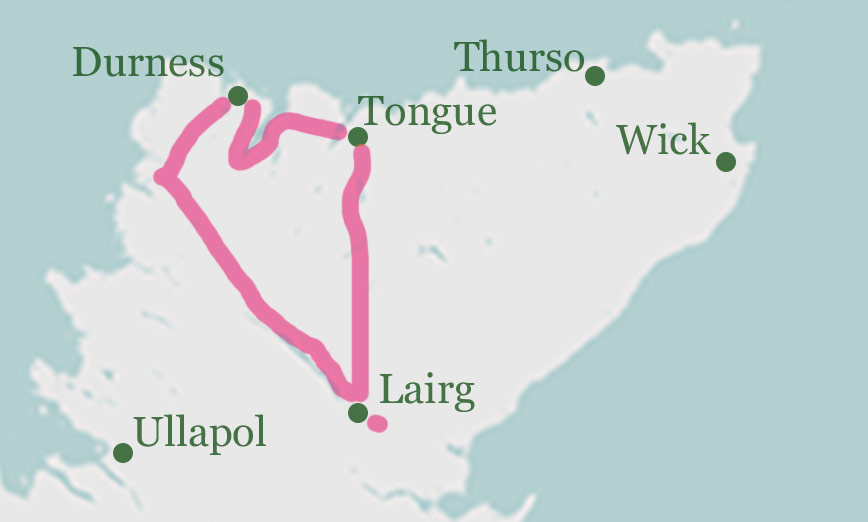
But if you have a spare day, the loop presented here is well worth it, taking you into the heart of the North Highlands too. It follows the main coastal road, then turns off into the barely inhabited interior. As a bonus, it passes through the coldest place in the United Kingdom.
The North Highlands Loop (214 kilometres, 3:30 hours driving time, 7 hours total)
Starting point – Tongue
We start in Tongue, a village up in the far north, roughly in the middle of the north coast.
From here we take the A838 towards Durness.
Stop 1 – Loch Eriboll (short stop)
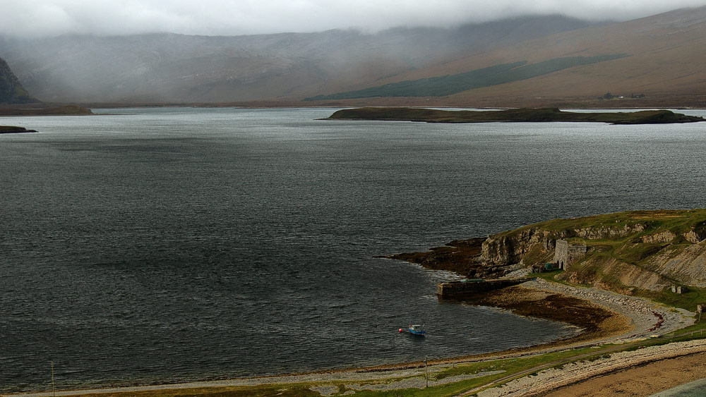
After around 20 minutes and about as many kilometres we reach Loch Eriboll. At 60 metres, it’s one of the deepest sea lochs in Britain. Fairly near the start of the loch, on the right, a small peninsula appears with a gate-like structure on it. That’s the old 19th-century lime kiln.
Photo tip: the peninsula with the building is really the main subject here. The loch itself just serves as a backdrop.
Stop 1 – Ceannabeinne (15 to 30 minute stop
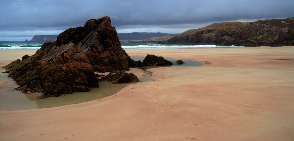
Continue towards Durness, skirting Loch Eriboll. After that keep an eye out – the car park is on the left, the beach on the right.
Here you’ll find a little-known sandy beach. To me, though, it’s one of the loveliest in the Highlands. Firstly because Ceannabeinne gets very few visitors, and secondly because its colourful rocks make for some lovely photo subjects.
Photo tip: an HDR shot is well worth it here. It really brings out the red streaks of colour in the rocks. See the image on the right.
Stop 2 – Smoo Cave (60 minute stop)
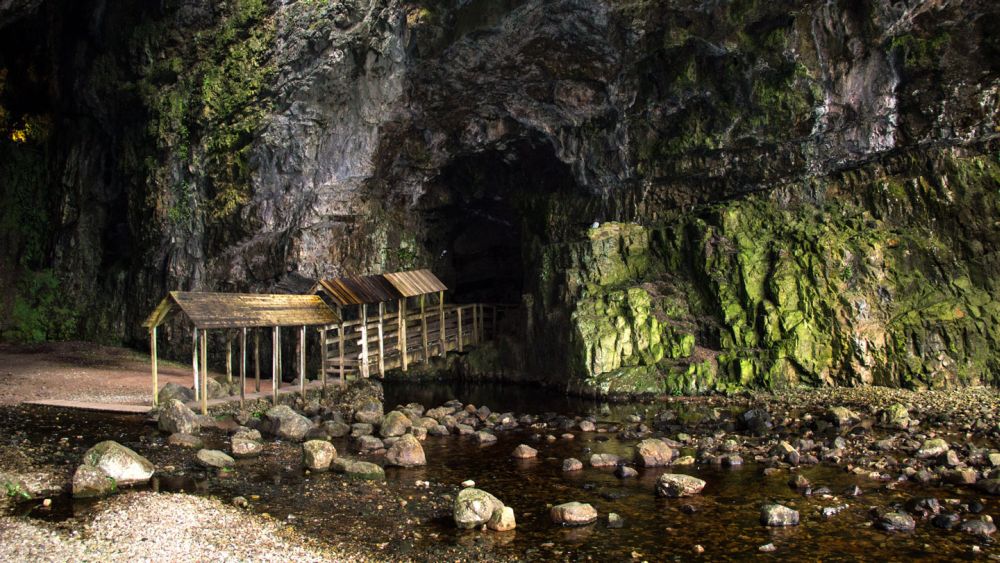
A further three kilometres along the road, Smoo Cave awaits us – a beautiful sea cave with a waterfall inside. The car park for Smoo Cave is signposted on the right off the A838 and is easy to find.
Photo tip: a tripod is worthwhile for the cave. The waterfall at the back can be softened into a veil with a long exposure. There’s plenty of room to shoot from wherever you like.
Stop 3 – Sango Sands (30 minute stop)
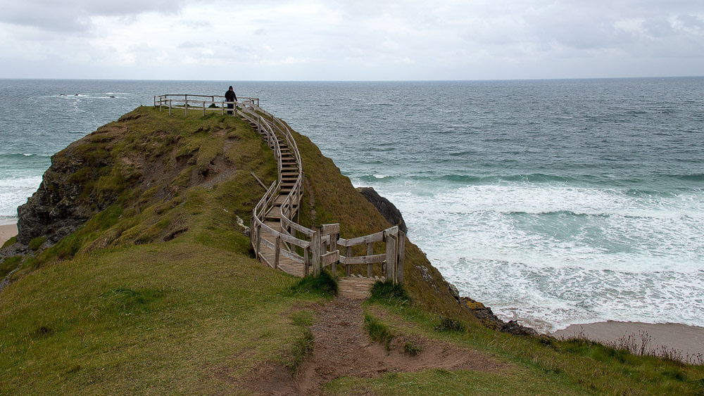
The famous Sango Sands beach lies behind the campsite. It’s actually two beaches, separated by a headland with a viewing platform on it.
Personally, I could take or leave Sango Sands. But for many people, thanks to its fame, it’s simply a must.
Photo tip: from the viewpoint you get a great shot looking down onto both bays with their beaches.
Stop 4 – Balnakeil (45 minute stop)
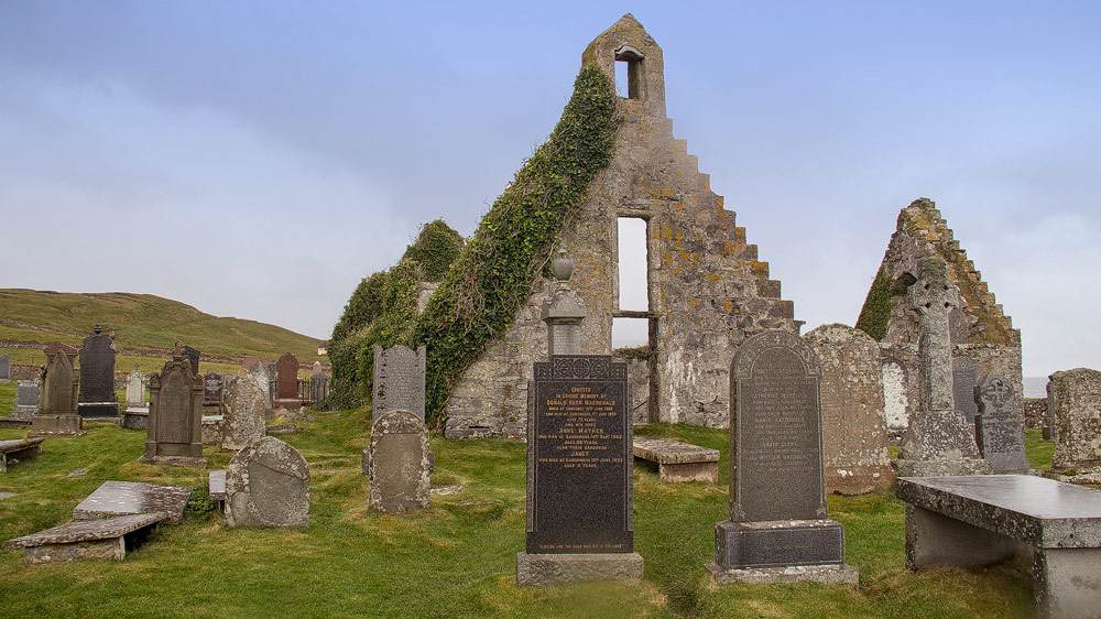
Fair warning: a murderer is buried here – along with John Lennon’s aunt. Balnakeil is a deserted village, of which only the church and graveyard still stand today, plus two houses. Drive the A838 all the way into Durness. There, Balnakeil branches off to the right. Follow the road straight ahead all the way to the small car park in front of the ruined church. Stop here for a while and maybe take a quick look at the beach nearby too. Then turn back and head to the Craft Village, now on the right of the road. There’s chocolate at Cocoa Mountain here – you have to try it!
Photo tip: the roofless church. The grave… nicely eerie. Don’t forget: the big Balnakeil house and the beach.
Stop 5 – Kyle of Durness (short stop)
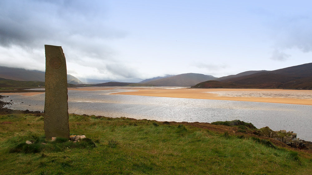
Continue on the A838. Soon a turning to the right leads to the ferry that takes you to Cape Wrath. That, though, would be a day trip in its own right. That said, from the car park right behind the ferry turning you get a wonderful view over the sandy Kyle of Durness.
Photo tip: since the shot somehow lacked a focal point in the foreground, a standing stone was specially erected here. It’s not old, but it really suits the picture. See right.
Stop 6 – Falls of Shin (1 hour stop)
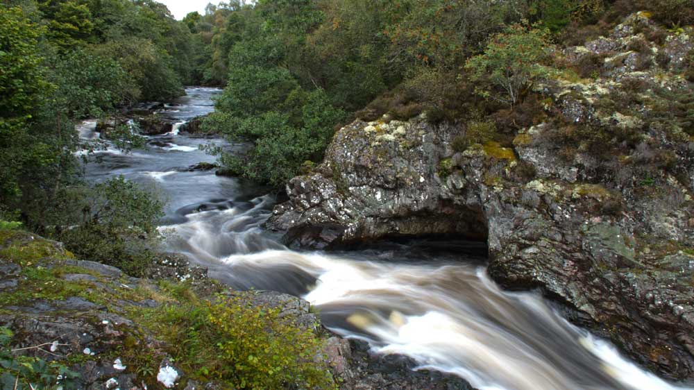
Before we reach the Falls of Shin with their leaping wild salmon, there’s a longer drive through the heart of the Highlands. Around 100 kilometres and an hour and a half.
First we head to Laxford Bridge. There we turn left onto the A838, while the coastal road continues straight ahead as the A894. It passes several lochs before finally reaching the large Loch Shin. Keep going, through Lairg. Almost at the end of Lairg, a bridge over the River Shin appears on the right – that’s the A839 to Ullapool. Cross the bridge and immediately turn left again onto the road to the Falls of Shin Visitor Centre car park.
Photo tip: photographing salmon is tricky. You need a good instinct for timing, a decent lens, a tripod (otherwise your arms will soon get tired) and patience.
Stop 7 – Altnaharra (short stop)
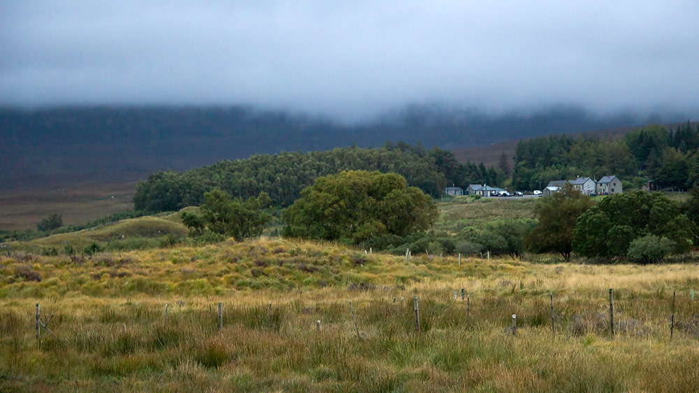
Okay, you don’t really need to stop here, and the village isn’t especially photogenic either. It’s mainly of interest to salmon anglers. What is notable, though, is that Altnaharra holds the record for the lowest temperature recorded anywhere in the UK since 1995 – the thermometer showed minus 22.3 degrees on 8 January 2010.
Maybe better to press on quickly? There are still around 30 kilometres to go, and about as many minutes.
End point – Tongue
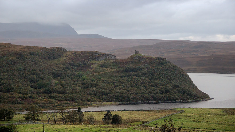
Just before you reach Tongue, you get one last clear view on the right of Varrich Castle (Castle Bharrich).
Photo tip: ideally a good zoom lens, and make sure the winding road up to the castle stands out in the shot. I have to admit I only managed this with mixed success myself, shooting at dusk with a travel zoom lens.
