Sliabh nan Carraigean, Moor of the Standing Stones, is the name of the area around Machrie on the Isle of Arran. Small wonder: eleven stone circles can be found here. But where did their builders disappear to?
From the car park, it’s only about two kilometres back to the Stone Age – two kilometres along a good farm track that leads into the moor of the standing stones. Don’t worry: nobody’s about to sink into the ground here. But a once-flourishing culture did meet its end here.
Machrie Moor forms a plain in the west of the Isle of Arran, at the foot of Glen Machrie. Standing among the stones, the visitor looks out into a wonderful valley. Neolithic people likely enjoyed this same view too, though far more important to them was probably that the plain offered fertile land for farming. Here they built houses and eventually erected the ritual sites still visible today.
Archaeologists have so far uncovered a full eleven stone circles at Machrie Moor. Many are quite small, but some are impressively large. Some are made of grey granite, others of red sandstone.
Even on the way to the stone circles, you’ll find remains of the inhabitants from over 4,000 years ago. What looks like a stone circle here is actually a so-called cairn, which was once covered with many small stones.
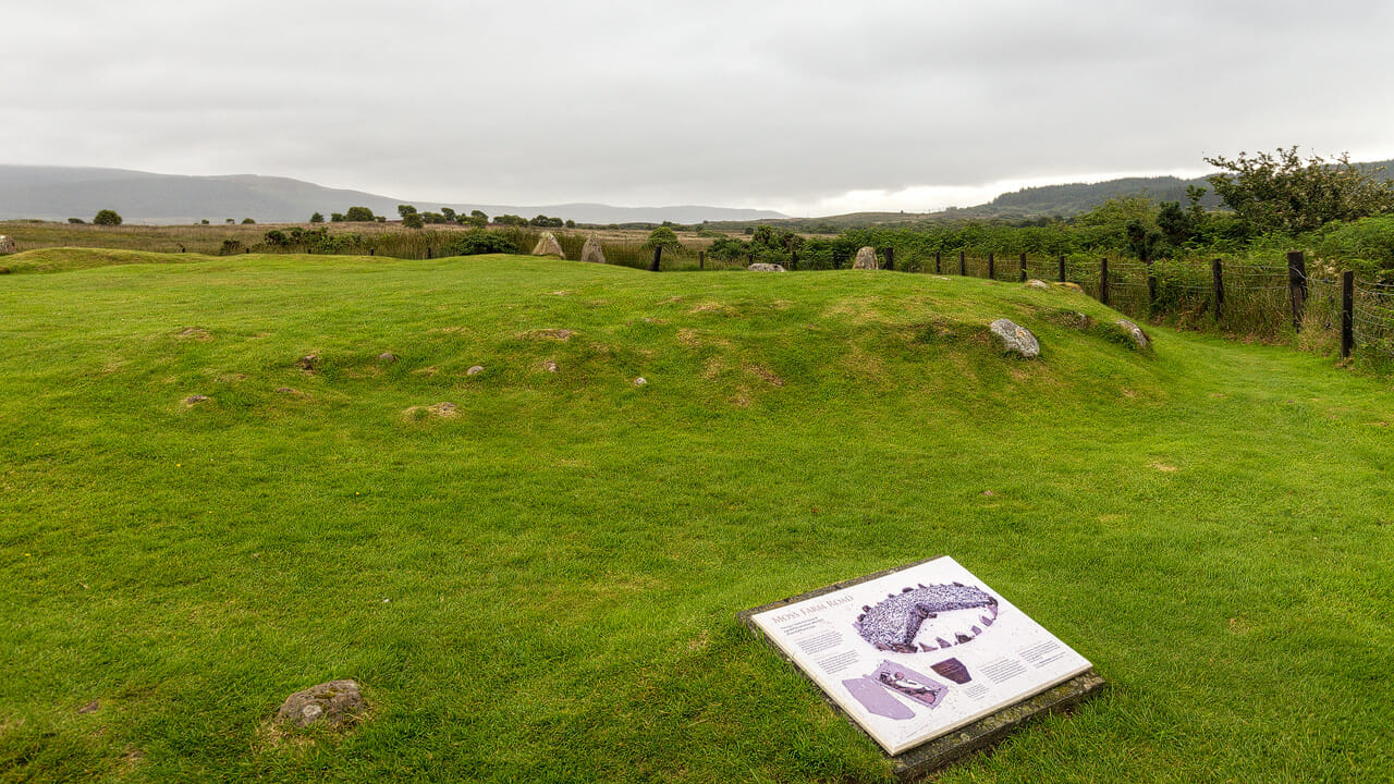
Only a single person was buried in this enormous grave. It traces what happened around 4,500 years ago: instead of a communal grave for all members, individual burials for high-status individuals suddenly came into fashion. As beautiful as the cairn once was, people caused it to nearly vanish, taking the stones for walls and other uses.
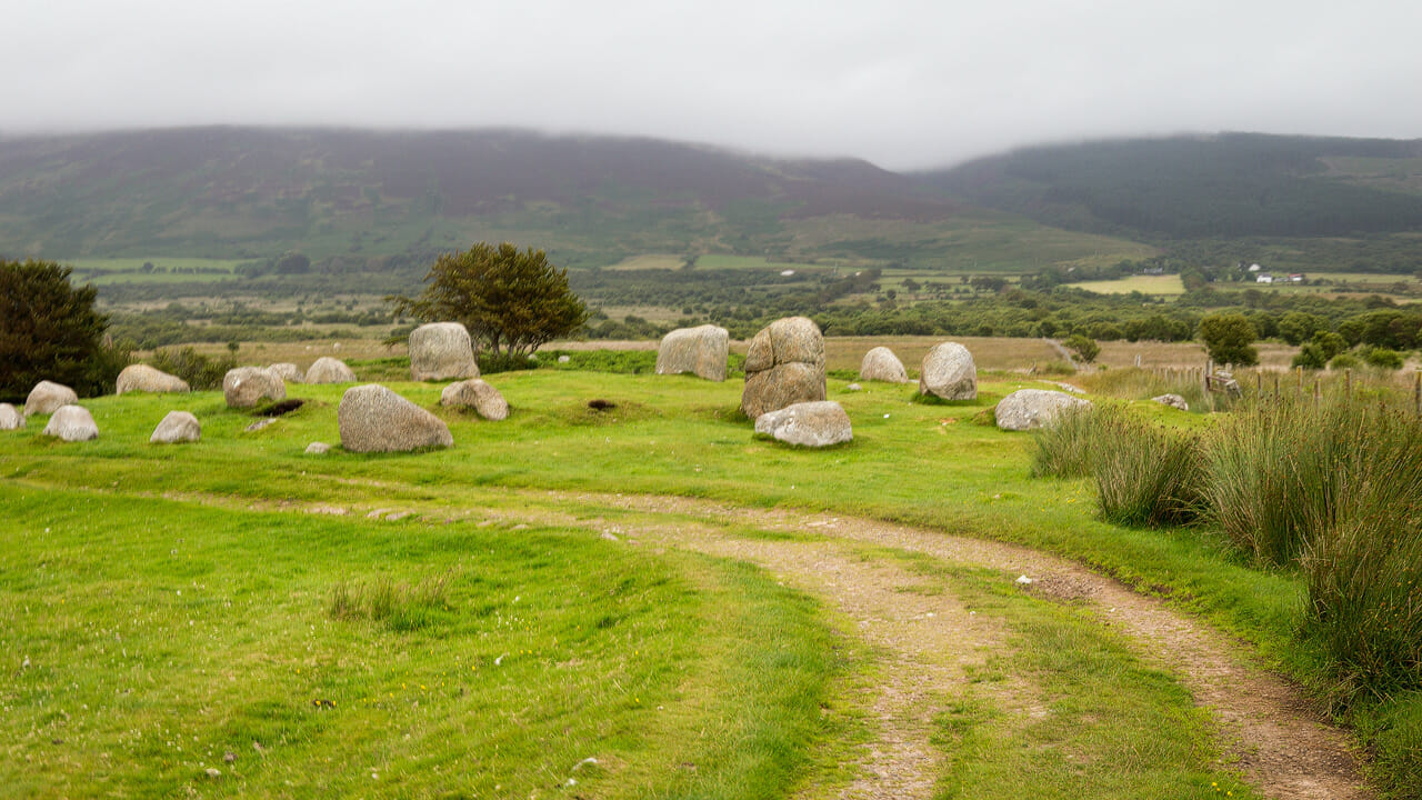
From the cairn, it’s still a fair way to the large stone circles of Machrie Moor. Even so, the first genuine stone circles soon appear, like Fingal’s Cauldron here.
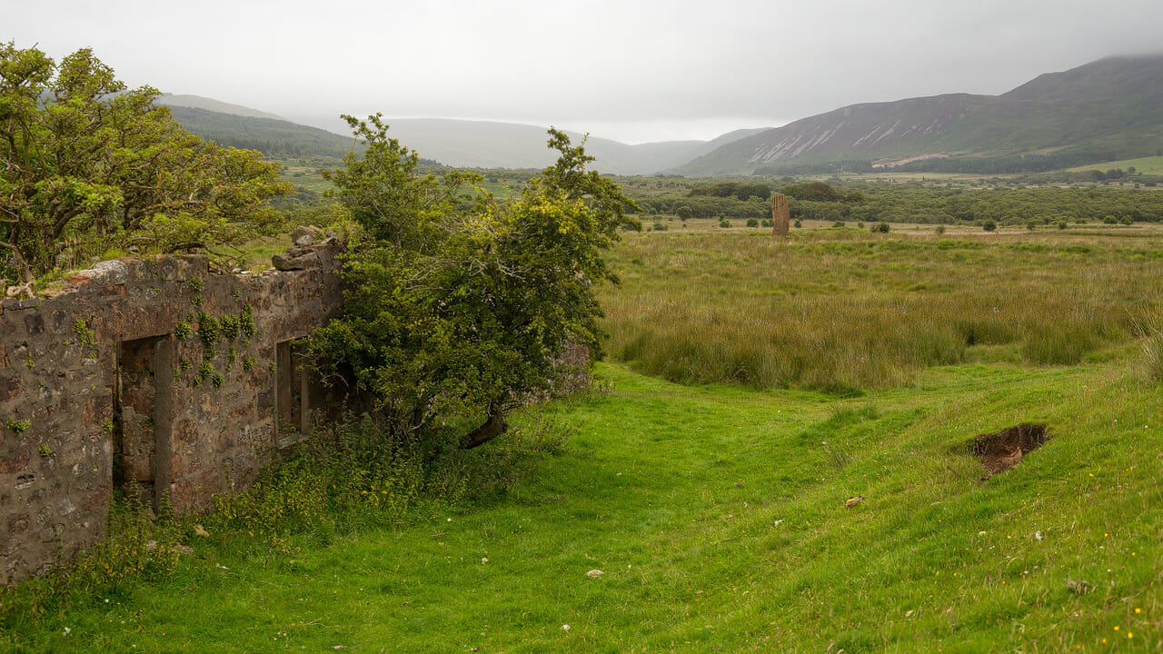
The road eventually ends at its namesake, Moss Farm. It’s abandoned and derelict, nature patiently reclaiming the buildings.
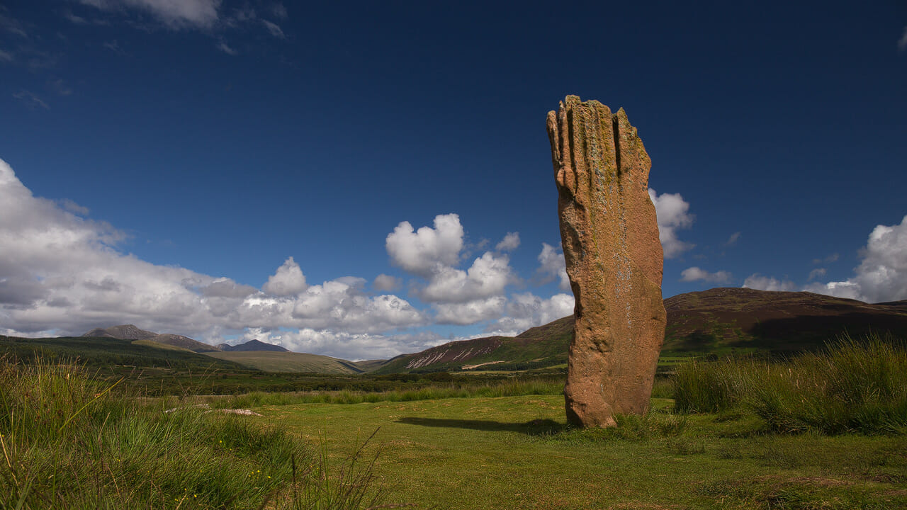
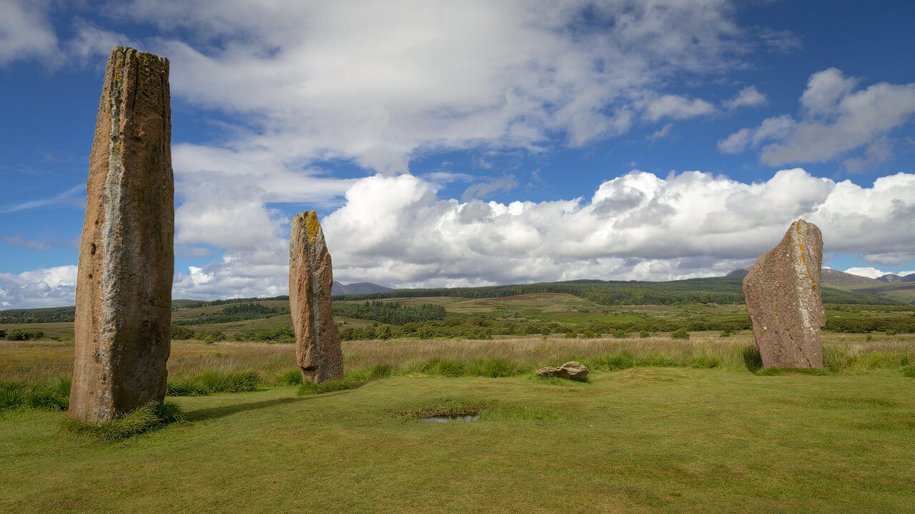
Beyond it, the visitor finally enters the wide land of the stone circles. A single monolith on the left immediately catches the eye. It’s the remains of stone circle number 3, of which only this red sandstone giant still stands. Once nine of its kind stood here. In structure, size and colour, it’s one of the finest at Machrie Moor and blends beautifully with the peaks behind it.
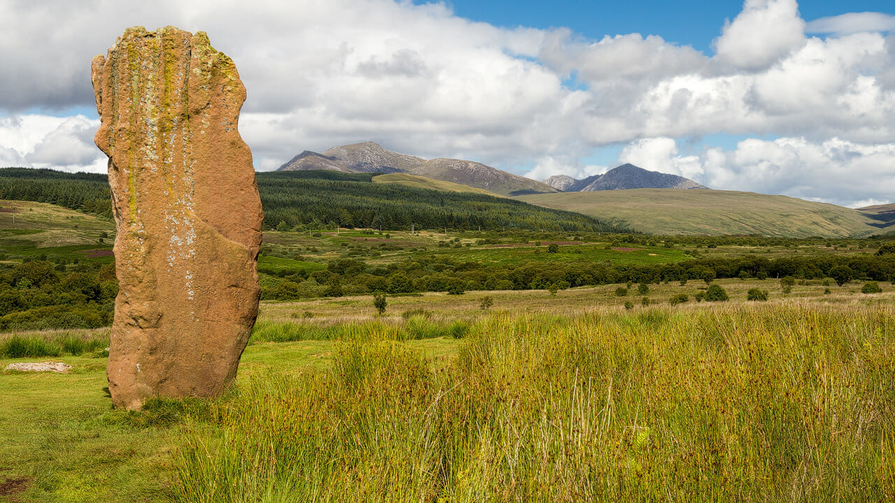
It stands 4.3 metres tall – standing next to it as a human, you feel humbly small. A little further to the right, three red giants stand together.
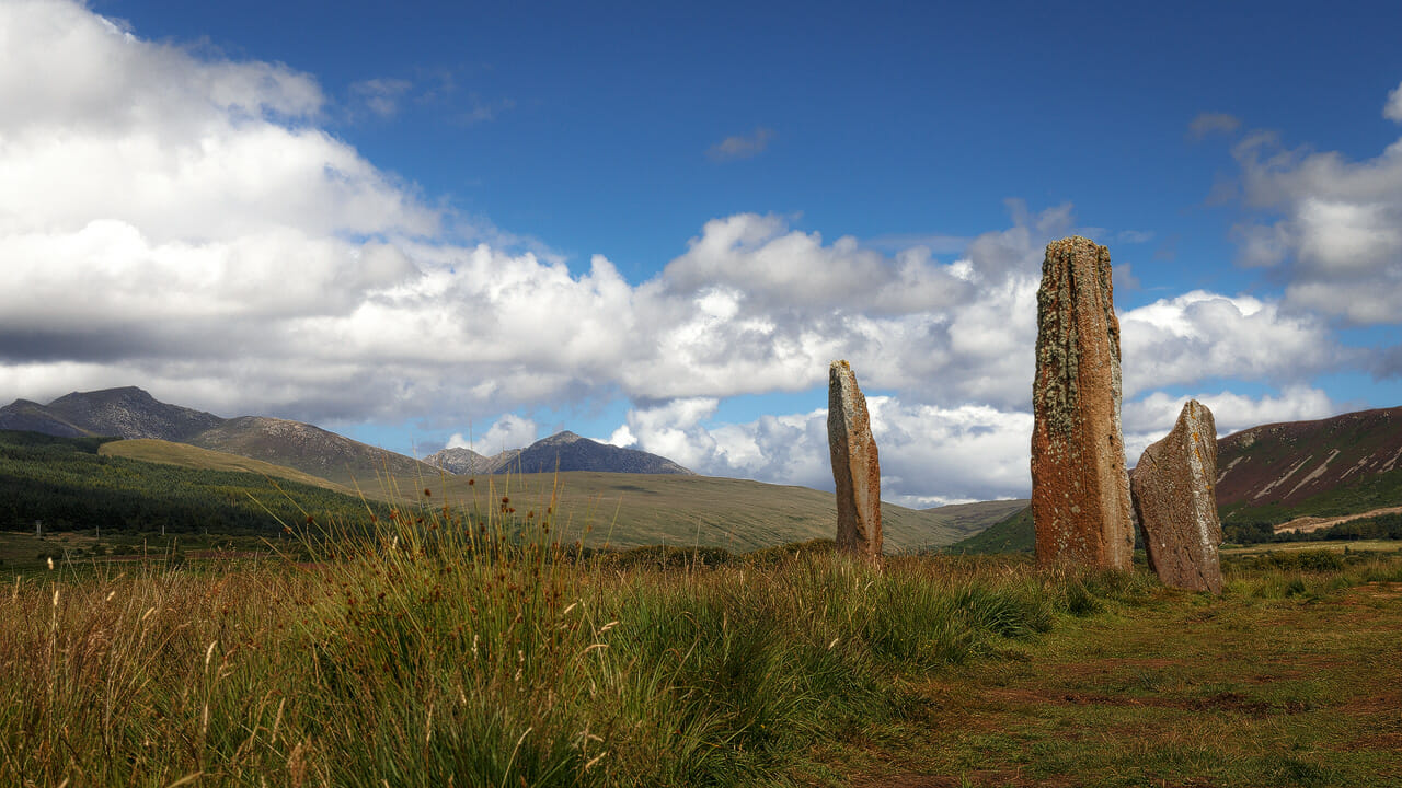
This circle too once had eight or nine stones arranged in a circle over 13 metres across. It’s beautiful how the pale green moss growth forms a colourful duet with the red sandstone here.
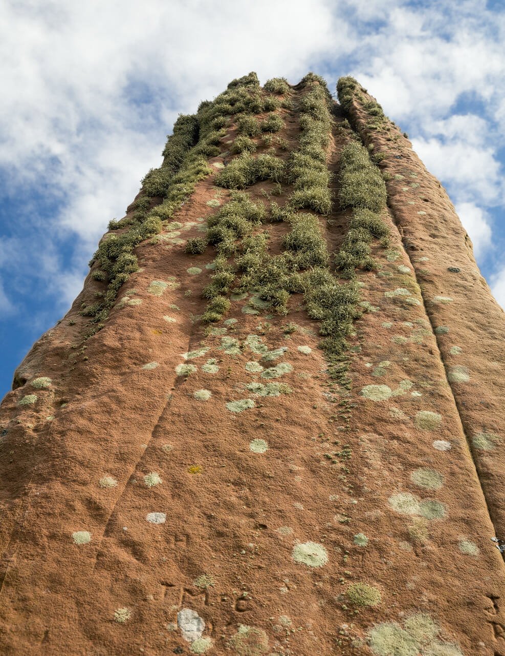
Now, there are people who wanted to immortalise themselves here, who’ve carved their initials into the soft sandstone. I couldn’t bring myself to do that, out of respect. But people are often pragmatic, of course. Carving initials isn’t the worst thing that’s been done to the stones at Machrie Moor. Because a few steps further, two circular stones lie on the ground:
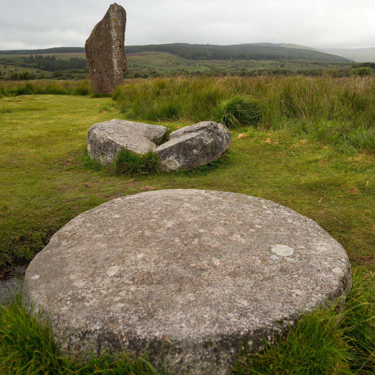
These are two millstones, easily recognised by the hole in the centre of the upper one. These millstones were probably hewn from a monolith in the 18th century, but then never used. Today they too form part of a story that keeps pointing to one thing: people had, and still have, a hard time at Machrie Moor. Because it wasn’t only the farm that was abandoned here. Around 750 BC, the climate on Arran changed dramatically. Overexploitation of the woodlands robbed the inhabitants of the protection they would now have needed. Over the following centuries, people fled the island for the mainland.
And so, by the end of the Bronze Age, the once-fertile plain had become a moorland landscape. Farming the fields was no longer possible. So the former inhabitants also left this area, leaving behind only the ritual sites, which over the years became overgrown with peat – until, in our own time, they were excavated again and we can marvel at them today.
Good to know: Ghosts and science at Machrie Moor?
In Gaelic, the place is called Sliabh nan Carraigean, and the obvious translation for that today would be “Moor of the Stones”. However, writer Thorbjörn Campbell, who wrote the standard work on Arran’s history, offers another possibility. According to him, it could be related to the Breton word “korrigan” and refer to pagan spirit-beings – in short, a kind of nature spirit. Fits the mood of the place …
Beyond the ghosts, the stone circles will surely have had another purpose too. Similar to Callanish on the Outer Hebrides or the Ring of Brodgar on Orkney, the sun and moon appear to have played a role here too. One theory: in the background, the valley forms a kind of notch in the landscape. At the summer solstice, the rising sun passes through this notch. The stone circles seem to be connected to this fact.
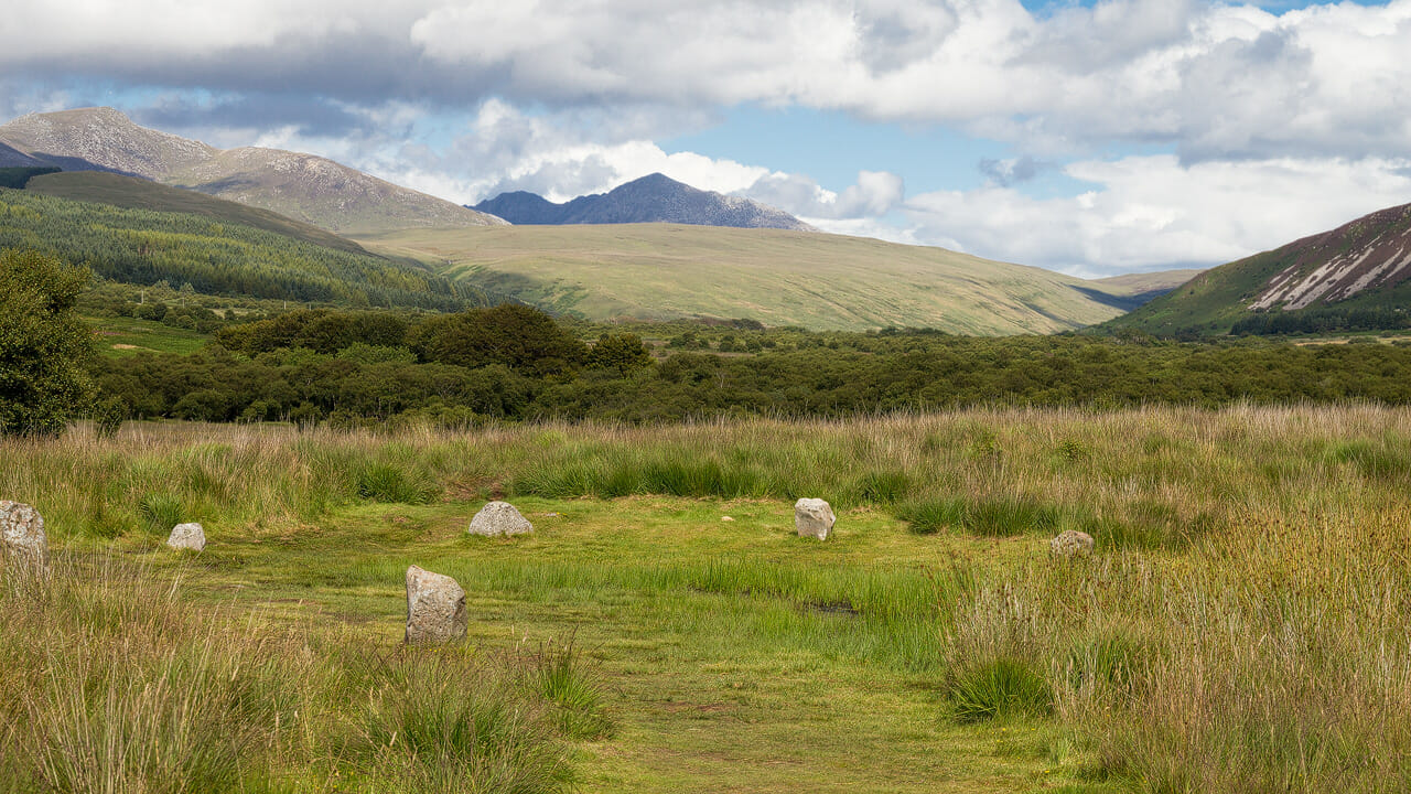
Incidentally, the stones were only the second phase. During excavations in the 1980s, scientists found the remains of circles made of wooden posts, which had already been in use here centuries earlier.
Whether the standing stones of Machrie Moor really were a kind of observatory, or whether other ideas played a role in the stone circles, is something we can really only speculate about. Historian Thorbjörn Campbell, for instance, also offers the idea of stone mandalas as an alternative.
Tip: The way to Machrie Moor and its information boards
The Moss Farm Road starts from a car park on the road in the west of Arran. It’s about a two-kilometre walk, the path is well marked and maintained, but can still have deep puddles in bad weather. So sturdy footwear is definitely a good idea. Overall, you should allow yourself one and a half to two hours for the visit.
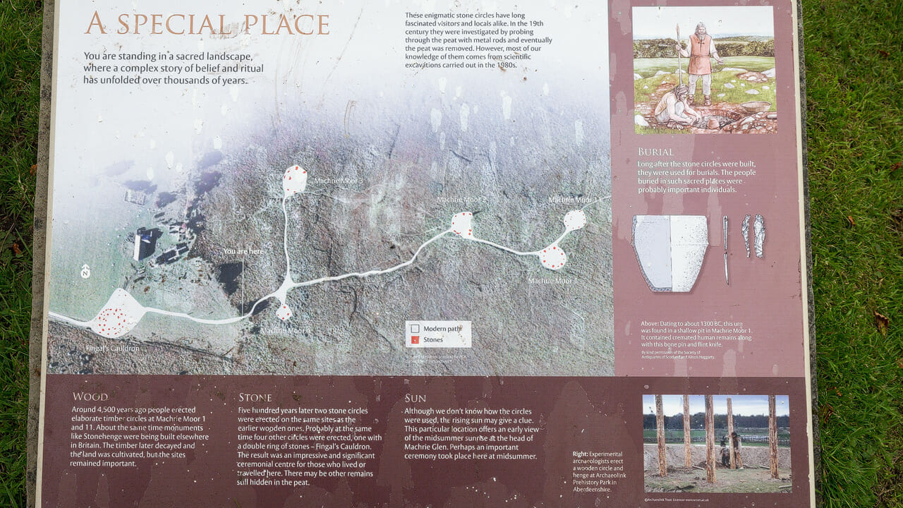
Although the area feels fairly remote, it’s well signposted and explained. Visitors are even shown the layout of the circles from a bird’s-eye view:
By the way: the Arran Distillery also bottles a whisky named Machrie Moor. Its release is limited, and connoisseurs describe it as unusually smoky.
Personal note: Whatever the weather!
As you may already have noticed from the photos, we visited the stones on two different days – once in dull weather, once in sunshine and blue sky. Both times were worthwhile, and each reveals its own atmosphere. Rather eerie under a clouded sky, a joy to soak up in bright light.
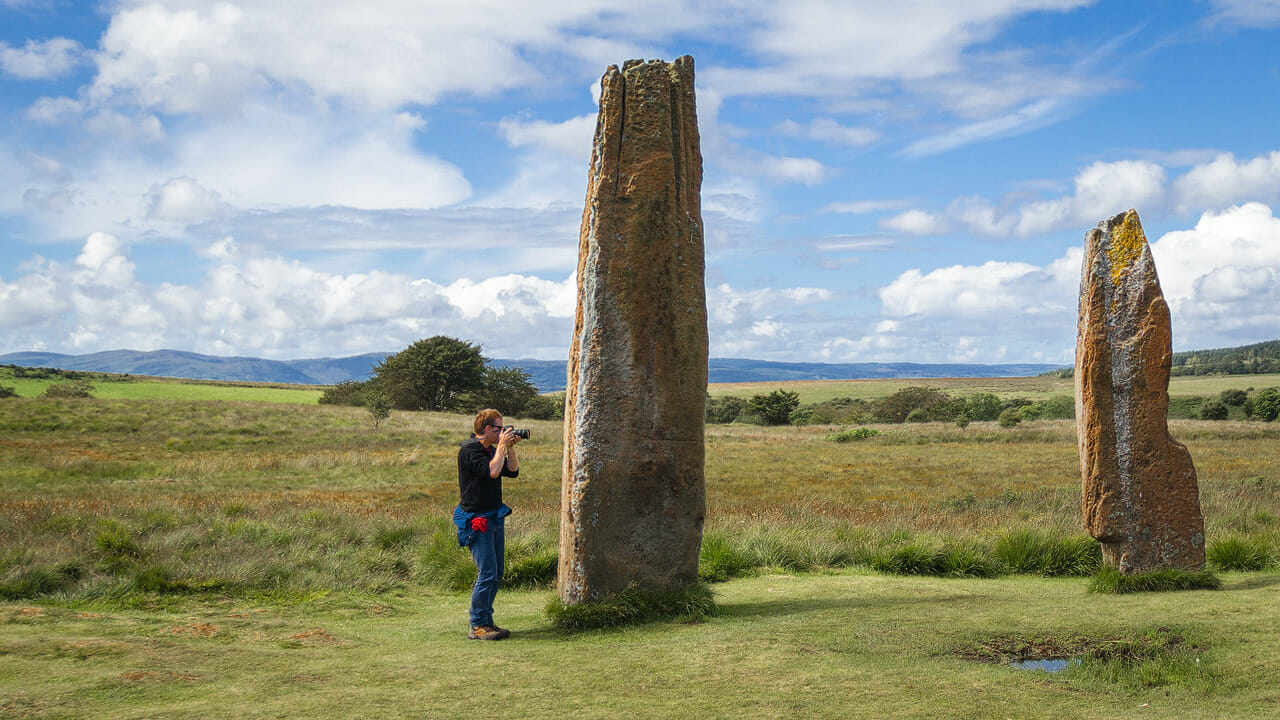
This time my wife photographed me while I was taking photos. And it gives a good sense of just how big the stones really are:
Getting there:
With sat nav: enter “KA27 8DX”, which will take you to the area around Tormore in the west of Arran.
Without sat nav: from Lochranza, take the coastal road towards Blackwaterfoot. After a few kilometres, a road branches off to the left towards Brodick. Once you pass this, you’re already at Machrie. The road soon crosses a small stone bridge over the “Machrie Water”. Stay alert after that, as the turn-off appears fairly suddenly on the left. It leads to a medium-sized car park.
From Brodick, drive towards Blackwaterfoot over the so-called “String”, cutting right across the island. Then continue as below.
From Blackwaterfoot, follow the road north towards Lochranza. At first there are still plenty of houses to either side of the road at Torbeg, but it soon grows quiet and you can see the wide plain of the moor to the right, with the mountains behind it. Eventually, scattered houses appear again, including a large farm on the left with modern farm buildings. From there it’s not far until the turn-off to the car park appears on the right.