The Scottish islands stretch all along the north and west coast. How many there are, what makes each one unique, and where you can spend a holiday – we find out in this article.
Contents:
Follow me on a little journey. A journey along Scotland’s coast, starting in the north and running all the way down to the southwest. We’ll visit the many small and large islands that belong to Scotland – islands each with their own character, their own culture, islands that have played their part in history, and islands that could enrich your future trips to Scotland, thanks to their fantastic and distinctive nature and sights you won’t find on the “mainland”.
Some of these islands are famous. Skye, Islay or Orkney are familiar names to almost every visitor to Scotland. But the “Highlands & Islands” offer more – islands where no one lives anymore and which can only be visited on a day expedition, for instance, or bare rocks out in the sea once used as a prison.
Together, the islands reflect the whole range of Scottish cultural influences: from the Vikings on the northern isles to the Gaels in the southwest. And scenically, hardly any two islands are alike either – rugged mountains on the Inner Hebrides, fertile land on Orkney, and wonderful sandy beaches on the Outer Hebrides.
How Many Islands Does Scotland Have?
In total, Scotland counts 790 islands, if you really count every tiny islet. Only around 130 Scottish islands, though, are inhabited.
Don’t worry: we’ll stick to the most important ones.
By the way: our tour obviously doesn’t take place in reality – it’s a journey of the mind. From north to south we’ll trace the islands on the map. Along the way we’ll visit some well-known islands, but also plenty of lesser-known ones, like the Shiant Isles or Rona. For each I’ll give a brief overview of the key sights and stories, along with size, location and population. By the end of our journey, I hope I’ll have conveyed just how varied Scotland’s islands are, highlighted their different characters, and perhaps given you a taste for visiting.
So: off we go, right up in the north.
Northern Isles: From Shetland via Fair Isle to Orkney
In the north of Scotland, above Sutherland and the Pentland Firth, an island chain stretches out towards Norway: the Northern Isles, split into Orkney and Shetland. Together they separate the North Sea in the east from the Atlantic in the west.
Two things make the Northern Isles – or Norðreyjar, as they were called in Old Norse – special: first, their many imposing prehistoric structures, and second, the legacy of the Vikings and Norwegians.
In fact, some residents feel closer to the countries to the north than to Scotland, or even the West Highlands. After all, Shetland and Orkney only passed to Scotland in 1471 – before that they belonged to Norway. That’s why Gaelic isn’t spoken at all on the northern isles and has no tradition there either; Old Norse came closer, though that too has since given way entirely to English.
Where the Vikings Still Party: Shetland
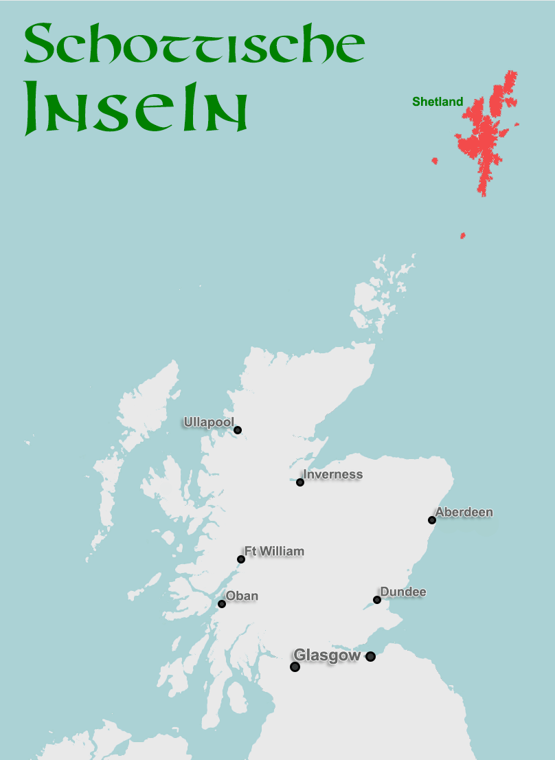
Shetland already sits at the same latitude as Bergen in Norway, meaning long nights in winter and long days in summer. Shetland breaks down into three larger islands: Yell up in the north, Unst below it, and finally Mainland, the main island, home to the capital Lerwick. The 2011 census counted 23,200 residents across Shetland in total, 6,958 of them living in Lerwick alone.
Anyone who doesn’t fancy the long trip by Northlink ferry, say from Aberdeen (overnight) or from Orkney (around eight hours), takes the plane instead. Flybe offers direct connections to Aberdeen, Edinburgh, Glasgow and Inverness – and also to Bergen in Norway.
Two of Shetland’s most important sights are Jarlshof and the Mousa Broch. The latter, at over 13 metres tall, is the best-preserved broch anywhere. It lies southwest of Lerwick and can only be reached by a small ferry.
Jarlshof lies on Sumburgh, the southern tip of Mainland. Amid gentle green hills you’ll find around 4,000 years of settlement history: from Neolithic houses to Viking longhouses, right up to a nobleman’s farmstead from the 16th century.
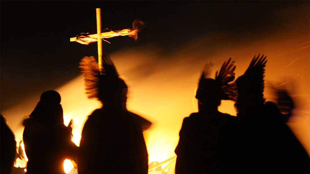
Once a year, always on the last Tuesday of January, the capital Lerwick belongs entirely to the Vikings again. In helmets and armour, they march through the streets, and at the end of the day they burn a Viking longship. That’s the festival “Up Helly Aa”. However much it evokes the old Norsemen, though, the tradition of Up Helly Aa actually dates from the 19th century, not the ninth. Still, it’s a spectacular event to see – some call it a “Viking carnival”.
» Detailed info and sights for Shetland
Roughly halfway between Sumburgh Head on the south of Shetland Mainland and North Ronaldsay, Orkney’s northernmost island, lies Fair Isle. It’s famous for the knitted jumpers made here, and for its rich birdlife. There’s a bird observatory here too, with accommodation available.
The island is only around five kilometres long and half as wide, and belongs to the National Trust for Scotland, a charity dedicated to preserving nature and historic sites. Visitors reach Fair Isle three times a week by the ferry Good Shepherd IV from Grutness, for around £20 per person without a car. The crossing takes just under two and a half hours. Alternatively, flights run up to four times a week from Tingwall near Lerwick – a return flight costs around £95.
Taking the ferry from Lerwick and travelling around 6 hours further south, we finally reach Orkney.
Neolithic Heritage: Orkney
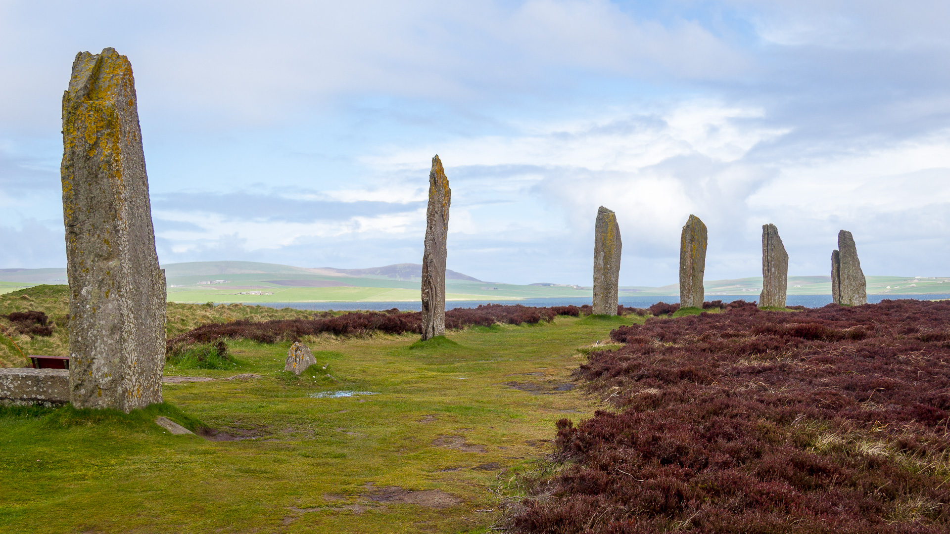
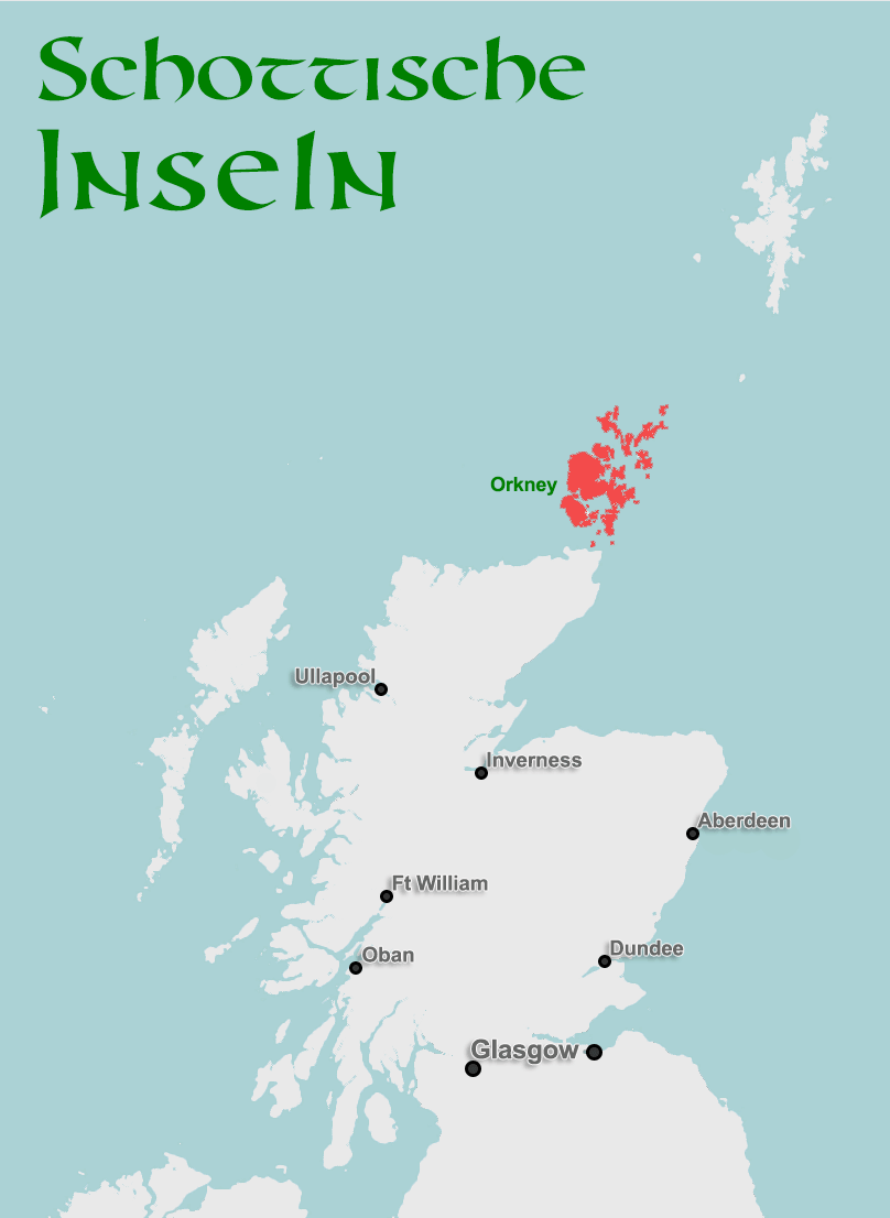
Its prehistoric past shapes this island group like almost nothing else. Even today, new discoveries keep turning up, and archaeologists work tirelessly to excavate settlements and Stone Age structures.
The chambered cairn of Maes Howe, the stone circle Ring of Brodgar and the settlement of Skara Brae together make up the “Heart of Neolithic Orkney”. Together they’re part of the UNESCO World Heritage. These monuments – and there are many more still to see across the island group – are extremely well worth visiting. Beyond them, there are also ruined palaces, a cathedral and impressive nature to admire.
The Orkney archipelago is fairly large, with 62 islands, and as with Shetland the largest is simply called Mainland. On it sit the capital Kirkwall, with 7,045 residents (2011 census), and the much smaller Stromness, with 1,758 people. Other interesting islands include Hoy, with its famous sea stack the Old Man of Hoy, and North Ronaldsay, famous for its seaweed-eating sheep – the meat is said to taste quite distinctive.
You can reach Orkney by the Northlink ferry from Aberdeen and Scrabster near Thurso, or by Pentland ferry from Gills Bay. Flybe also runs several flight routes from Kirkwall to Scotland’s major cities, or to Bergen in Norway and to Sumburgh on Shetland.
» Detailed info and sights for Orkney
But let’s leave the northern isles now and travel along Scotland’s north coast, where at first there’s nothing but the tiny islets of Sule Skerry and Sule Stack, which barely offer enough room for birds – and, in the case of Sule Skerry, a lighthouse.
If we now trace our finger westward across the map from these little islands, we reach the most remote outliers of the Outer Hebrides …
Outer Hebrides: the Island Chain in the Atlantic
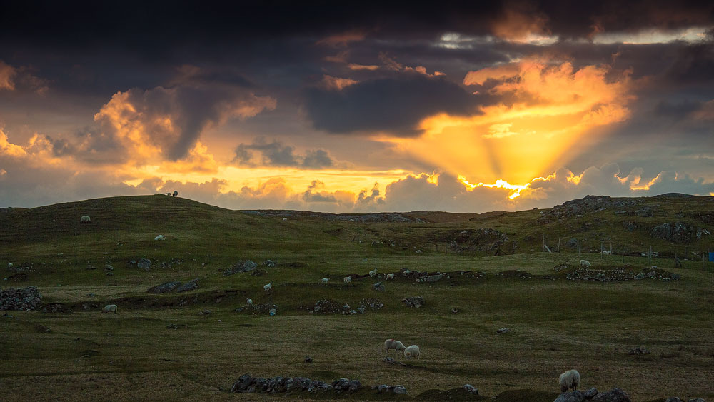
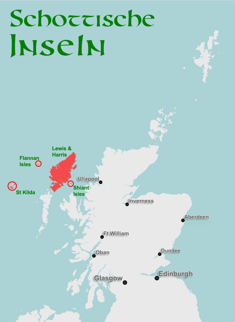
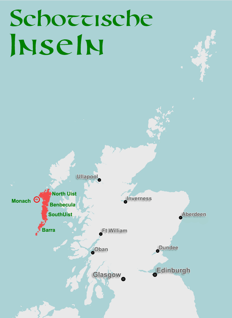
Like a giant shield against the raw Atlantic, the Western Isles or Outer Hebrides stretch along Scotland’s west coast. Since Scotland’s Gaelic heritage remains most alive here, their official name – even on official maps (O&S Maps) – is actually “Na h-Eileanan Siar”, and the local authority officially calls itself “Comhairle nan Eilean Siar”, the council of the western isles.
The northernmost outliers of the Outer Hebrides even sit at the same latitude as Orkney, though no one lives there anymore. Even so, these islands are steeped in history.
Remote Satellites: North Rona and Sula Sgeir
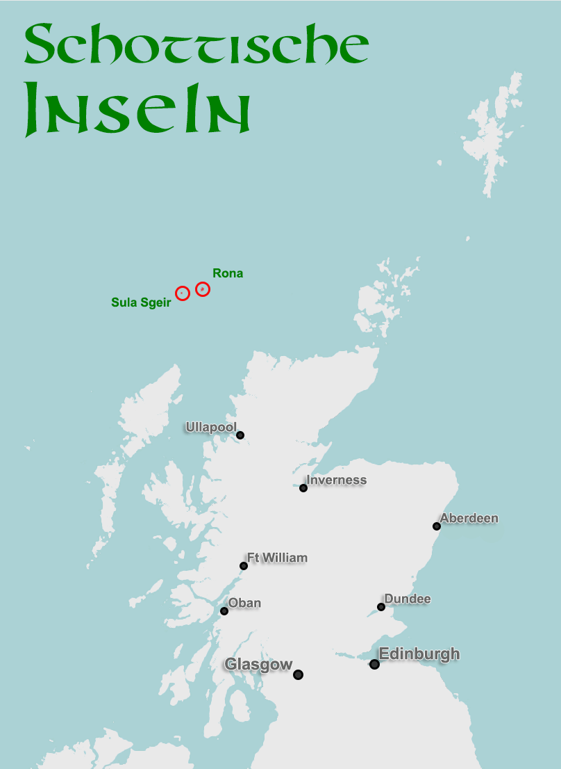
Around 70 kilometres northeast of Lewis lies North Rona. The island is two kilometres long and one and a half kilometres wide. That was enough, once, for a thriving little community: a village with a chapel and blackhouses, home to around 30 souls. But rats destroyed the harvest in 1680, and the entire population starved. After that, only the odd shepherd lived here grazing animals – though they too had to leave once North Rona changed owners in 1844. From then on, mostly only sheep were kept here; an attempt by two shepherds to resettle in 1884 ended with their deaths in 1885. No one has lived here for any length of time since – aside from a great many seals and birds.
Today, North Rona has an automated lighthouse and the remains of an old chapel that may date back to the 8th century. Since landing a boat here is very difficult, North Rona so far can only be visited as part of a longer, multi-day expedition with Northernlight.
16 kilometres further west of North Rona lies the uninhabited Sula Sgeir. As with the more easterly Sule Skerry (mentioned above), the names “Sgeir” and “Skerry” seem to point to the Old Norse term for a skerry island, while “Sula” and “Sule” refer to the gannet.
And gannets are exactly what Sula Sgeir has to offer the world. On this rock, 830 metres long and 300 metres wide, around 5,000 breeding pairs of gannets nest. Although Sula Sgeir, together with North Rona, forms a nature reserve, the so-called “Guga Hunters” are allowed once a year to take around 2,000 young gannets and bring them to the mainland, where “guga” is considered a delicacy. Only selected individuals are allowed to take part in the guga hunt, since it’s both an honour and genuinely dangerous. On the rock, the birds are hunted, killed, singed and lowered down wooden chutes to the landing point.
Author Peter May wove the tradition of the guga hunt into his novel The Blackhouse, bringing it wider fame.
The Big Island: Isle of Lewis
Let’s follow the Guga Hunters on their way back from Sula Sgeir – the boat heads straight south and reaches its home port of Port Nis (Ness in English), just below the Butt of Lewis, (German only for now). This is where the Isle of Lewis begins, the largest island of the Outer Hebrides. Lewis isn’t really a separate island at all – it’s joined to Harris in the south – but because the two parts are separated by fairly high mountains, two distinct areas have formed, each with its own name.
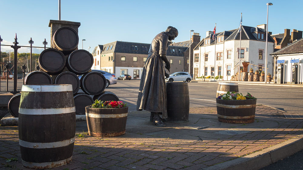
Lewis’s capital, Stornoway, (German only for now), is the largest settlement in the Western Isles: the 2011 census counted 5,714 people there. Stornoway has an airport with flights to and from Edinburgh, Glasgow, Inverness and the neighbouring island of Benbecula. A new pier at the harbour also handles the larger car ferry that links Lewis with the mainland town of Ullapool.
Scenically, peat moorland dominates the north, while the southwest gets increasingly mountainous. The coast is mostly rocky, though beautiful sandy beaches have formed around Uig, (German only for now), and elsewhere too.
Mysterious Deaths at the Lighthouse: Flannan Isles
Let’s take a short detour from Uig, 33 kilometres west as the crow flies out into the Atlantic. Here lies another small archipelago, the Flannan Isles. Eight small islands – the largest, Eilean Mòr, has a now-automated lighthouse. The group has been uninhabited since 1971; before that, at least there were lighthouse keepers.
It’s precisely around those keepers that the islands’ great mystery revolves. Three of them vanished from the island without a trace, under circumstances that remain unexplained. To this day, people still puzzle over how and where the men were lost – the leading theory is that they were simply swept away by the sea.
Right in the Minch: Shiant Isles
Let’s jump now to the other side of the Isle of Lewis. About eight kilometres east, in the strait between the mainland and Lewis, lie a few more notable islands that belong to the Outer Hebrides: the Shiant Isles, in Gaelic “Na h-Eileanan Seunta” – the enchanted isles. The three islets are privately owned and no longer inhabited today. Seabirds and basalt cliffs make them a rewarding destination for tourists too, in principle.
Even so, currently only the operator Seaharris offers charter trips from £500 out to the Shiant Isles.
Lewis’s Little Brother: Isle of Harris
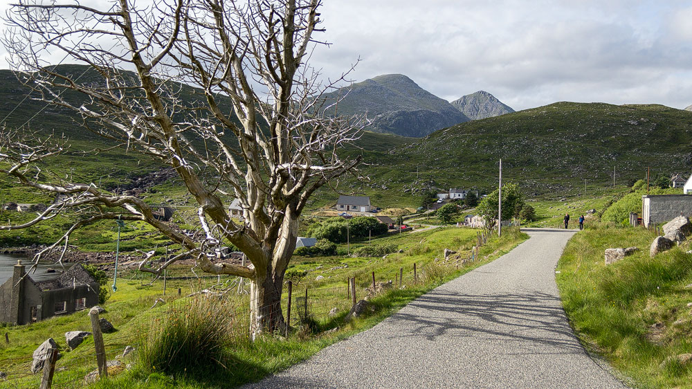
Back to Lewis and Harris. The dividing line between the two runs along Loch Seaforth in the east and Loch Reasort in the west.
The north of Harris then climbs steeply: the mountain An Cliseam reaches up to 799 metres, its flank followed by the pass road towards the main village of Tarbert. Tarbert is also Harris’s ferry port to the east, sailing to Uig on the Isle of Skye.
Beyond the village of Tarbert, Harris splits into a rocky east studded with small bays, and a sandy west with dream beaches that could pass for the South Pacific – though the Atlantic’s temperatures here are decidedly less friendly than, say, in Fiji. Both sides are well worth seeing – the main road runs through the west, but you can also explore the east via the Golden Road, (German only for now).
The main road, meanwhile, ends in Leverburgh at the southern tip of Harris. Not only does the ferry to Berneray and the Uists depart from Leverburgh, but this is also where expeditions to a very special island group set off …
Outposts in the Atlantic: St Kilda and Rockall
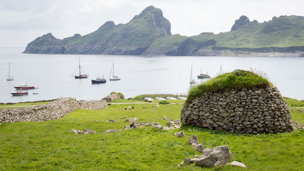
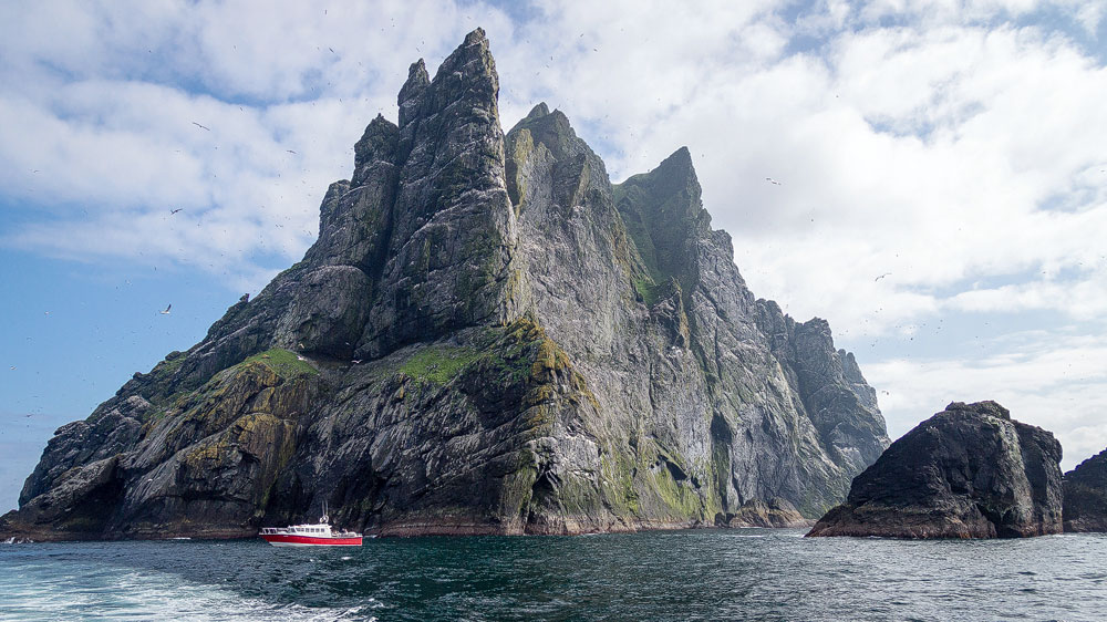
Around 90 kilometres off Harris lies the archipelago of St Kilda. The main island, Hirta – or in Gaelic Hiort (pronounced roughly “Hirscht”) – forms a picturesque bay that then climbs into a high mountain, dropping away steeply again on several sides. Here you’ll find the remains of a village abandoned on its own initiative back in the 1930s. Today only a handful of researchers and soldiers live here, alongside goats and various birds. There are also the neighbouring islands of Boreray (Gaelic Boraraigh) and Soay (Gaelic Soaigh). Boreray and the two nearby sea stacks host huge colonies of various seabird species. Hirta is accordingly both a Natural and a Cultural World Heritage Site.
A trip to St Kilda takes most people just a day by speedboat and costs around £200 per person. But it’s an experience you certainly won’t forget – absolutely worthwhile for the adventurous. One more tip: watch out for the skuas, (German only for now), out there.
St Kilda isn’t Scotland’s westernmost island, though. From there it’s still around 310 kilometres further to Scotland’s true westernmost outpost: Rockall. An island that lives up to its name entirely, since it really is nothing more than a rock in the surf. Vegetation is limited to algae, and the only large animals you’ll find are seabirds. Although no one could ever live here, Britain insists on its ownership rights to the island – understandably, since that also brings a claim to the surrounding waters within a 200-mile radius, complete with fishing and oil-drilling rights. Iceland, Ireland and Denmark all dispute ownership with Britain, but the UK has at least stationed a garrison there in the past and had an official plaque installed.
Rockall still gets visitors, though – from amateur radio enthusiasts to Greenpeace, people have kept turning up on the island. Most recently, adventurer Nick Hancock had himself dropped off on the island in a survival pod and held out there for a full 60 days – a new record!
But let’s leave this inhospitable spot and head back to the beautiful islands of the Outer Hebrides: the Uists.
Sandy Beaches and a Special Soil: Berneray, North Uist, Benbecula, South Uist and Eriskay
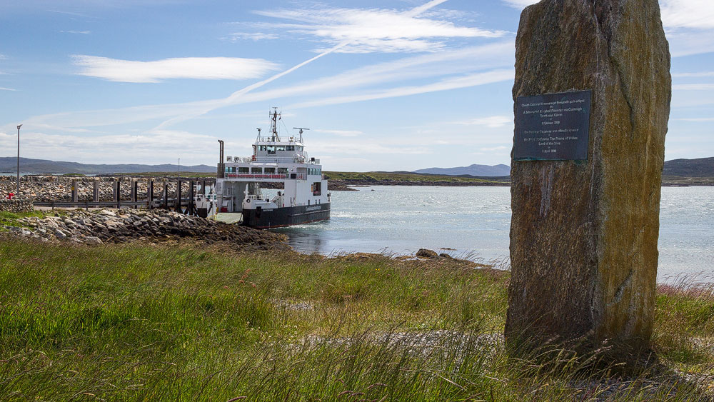
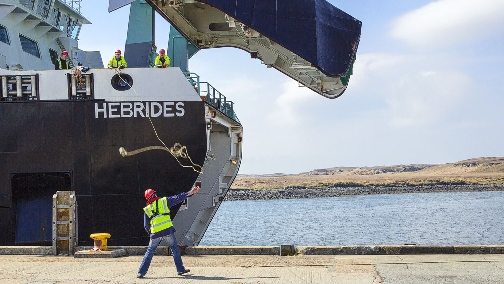
The ferry from Leverburgh on Harris takes about an hour, winding through a maze of small rocks in the Caolas na Hearadh, the Sound of Harris. Along the way it hooks southwest, reaching the island of Berneray (Beàrnaraigh), (German only for now), where it deposits cars and passengers back on land.
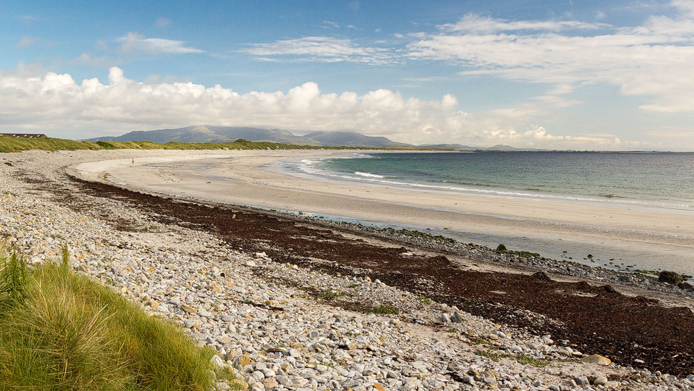
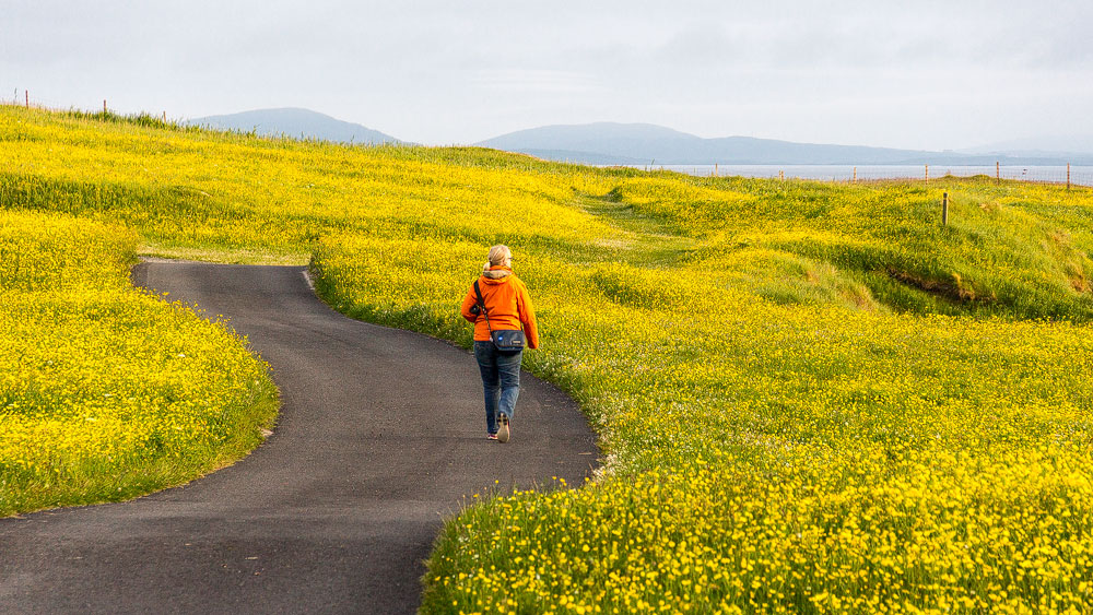
All the islands that follow, from Berneray down to Eriskay, are linked by causeways, along which the main road runs. The landscape here is defined by moorland, riddled with large and small freshwater lochs and cut into by sea inlets in the east. While the east tends to be rocky, long sandy beaches wind along the entire west coast, backed by the rare machair, (German only for now), a distinctive soil found on these islands that lets wildflowers bloom right by the sea.
On North Uist (Gaelic: Uibhist a Tuath) you’ll find several Neolithic remains, such as the chambered cairn Barpa Langais, (German only for now). There’s also the Balranald Nature Reserve and the famous Teampall na Trianaid, both German only for now. Don’t expect any grand palaces or castles here, though. In the island’s east lies the main village of Lochmaddy, which runs the ferry link to Uig on Skye.
You’d think South Uist should logically follow North Uist. But Benbecula (Beinn na Faoghla) has wedged itself between the two. The island was once a seat of Clanranald, an important and once-powerful clan that also produced the heroine Flora MacDonald, (German only for now). Although Milton on South Uist is often cited as her birthplace, it’s actually more likely that she was born – and grew up – in Balivanich (Baile a’Mhanaich). That same village, incidentally, is home to an airport connecting the Uists with Glasgow, Inverness and Stornoway.
Finally we arrive on South Uist (Uibhist a Deas). The island even has a proper mountain in Beinn Mhòr, at 620 metres. Otherwise you’ll find Bronze Age settlements at Cladh Hallan and the remains of old church buildings at Tobha Mòr, both German only for now. South Uist’s “capital” is Lochboisdale, from where a ferry sails to Oban – a crossing of the so-called Minch that takes almost six hours.
But we’re drawn further south still, to Eriskay, (German only for now). The small island is world-famous for its pony breed, (German only for now). And, of course, for the fact that Bonnie Prince Charlie first set foot on Scottish soil here on the beach, (German only for now). The island also became famous for the wreck of the “SS Politician”, which was carrying whisky – inspiring author Compton Mackenzie to write the novel Whisky Galore, later made into a film of the same name. We Germans have a connection to Eriskay too: the bell outside the church came from an Imperial German battlecruiser from the First World War, (German only for now).
Before we leave the Uists and take the ferry to Barra, let’s make one more short detour back up to North Uist. To its west, out in the Atlantic, there are a few smaller satellite islands still.
The Lady’s Prison: Monach Islands
The Monach Islands are also known as Heisker. There are two large islands and several smaller ones, lying 13 kilometres off the island of Baleshare (Baile Sear) near North Uist. In the past, it was apparently possible to walk between Baleshare and the Monach Islands at low tide, but a large wave in the 17th century is said to have destroyed the land link at low water. At least it still works between the four islands themselves.
The Monachs became famous as the prison of Lady Grange, held here – and later on St Kilda – by her husband from 1732 onward, out of fear she would expose him as a traitor and Jacobite sympathiser.
The islands were inhabited until 1942, and in the 19th century they’re said to have held around a hundred people at times. Today there’s an old, recently renovated school that serves as a visitor centre. The flora and fauna are said to be remarkable.
The Southern Outliers: Barra, Vatersay and Many Small Islands
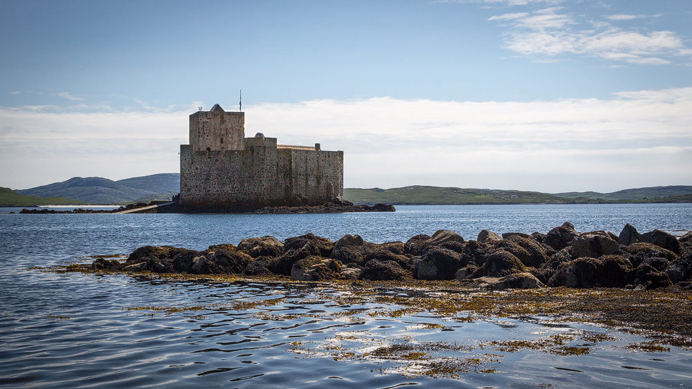
Back to Eriskay, and straight onto the car ferry to Barra. The island, with its 1,174 residents (as of 2011), has a ring road around 21 kilometres long, making it ideal for a half marathon – which is indeed held here every year, called the Barrathon.
There’s plenty more to see here too: in the main village of Castlebay, (German only for now), you’ll find Kisimul Castle, (German only for now), perched on a rock in the bay. The village itself has a small museum, and the west of the island has some beautiful sandy beaches.
Barra connects to the mainland two ways: by ferry from Castlebay to Oban, and by plane to Glasgow. The landing strip: the great beach in the north, (German only for now) – watching a plane land there is a sight worth seeing in itself.
A causeway links Barra to the southernmost still-inhabited island of the Outer Hebrides: Vatersay, (German only for now). Around 90 people live here today, enjoying two beautiful sandy beaches that almost touch in the middle.
With the uninhabited islands of Sandray, Pabbay, Mingulay and finally Berneray (a different Berneray from the one we passed earlier), the Outer Hebrides finally trail off, both German only for now. 160 kilometres further south lies Northern Ireland.
» Detailed info and sights for the Outer Hebrides, (German only for now)
Now let’s leave the Outer Hebrides behind and turn east.
Realm of the Lords of the Isles: Inner Hebrides
In the north, the Inner Hebrides are separated from the Outer Hebrides by the so-called Little Minch. We’ll start with the largest island in this group.
Over the Sea to …: Skye, Raasay, Rona and Scalpay
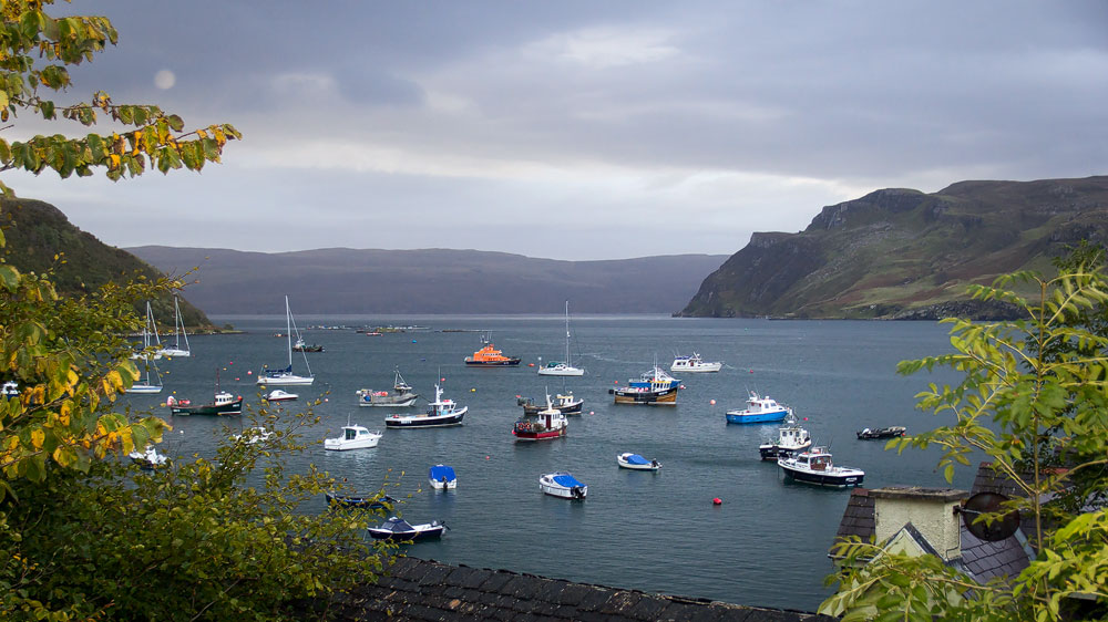
I’ve already written a great deal about the Isle of Skye, with its magnificent mountains and wonderful wildlife, here. To my mind, it’s one of the most scenic landscapes in Scotland. But around it lie a few more, lesser-known islands.
To the east, separated by a quarter-hour ferry crossing from Sconser on Skye, stretches the island of Raasay for over 20 kilometres, though it’s only around four kilometres wide. 164 people live here. The island was too small a hiding place for Bonnie Prince Charlie in 1746, so he soon moved on. During the Second World War, prisoners of war were held here and forced to work in the local iron mines. Today the Raasay House Hotel is working hard to draw in tourists, hoping to lure them with outdoor activities.
Above Raasay lies Rona, an island where you can retreat to a cottage – great for anyone stressed out by the world. And below Raasay there’s Scalpay, a privately owned island home to four people.
Around Skye there are of course still more islands, like Soay or Wiay, both uninhabited. They only play a minor role on our journey along Scotland’s islands, though.
The “Small Isles”: Canna, Rùm, Eigg and Muck
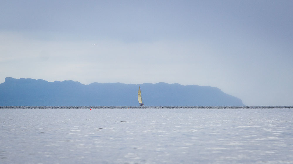
Let’s set off from where Bonnie Prince Charlie himself once left the Isle of Skye: Elgol. We travel a good 25 kilometres west with a slight dip south, and reach Canna, the westernmost of the “Small Isles”. And Canna really is small: about 7.5 kilometres long and one kilometre wide, its highest “mountain” reaching just 211 metres. Canna has a small neighbour named Sanday – technically its own island, but linked by a footbridge, when that footbridge hasn’t recently been swept away by a wave, as happened not long ago. Canna currently has barely 15 residents – a few centuries ago it had around 300. Canna is known as the “Garden of the Hebrides” and provides nesting grounds for many seabirds. The island is managed by the National Trust for Scotland.
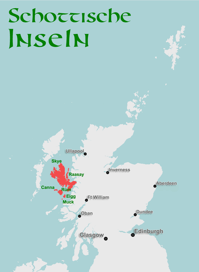
From Canna’s eastern tip, the west coast of its neighbouring island Rùm – pronounced “Room”, not “Rum” – lies less than four kilometres away. It’s the largest of the Small Isles, almost circular, with a diameter of up to eleven kilometres. And yes: Rùm has mountains, the Rùm Cuillin. The peak of Askival rises to 812 metres, its neighbour Ainshval to 778 metres. On the flanks of these mountains you’ll mainly spot one thing: red deer. The island is known – and protected – for its wildlife. There are sea eagles, otters, goats and seals here. Only one species has become rare: humans. As so often, the story of the largest of the “Small Isles” mirrors what happened across Scotland as a whole. Rùm’s once 450 residents were evicted in 1827 as part of the Highland Clearances, (German only for now), the land needed for sheep farming. Today perhaps twenty people live here permanently.
Rùm does at least have a castle – or rather, a grand house. It dates from 1900, when the then owner had red sandstone brought in to build a stately residence, complete with ballroom, wine cellar and much more. In 1957 the estate’s heirs left the island and handed it over to Scottish Natural Heritage. Today Rùm is a great place for walking and wildlife watching. More info on Rùm.
Scottish island with four letters? Comes up a lot in crosswords. The answer is usually either Eigg or Muck. Eigg lies around seven kilometres southeast of Rùm, and is seven kilometres long and 5.5 kilometres wide. The Sgurr, a bare rock cone rising almost 400 metres, dominates the island. At its foot lies a cave where the island’s most brutal chapter played out: a group of MacLeods landed here seeking revenge for a previous offence against them. In response, the people of Eigg withdrew into the cave at An Sgurr and successfully hid. Even so, the MacLeods soon discovered the hiding place and simply lit a fire at its entrance, killing everyone inside.
Today things are more civilised on Eigg – the island belongs to the Eigg Heritage Trust, involving the residents, the Highland Council and the Scottish Wildlife Trust. More info on Eigg on the official website.
And finally, the smallest and southernmost of the Small Isles: little Muck. It’s also considered the most fertile island in the group, and around 40 people live here. Muck measures roughly 4 x 2 kilometres and rises to a maximum of 138 metres. Worth seeing there: the beach “Shell Bay”, the remains of a prehistoric fort and a restored crofter’s house. Muck’s website can be found here.
All four of the Small Isles can be reached by Caledonian MacBrayne ferry from the coastal village of Mallaig, or from Arisaig aboard the MV Sheerwater.
The Sunny Side of the Islands: Coll and Tiree
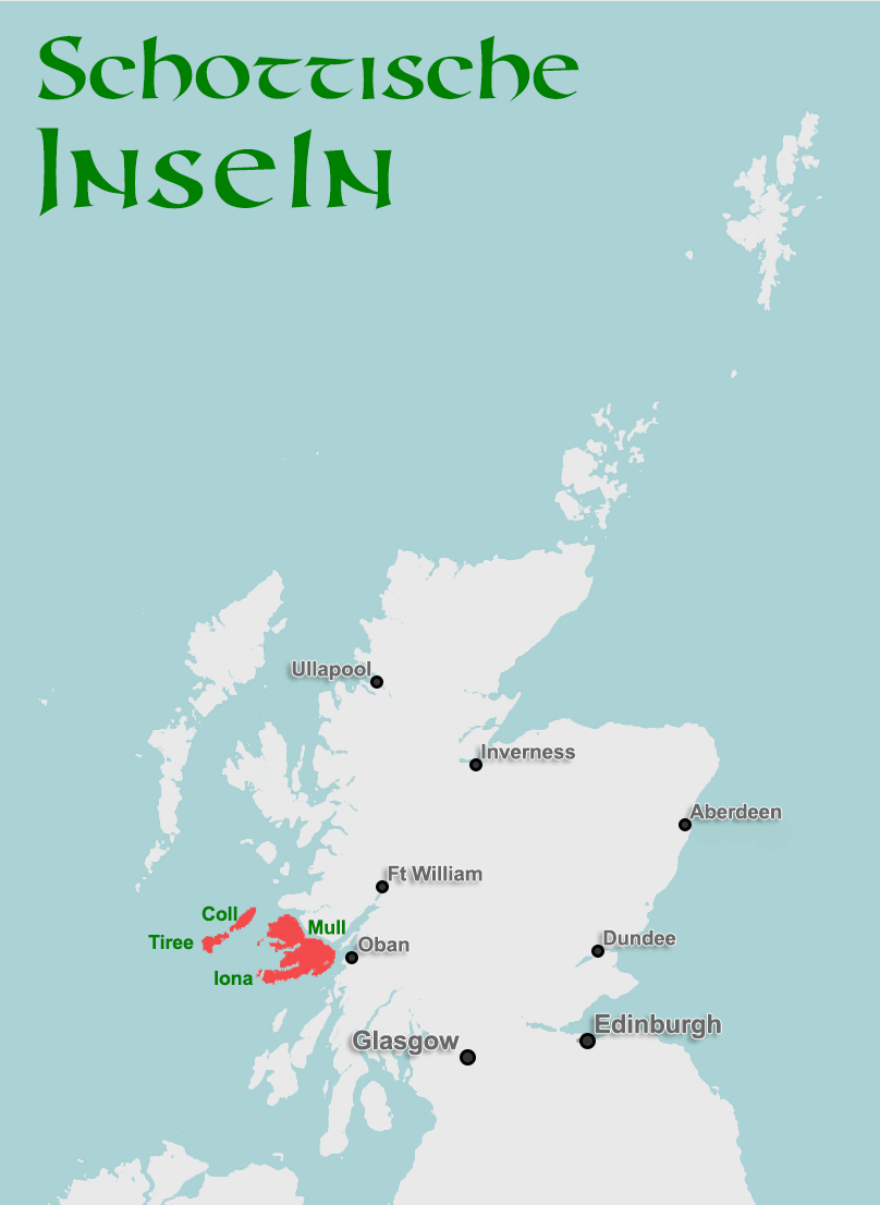
Further south, the sea between here and the mainland is no longer called the Minch but the Sea of the Hebrides. Here we first meet the islands of Coll and Tiree to the west. Coll is around 20 kilometres long and about 5.5 kilometres wide. 195 people live here – more than on all the Small Isles combined (the census counts just 153 people across the Small Isles).
On Coll there’s finally a proper castle again, Breachacha Castle, standing here since the 14th century – since the time of the Lords of the Isles, (German only for now). There were fortifications here even earlier, as Dùn Amhlaidh proves, attributed to a Viking chieftain. Where dragon-prowed longships once sailed, it’s now windsurfers who find ideal conditions here, thanks to the beautiful beaches and brisk winds. More on Coll on the official website.
If you picture the narrow shape of Coll continuing on, with just a small gap, you get Tiree. The flat island stretches for 17 kilometres before forming a thicker lump seven kilometres wide at its end. The population here is surprisingly large for such a small spot: the 2011 census counted 653 residents. Tiree even has an airport, connecting the island to Glasgow.
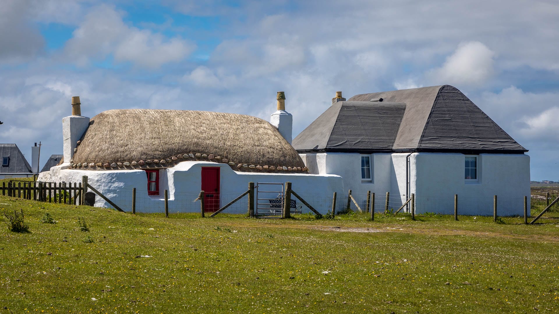
Tiree is the westernmost island of the Inner Hebrides. It’s famous for its sandy beaches, its nature, and for the handful of well-preserved thatched houses built in the old style – nowhere else are so many found in such a small area. What’s more, they’re built in a distinctive way: the roof doesn’t meet the outer walls flush, but sits set back, creating a broad ledge around the house. All of the houses are whitewashed.
More info on the Tiree page.
By the way: Coll and Tiree both have a mild climate and more hours of sunshine than almost anywhere else in Britain. No wonder – they’re so flat that rain usually passes right over them, only catching up once it reaches the mainland. Both islands are served regularly by Calmac ferries from the mainland town of Oban.
Mull, Ulva, Iona and the Treshnish Isles
Now on to Mull, the second-largest island of the Inner Hebrides after Skye. The main village of Tobermory, with its colourful house fronts, is home to 954 of the island’s 2,819 residents. Mull has something many other islands lack: forests – and that in turn helps plenty of animals feel at home here. Mull, for instance, is known for its golden and white-tailed eagles. In autumn you can even hear stags roaring through the glens in rut come evening.
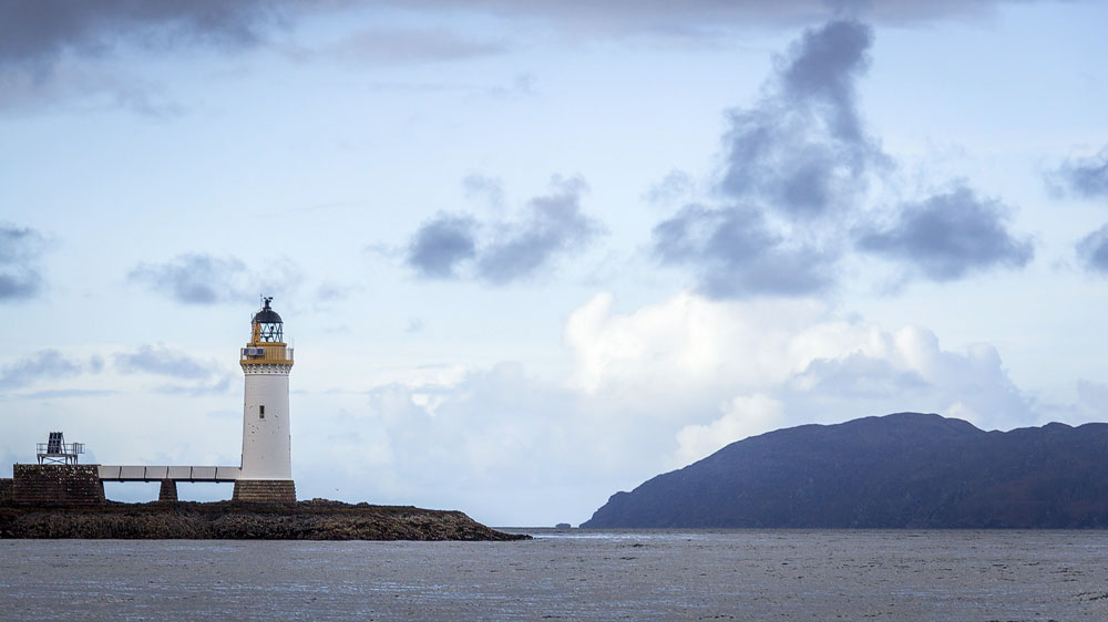
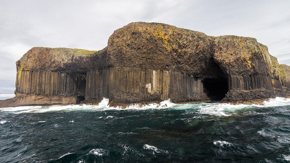
To the west of Mull lie a few more small islands, the Treshnish Isles: Lunga is well known for its puffins, which visitors can go and see. The birds don’t mind people being close, since they know visitors mean them no harm – quite the opposite, in fact, as people help keep their predators away. A visit to the Treshnishs is often combined with the island of Staffa, (German only for now). It’s known for its basalt columns and the cave that inspired Felix Mendelssohn Bartholdy’s overture “The Hebrides”. You can visit the islands, for example, with Staffa Tours or Turus Mara from Tobermory.
Between the Treshnish Isles and Mull lie two larger islets: Gometra and Ulva. The latter is a popular destination for walking, after which visitors can treat themselves to a bite at the “Boathouse”. A small passenger ferry covers the roughly 200 metres across to Mull. More info on Ulva here.
Much smaller, but no less significant, is another island at Mull’s southwestern tip: Iona. It’s barely five kilometres long and about two kilometres wide, yet it was from here that St Columba once christianised the whole of Scotland – making it a holy island. It can be visited by Calmac ferry, which also supplies the 177 residents with life’s essentials.
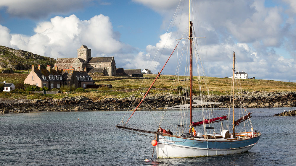
Mull also connects to the mainland by Caledonian MacBrayne ferries: either via the short crossing from Ardnamurchan, from Kilchoan to Tobermory, or via the Oban to Craignure route on Mull, which takes around ninety minutes. There’s also a short crossing from Lochaline in Morvern to Fishnish on Mull.
From Oban, incidentally, we can take the ferry straight on to our next island.
Colonsay, Oronsay, Islay & Jura, Gigha
At Scalasaig we step off the Oban ferry and set foot on Colonsay. The island, home to 132 people, also plays host to some particularly hard-working creatures: bees. Apis mellifera mellifera, the dark European honeybee, has found a protected home here – no other bee species may be introduced. Naturally, they busily produce honey too, gathered from the machair’s flowers. Alongside the bees, Colonsay is also home to oyster farming and carefully tended gardens – the latter at Colonsay House Gardens.
Directly below Colonsay lies Oronsay. It can be reached on foot at low tide. Oronsay is an RSPB (Royal Society for the Protection of Birds) reserve, so plenty of birdlife can be spotted here too. There are also the remains of a small 14th-century priory, complete with a beautiful stone cross. Armin Grewe has put together tour info on his website. Just be sure to head back across the beach to Colonsay in good time before the tide turns.
From Colonsay we now cross over to its big neighbour, Islay. We could do that by Caledonian MacBrayne ferry from Scalasaig, which sails to Port Askaig in the east of Islay. In our minds, though, we’ll take the plane instead, with Hebridean Air to Islay Airport near Glenegedale on the west coast.
Islay (Gaelic “Ìle”) was once the centre of the western isles. From Finlaggan, the Lords of the Isles ruled – nominally subject to the Scottish crown, though their power was arguably at least as great, both German only for now. Nimble ships could carry them quickly to every corner of their realm from here, while the mainland Scots had to contend with towering mountains.
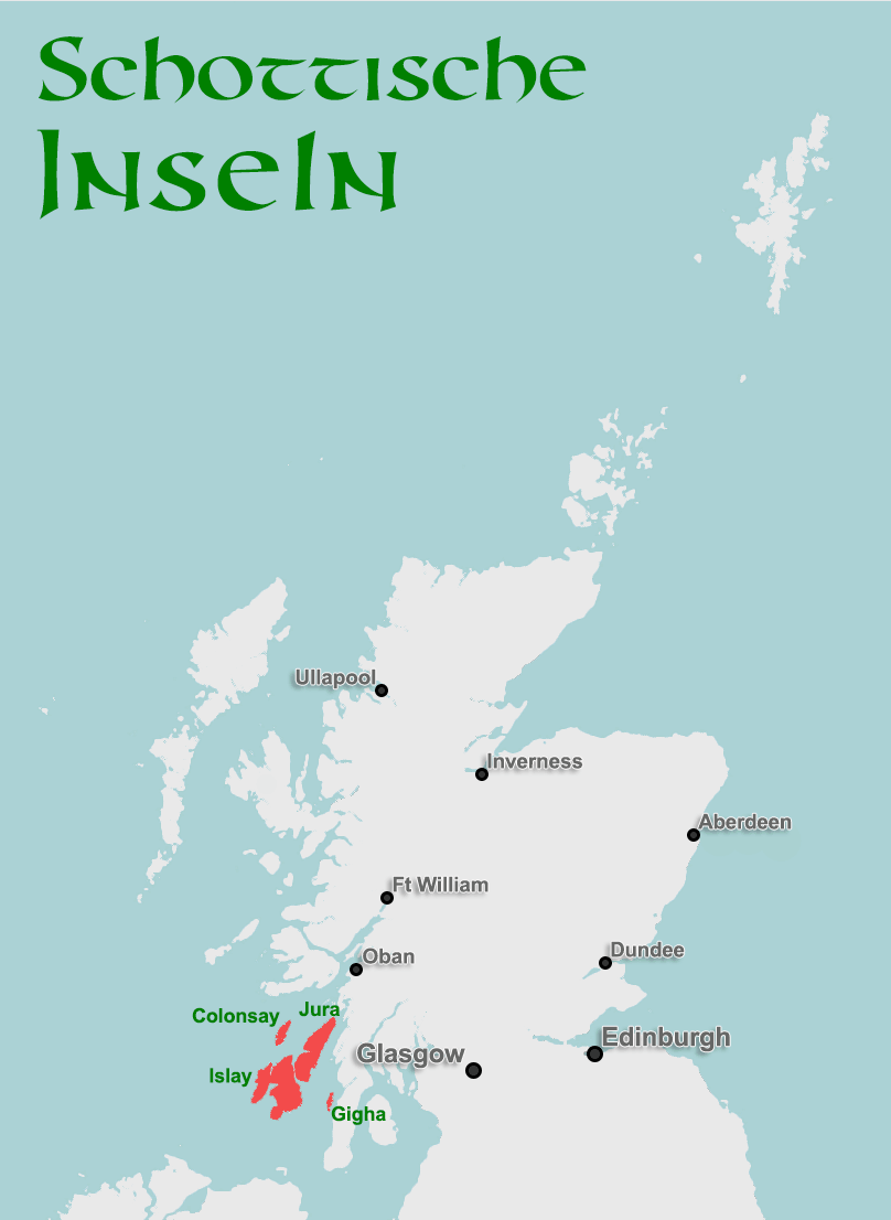
Of course, not much remains of that former power today. Instead, Islay is now famous for something else: the water of life – uisge beatha. Whisky. The island currently has eight active distilleries: Ardbeg, Bowmore, Bruichladdich, Bunnahabhain, Caol Ila, Kilchoman, Lagavulin and Laphroaig. Another, Gartbreck, is currently under construction. Islay’s whiskies tend to stand for fairly smoky, peaty notes – with the possible exception of Bruichladdich.
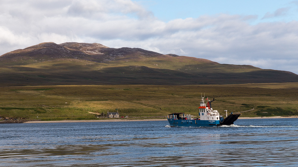
Islay is fairly large, with a landmass measuring around 40 x 23 kilometres. There are a few mountains in the east – the highest, Beinn Bheigier, reaches 491 metres – but overall Islay stays fairly flat. 3,228 people live on Islay, most of them spread across the villages of Bowmore (784) and Port Ellen (846). From Port Ellen you can leave the island by ferry to the mainland, docking at Kennacraig. Another option is Port Askaig in the east of the island, where the ferry from Kennacraig also calls. A boat also runs from Port Askaig over to the neighbouring island of Jura – just a few hundred metres across, though the crossing over the Sound of Islay is often rough.
More on Islay, its sights and, of course, its distilleries, here.
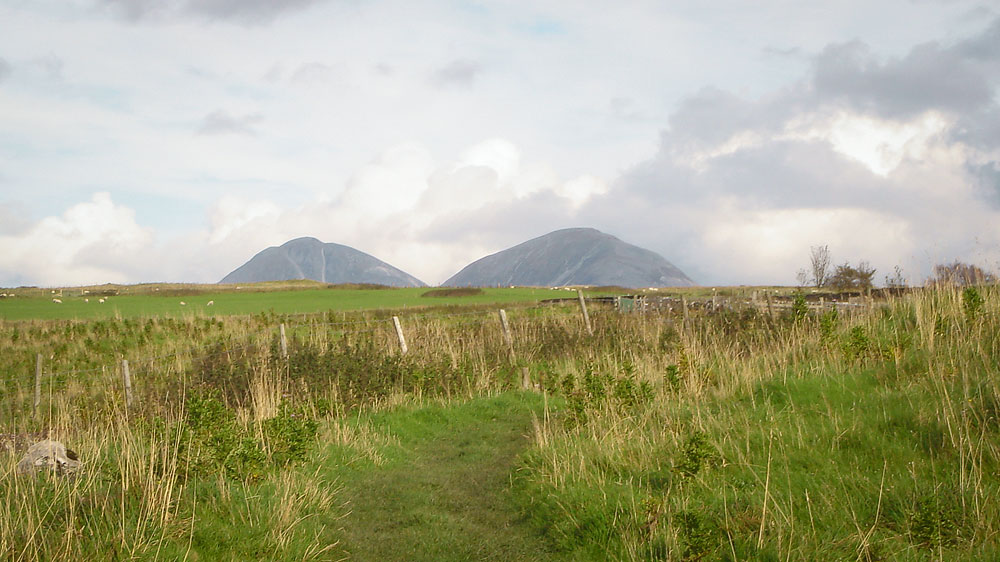
Jura – or Diùra in Gaelic – has three well-known claims to fame: first, the Paps of Jura, the mountains at the island’s centre, rising to a full 785 metres. Second, the whisky “Jura”, and third, the Corryvreckan in the north, a massive whirlpool.
The name Jura probably comes from Old Norse and points to the island’s red deer population – essentially “deer island”. Jura is only lightly populated: 196 residents share the 44 x 12-kilometre island, most of them living in the east, where the island’s only road runs.
To get back down off Jura, we first need to return to the ferry to Port Askaig. From there we take the Calmac boat and reach Kennacraig in a little under two hours. From there we head south towards the Mull of Kintyre, until we reach the village of Tayinloan. Here we board the ferry to the last and southernmost of the Inner Hebrides.
Just under 20 minutes, and the ferry docks again. Gigha is the name of this little islet, or Giogha in Gaelic. At barely 9.5 kilometres long and around 2.5 kilometres wide, Gigha has 163 residents – a decent number! In the 18th century there were up to 600 residents here, but as so often, the Highland Clearances and rural depopulation took their toll. At times fewer than a hundred remained. The turnaround only came in 2002, when the community bought the island from its owner and has managed it collectively ever since.
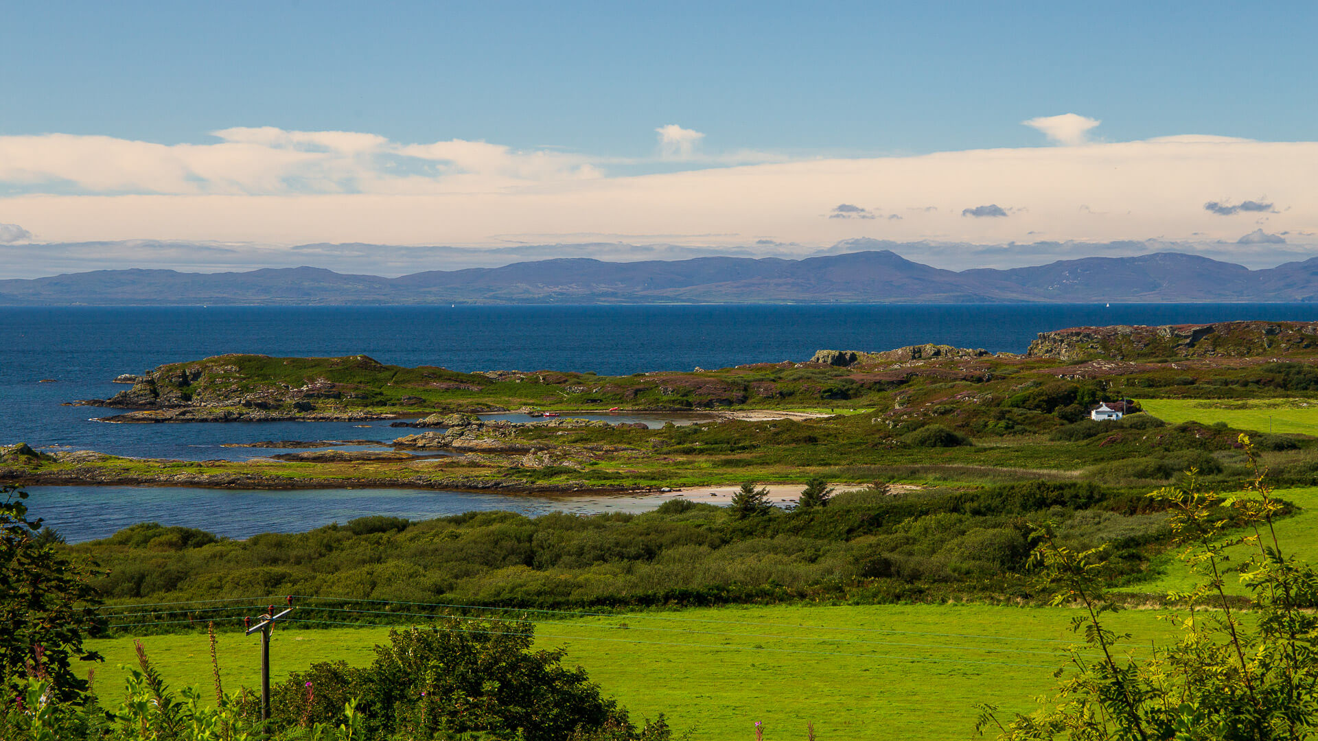
Gigha has a mild climate and plenty of sunshine. That’s why one of its biggest draws is Achamore House, with its gardens, home to over 600 orchids across 50 different varieties.
With Gigha, we now finally leave the Inner Hebrides and take the short route over the Kintyre peninsula to Claonaig, where the next ferry awaits.
Firth of Clyde Islands: Arran, Bute and Great Cumbrae
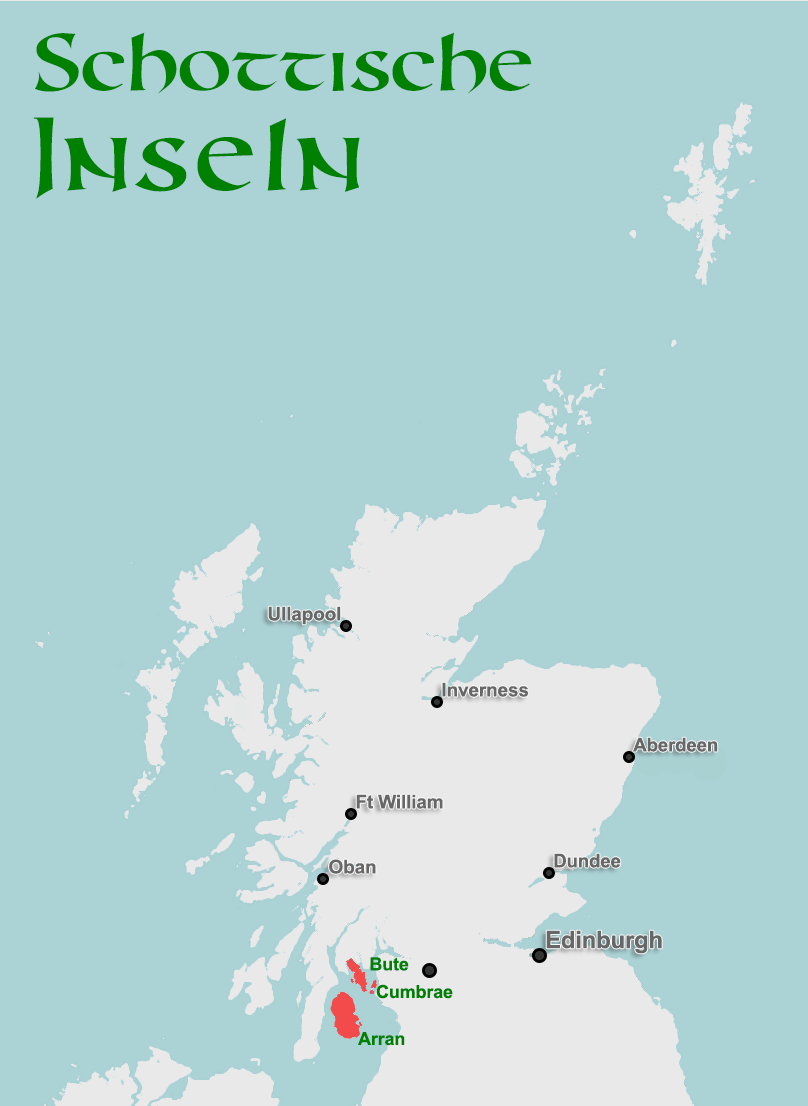
East of Kintyre’s long peninsula lies the Firth of Clyde, a sea inlet into which the River Clyde flows. A few more islands sit here.
Place of Pilgrimage for Geologists: Arran
From Claonaig, we cross to Lochranza on the Isle of Arran in just under half an hour. At 32 kilometres long and half as wide, Arran has settled comfortably between the Kintyre peninsula in the west and the mainland, with Glasgow, in the east.
Besides being a beautiful island that packs many typically Scottish landscapes into one, Arran is also the cradle of modern geology. James Hutton examined rock strata at Lochranza in 1787 and reached the revolutionary – and at the time dangerous – conclusion that the Earth must be far older than the Bible suggested. Arran is also crossed by an outlier of the Highland Boundary Fault, the geological line dividing the Highlands from the Lowlands, (German only for now).
Arran offers its 4,660 residents a stunning landscape every day, including mountains like Goatfell, at 874 metres. It’s a popular destination for experienced hikers, who can enjoy a magnificent view from the top – as long as clouds aren’t hanging over the summit.
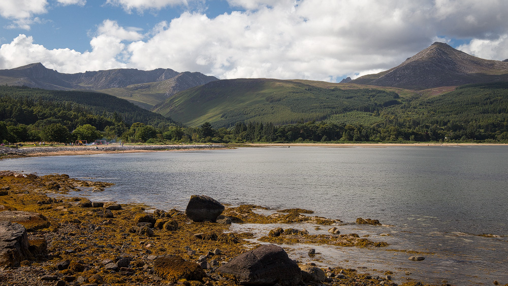
The island is ringed by a coastal road, shortened in the middle by another road across. Up in the north sits the beautiful Lochranza Castle, dating from the 13th century. In the east of the island, Brodick has grown into the largest settlement – and it’s from here that you can leave the island again by ferry. The crossing to Ardrossan, just around 40 kilometres from Glasgow as the crow flies, takes a good hour.
Island of the Curling Stones: Ailsa Craig
Around 20 kilometres south of the Isle of Arran and 16 kilometres east of the Scottish mainland lies Ailsa Craig. The island is about 1,200 metres long, 1,100 metres wide and rises to 338 metres. No one lives there except a large colony of seabirds – the island’s lighthouse has been automated since the 1970s. Before that, around 30 people would be there each summer, quarrying granite or maintaining the lighthouse.
Ailsa Craig looks like a floating champagne cork, and in a way, that’s basically what it is: the plug of a former volcano. Ailsa Craig is best known for its granite, called Ailsite, used to make curling stones. At least half of all curling stones in the sport come from this small island. The rest come from a quarry in Wales.
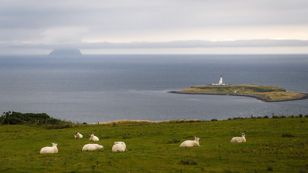
Ailsa Craig has been up for sale since 2012; figures of around £1.5 million have been mentioned most recently – though no one currently seems willing to pay it.
A Small, Great Island: Great Cumbrae
But we’ll head a little further up the west coast first. At Largs, a ferry takes us across in just a few minutes to Great Cumbrae Island. It’s barely six kilometres long and 2.7 kilometres wide, yet a full 1,376 residents are packed onto this small patch of land. Cumbrae is home to the smallest cathedral in Europe. Below Great Cumbrae lies its sister island, Little Cumbrae, which is uninhabited.
The Cultivated One: Isle of Bute
Let’s head back to the mainland for our final destination. A little further up the west coast lies Wemyss Bay. From here a ferry carries us across in about half an hour to Rothesay, the largest settlement on the Isle of Bute. Thanks to its proximity to Glasgow, the 24-kilometre-long, 8-kilometre-wide island has 6,498 residents.
Bute has a castle in Rothesay Castle, a beautiful stately home in Mount Stuart House, and the remains of a 12th-century chapel. On top of that, there’s the beach at Ettrick Bay.
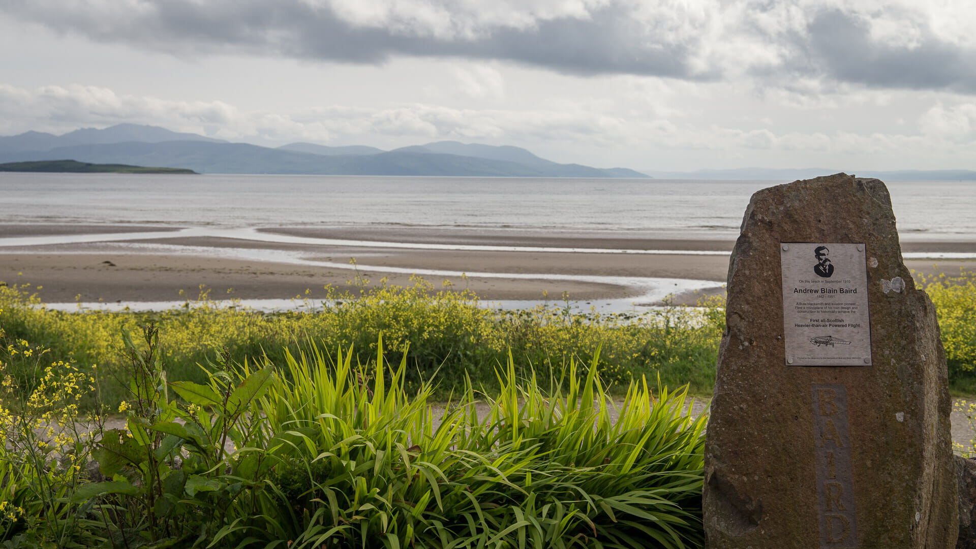
The ferry from Rhubodach to Colintraive carries us, in just a few minutes, down off our final island too.
All the info on the Isle of Bute can be found here.
But wait – there are still a few islands that deserve an honourable mention …
Islands With a Special History: Gruinard and Bass Rock
There are a few islands that, while small, have become famous. Let’s visit those now too.
The Anthrax Island: Gruinard Island
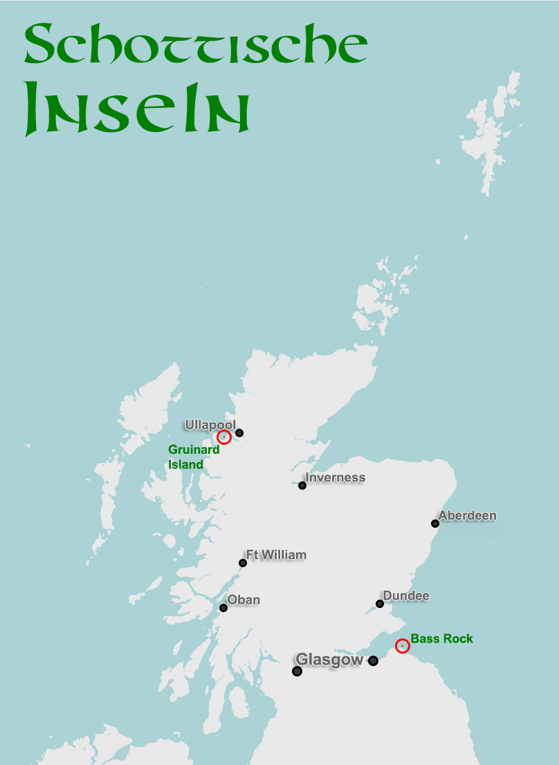
On Scotland’s west coast, a little below Ullapool, lies Gruinard Bay, and within it an island of the same name. It would be nothing special in itself, had the British military not chosen it during the Second World War as the site for tests with anthrax bacteria. 80 sheep were “successfully” killed by the bio-bombs. Unfortunately, only after the tests did anyone realise the anthrax had soaked into the ground, contaminating it permanently. And so Gruinard Island became a no-go zone.
Only in 1986 was it recognised that the problem wouldn’t simply resolve itself, and so began the process of decontaminating the island using a mixture of formaldehyde and seawater.
Since 1990 Gruinard has officially been declared safe – though no one seems keen to actually live on the one-kilometre-wide, two-kilometre-long island regardless.
The Island of Birds in the East: Bass Rock
Even from a distance, the sight is “uplifting” in the most literal sense – a bare rock, 107 metres high, rises straight out of the sea off Scotland’s east coast. The famous Bass Rock, sometimes simply called “the Bass”.
It’s famous, for one, for its sheer mass of nesting gannets – an estimated 150,000 of them, around ten percent of the entire North Atlantic population. In the past, as with Sula Sgeir, the young birds were considered a delicacy, hunted and sold ashore.
Bass Rock is also known for a former castle here that was converted into a prison. The castle already existed in the 14th century, and by the 16th century political enemies were regularly being “stored” there. In the 17th century – after Cromwell’s New Model Army invaded – the Bass genuinely became a notorious prison camp.
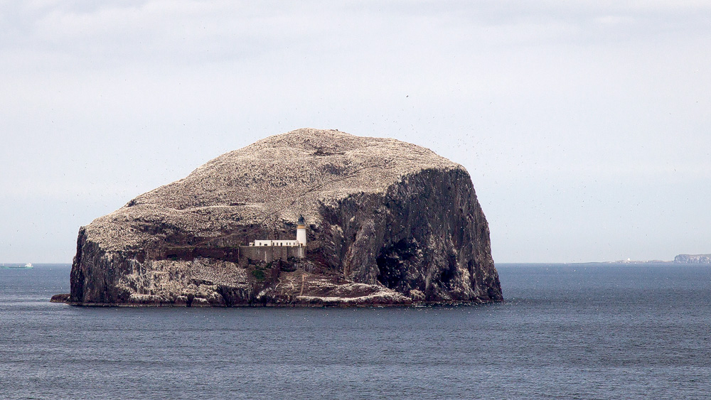
Today it’s a haven for birds and a magnet for tourists, who are ferried across, for example, from the Scottish Seabird Centre.
Here, near the capital Edinburgh, our little journey around Scotland’s many islands comes to an end. Have I forgotten an important island? No problem: the comments below are open. Just let me know what’s on your mind.
Fictional Islands
Since I keep seeing odd island names crop up in search queries, I’m including fictional islands here too – islands that appear in films or books but don’t actually exist.
Isle of Mure: The Island of Summer Seaside Kitchen
This island doesn’t exist – or only in the imagination. Author Jenny Colgan describes, in her light-hearted novel “The Summer Seaside Kitchen”, the life of Flora, who has turned her back on her home and moved to London. That home is the Isle of Mure. For business reasons, though, she has to return to the island, where her past life catches up with her. The book won the Romantic Novel of the Year Award in 2018.
